National Highway 39 (India)
Appearance
| National Highway 39 | ||||
|---|---|---|---|---|
 NH 39 (former NH75) | ||||
| Route information | ||||
| Length | 869 km (540 mi) | |||
| Major junctions | ||||
| West end | Jhansi | |||
| East end | Ranchi | |||
| Location | ||||
| Country | India | |||
| States | Uttar Pradesh, Madhya Pradesh, Jharkhand | |||
| Highway system | ||||
| ||||

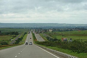
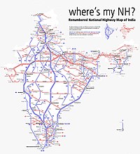
National Highway 39 (NH 39) is a National Highway in India. This highway passes through the Indian states of Madhya Pradesh, Uttar Pradesh and Jharkhand.[1]
Route
This 869-kilometre-long (540 mi) highway passes through Jhansi, Chhatarpur, Panna, Satna, Rewa, Sidhi, Singrauli, Renukut, Shaktinagar, Garhwa, Daltonganj, Latehar, Chandwa, Ranchi
See also
- List of National Highways in India
- List of National Highways in India (by Highway Number)
- National Highways Development Project
References
- ^ "Rationalisation of Numbering Systems of National Highways" (PDF). New Delhi: Department of Road Transport and Highways. Archived from the original (PDF) on 31 March 2012. Retrieved 3 April 2012.


