List of rivers of Florida
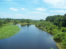
This is a list of streams and rivers in the U.S. state of Florida. The term river of grass has been used to describe the vast complex of waterways that make up the Everglades but the state has many ordinary rivers as well.
By drainage basin
Atlantic coast


Rivers are listed as they enter the ocean from north to south. Tributaries are listed as they enter their main stem from downstream to upstream.
- St. Marys River
- Nassau River
- Fort George River
- St. Johns River – Juniper Springs, Salt Springs, Silver Glen Springs, Alexander Springs, Blue Spring, Beecher Spring
- Matanzas River
- Halifax River
- Indian River North
- Indian River
- St. Lucie River
- Loxahatchee River
- Hillsboro River
- Stranahan River
- Oleta River
- Little River
- Miami River
Alachua Sink
Water enters Paynes Prairie Basin from a number of sources. Historically it drained only into Alachua Sink. Once underground, the water flows northwest towards the Santa Fe River Basin. In 1927, Camps Canal was built, which linked the basin to the Orange Lake through the River Styx and ultimately to the Atlantic Ocean.
- Bivens Arm
- Tumbling Creek
- Little Tumbling Creek
- Sweetwater Branch
- Prairie Creek
- Newnans Lake
- Hatchet Creek
- Lake Forest Creek
- Little Hatchet Creek
- Newnans Lake
- Chacala Run
- Chacala Pond
- Sawgrass Run
- Sawgrass Pond
- Lake Wauburg
- Georges Pond
- Burnt Pond
- Georges Pond
- Lake Wauburg
- Sawgrass Pond
- Sawgrass Run
- Chacala Pond
- Dog Branch
Lake Okeechobee
Lake Okeechobee drains into the Atlantic Ocean via the St. Lucie River, the West Palm Beach Canal, the Hillsboro Canal, the North New River Canal, and the Miami Canal, and into the Gulf of Mexico via the Caloosahatchee Canal which connects to the head of the Caloosahatchee River. The major input of water into Lake Okeechobee comes from the north, via the Kissimmee River. Rivers are listed as they enter Lake Okeechobee from west to east. Tributaries are listed as they enter their main stem from downstream to upstream.
- Fisheating Creek
- Indian Prairie Canal
- Kissimmee River[1][2]
- Taylor Creek
- Mosquito Creek
- Henry Creek
- Lettuce Creek
Gulf coast


Rivers are listed as they enter the gulf from south to north, then west. Tributaries are listed as they enter their main stem from downstream to upstream.
- Joe River
- Shark River
- Harney River
- Broad River
- Rodgers River
- Lostmans River
- Chatham River
- Huston River
- Lopez River
- New River in Collier County
- Turner River
- Barron River
- Fakahatchee River
- Whitney River
- Big Marco River
- Henderson Creek
- Cocohatchee River
- Imperial River
- Estero River
- Caloosahatchee River
- Peace River
- Myakka River
- Manatee River
- Little Manatee River
- Alafia River – Buckhorn Spring, Lithia Springs
- Palm River
- Hillsborough River – Crystal Springs
- New River in Pasco County
- Anclote River
- Pithlachascotee River
- Weeki Wachee River – Weeki Wachee Springs
- Chassahowitzka River
- Homosassa River – Homosassa Springs
- Crystal River
- Withlacoochee River (central Florida)
- Waccasassa River
- Suwannee River – Suwannee Springs, Hart Springs, Ginnie Springs, Fanning Springs, Manatee Springs, Otter Springs, Troy Springs
- Steinhatchee River
- Fenholloway River
- Econfina River
- Aucilla River – Nutall Rise
- Wacissa River – Wacissa Springs, Aucilla Spring,
- Pinhook River
- St. Marks River – St. Marks Spring
- Ochlockonee River
- Crooked River
- Carrabelle River
- Apalachicola River
- Jackson River
- Chipola River – Baltzell Spring, Blue Hole Spring
- Chattahoochee River
- Econfina Creek
- Choctawhatchee River – Vortex Spring
- East Bay River
- Yellow River
- Blackwater River
- Escambia River
- Perdido River
Alphabetically
See also
References
- ^ "Kissimmee Upper Basin" (PDF). South Florida Water Management District. Retrieved April 10, 2019.
- ^ "Kissimmee Lower Basin" (PDF). South Florida Water Management District. Retrieved April 10, 2019.
- Fernald, Edward A., Ed. 1981. Drainage Basins and Divides. Atlas of Florida. Tallahassee, Florida: The Florida State University Foundation, Inc. p. 18. ISBN 0-9606708-0-7

