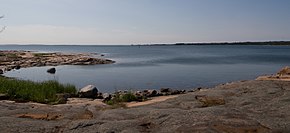
Sea of Åland
Appearance


The Sea of Åland (Template:Lang-fi; Template:Lang-sv) is a waterway in the southern Gulf of Bothnia, between the Åland islands and Sweden. It connects the Bothnian Sea with the Baltic Sea proper. The seas are often choppy here. The narrowest part is named South Kvarken. The trench running on the bottom of the Sea of Åland contains the second-deepest spot of the Baltic Sea, at a depth of 301 meters, which is second only to Landsort Deep.
Many ferries moving between Finland and Sweden cross the Sea of Åland.[1]
References
- ^ Lasse Jansson (19 June 2014). "Vad hände sen med de gamla färjorna" (in Swedish). Aftonbladet. Retrieved 30 January 2016.
External links
![]() Media related to Sea of Åland at Wikimedia Commons
60°10′N 019°10′E / 60.167°N 19.167°E
Media related to Sea of Åland at Wikimedia Commons
60°10′N 019°10′E / 60.167°N 19.167°E

