
Wissahickon Trail
| Wissahickon Trail | |
|---|---|
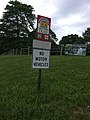
 Trail marker on Morris Road in Fort Washington | |
| Length | 20 mi (32 km) |
| Location | Montgomery County / Philadelphia, Pennsylvania, USA |
| Trailheads | Schuylkill River Trail to Upper Gwynedd Township, Montgomery County, Pennsylvania |
| Use | Multi-use |
| Difficulty | Easy |
| Season | Year-round |
The trails of the Wissahickon Valley Park and watershed are a series of trails in southeastern Pennsylvania, United States.
It is nearly 20 miles (32 km) in length and travels from the Schuylkill River Trail in Philadelphia to Upper Gwynedd Township, Montgomery County, generally following the path of the Wissahickon Creek.
Philadelphia Trailhead
Gallery
-
 Trail sign in Montgomery County
 -
 A green blaze on the trail
 -
 Stepping stones on the trail where it crosses the Wissahickon Creek near Penllyn


See also
External links
40°00′59″N 75°12′21″W / 40.0164°N 75.20594°W
This Philadelphia County, Pennsylvania state location article is a stub. You can help Wikipedia by expanding it. |
This Montgomery County, Pennsylvania state location article is a stub. You can help Wikipedia by expanding it. |
This United States trail or long-distance path–related article is a stub. You can help Wikipedia by expanding it. |