
Folegandros
Folegandros
Φολέγανδρος | |
|---|---|
Settlement | |
 Cliffs at Chora on Folegandros | |
 Folegandros Location within the region  | |
| Coordinates: 36°37′N 24°54′E / 36.617°N 24.900°E | |
| Country | Greece |
| Administrative region | South Aegean |
| Regional unit | Thira |
| Highest elevation | 455 m (1,493 ft) |
| Lowest elevation | 0 m (0 ft) |
| Population (2011)[1] | |
| • Community | 513 |
| Time zone | UTC+2 (EET) |
| • Summer (DST) | UTC+3 (EEST) |
| Postal code | 840 xx |
| Area code(s) | 22860 |
| Vehicle registration | EM |
| Website | www.folegandros.gr |
Folegandros (also Pholegandros; Greek: Φολέγανδρος) is a small Greek island in the Aegean Sea that, together with Sikinos, Ios, Anafi and Santorini, forms the southern part of the Cyclades. Its surface area is 32.216 square kilometres (12.439 sq mi)[2] and it has 765 inhabitants. It has three small villages, Chora, Karavostasis, and Ano Meria, which are connected by a paved road. Folegandros is part of the Thira regional unit.[3]
Mythology
According to Greek mythology, it was said to have derived its name from a son of Minos.[4]
History
Little is known about the ancient history of Folegandros. Its inhabitants were Dorians. Later it came under Athenian rule. The island contained a polis (city-state) called Pholegandros, which was sited at the modern Chora and a member of the Delian League where it appears on Athenian tribute lists between 425/4 and 416/15 BCE.[5] The island was called the iron Pholegandros by Aratus on account of its ruggedness, and is also noted by ancient geographers Strabo[6] and Ptolemy, who calls it Pholekandros (Ancient Greek: Φολέκανδρος).[7]
The island was conquered in 1207 by the Venetian Marco Sanudo and remained under the rule of Venice until 1566, when it was taken by the Ottoman Turks. The Greeks reclaimed it in the 19th century.
Geography
Folegandros' landscape is varied, and includes tall cliffs and a large cave. The "capital" of the island, Chora, is built on the edge of a 200-metre high cliff. The port of Folegandros is the small village of Karavostasis. The Ano Meria village contains a small but interesting Ecological and Folklore Museum. Among the notable beaches on Folegandros is Katergo, accessible only by foot or by boat from Karavostasis. Katergo beach is used by naturists.[8]
Gallery
-
 View of Chora
 -
 Chora seen from the church of Panagia
 -
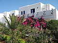 House of the island
 -
 Inside the "Kastro" of Chora


References
- ^ "Απογραφή Πληθυσμού - Κατοικιών 2011. ΜΟΝΙΜΟΣ Πληθυσμός" (in Greek). Hellenic Statistical Authority.
- ^ "Population & housing census 2001 (incl. area and average elevation)" (PDF) (in Greek). National Statistical Service of Greece. Archived from the original (PDF) on 2015-09-21.
- ^ Kallikratis law Greece Ministry of Interior (in Greek)
- ^ Stephanus of Byzantium. Ethnica. Vol. Φολέγανδρος.
- ^ Mogens Herman Hansen & Thomas Heine Nielsen (2004). "The Aegean". An inventory of archaic and classical poleis. New York: Oxford University Press. p. 769. ISBN 0-19-814099-1.
- ^ Strabo. Geographica. Vol. x. p. 484 et seq. Page numbers refer to those of Isaac Casaubon's edition.
- ^ Ptolemy. The Geography. Vol. 3.15.31.
- ^ Sinanidis, Mary (11 July 2014). "Your bare-all guide to nudist beaches in Greece". themanews.com. Retrieved 2016-08-07.
Folegandros
![]() This article incorporates text from a publication now in the public domain: Smith, William, ed. (1854–1857). "Pholegandros". Dictionary of Greek and Roman Geography. London: John Murray.
This article incorporates text from a publication now in the public domain: Smith, William, ed. (1854–1857). "Pholegandros". Dictionary of Greek and Roman Geography. London: John Murray.
External links
- Municipality of Folegandros (in English, French, Greek, and Italian)
- Beaches in Folegandros
| Regional unit of Andros |  | |
|---|---|---|
| Regional unit of Kalymnos | ||
| Regional unit of Karpathos-Kasos | ||
| Regional unit of Kea-Kythnos | ||
| Regional unit of Kos | ||
| Regional unit of Milos | ||
| Regional unit of Mykonos | ||
| Regional unit of Naxos | ||
| Regional unit of Paros | ||
| Regional unit of Rhodes | ||
| Regional unit of Syros | ||
| Regional unit of Thira | ||
| Regional unit of Tinos | ||
| ||
