
Aberdeen, Ohio
Aberdeen, Ohio | |
|---|---|
 Location of Aberdeen, Ohio | |
 Location of Aberdeen in Brown County | |
| Country | United States |
| State | Ohio |
| County | Brown |
| Township | Huntington |
| Area | |
| • Total | 1.63 sq mi (4.22 km2) |
| • Land | 1.35 sq mi (3.50 km2) |
| • Water | 0.28 sq mi (0.73 km2) |
| Elevation | 515 ft (157 m) |
| Population | |
| • Total | 1,638 |
| • Estimate (2012[4]) | 1,627 |
| • Density | 1,213.3/sq mi (468.5/km2) |
| Time zone | UTC-5 (Eastern (EST)) |
| • Summer (DST) | UTC-4 (EDT) |
| ZIP code | 45101 |
| Area code | 937 |
| FIPS code | 39-00142[5] |
| GNIS feature ID | 1056195[2] |
Aberdeen is a village in Brown County, Ohio, United States, along the Ohio River. The population was 1,638 at the 2010 census.
Aberdeen is connected to Maysville, Kentucky by the Simon Kenton Memorial Bridge to downtown Maysville and the William H. Harsha Bridge, a cable-stayed bridge completed in 2001. It was part of Zane's Trace, a frontier road through the Northwest Territory completed in 1797.
Gallery
-
 Along the Ohio River at Aberdeen.
 -
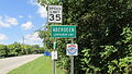 Aberdeen corporation limit sign.
 -
 Looking east on US Highway 52 in Aberdeen.


History
Aberdeen was platted in 1816. It was incorporated in 1850.[6]
Geography
Aberdeen is located at 38°39′54″N 83°46′3″W / 38.66500°N 83.76750°W (38.665027, -83.767638).[7]
According to the United States Census Bureau, the village has a total area of 1.63 square miles (4.22 km2), of which 1.35 square miles (3.50 km2) is land and 0.28 square miles (0.73 km2) is water.[1]
Climate
| Climate data for Aberdeen | |||||||||||||
|---|---|---|---|---|---|---|---|---|---|---|---|---|---|
| Month | Jan | Feb | Mar | Apr | May | Jun | Jul | Aug | Sep | Oct | Nov | Dec | Year |
| Mean daily maximum °F (°C) | 42.0 (5.6) |
44.5 (6.9) |
55.2 (12.9) |
66.3 (19.1) |
76.2 (24.6) |
84.4 (29.1) |
88.1 (31.2) |
86.7 (30.4) |
81.2 (27.3) |
70.0 (21.1) |
56.0 (13.3) |
44.8 (7.1) |
66.3 (19.1) |
| Mean daily minimum °F (°C) | 22.8 (−5.1) |
23.4 (−4.8) |
31.7 (−0.2) |
40.5 (4.7) |
50.1 (10.1) |
59.3 (15.2) |
63.5 (17.5) |
62.2 (16.8) |
55.4 (13.0) |
43.3 (6.3) |
33.6 (0.9) |
25.5 (−3.6) |
42.6 (5.9) |
| Average precipitation inches (mm) | 3.7 (94) |
3.1 (79) |
4.3 (110) |
3.8 (97) |
4.2 (110) |
3.9 (99) |
4.5 (110) |
3.9 (99) |
3.2 (81) |
2.6 (66) |
3.2 (81) |
3.6 (91) |
43.9 (1,120) |
| Source: Weatherbase [8] | |||||||||||||
Demographics
| Census | Pop. | Note | %± |
|---|---|---|---|
| 1820 | 87 | — | |
| 1830 | 165 | 89.7% | |
| 1840 | 405 | 145.5% | |
| 1850 | 808 | 99.5% | |
| 1860 | 836 | 3.5% | |
| 1870 | 871 | 4.2% | |
| 1880 | 885 | 1.6% | |
| 1890 | 874 | −1.2% | |
| 1900 | 711 | −18.6% | |
| 1910 | 568 | −20.1% | |
| 1920 | 477 | −16.0% | |
| 1930 | 452 | −5.2% | |
| 1940 | 497 | 10.0% | |
| 1950 | 551 | 10.9% | |
| 1960 | 774 | 40.5% | |
| 1970 | 1,165 | 50.5% | |
| 1980 | 1,566 | 34.4% | |
| 1990 | 1,329 | −15.1% | |
| 2000 | 1,603 | 20.6% | |
| 2010 | 1,638 | 2.2% | |
| 2015 (est.) | 1,607 | [9] | −1.9% |
2010 census
As of the census[3] of 2010, there were 1,638 people, 760 households, and 454 families residing in the village. The population density was 1,213.3 inhabitants per square mile (468.5/km2). There were 882 housing units at an average density of 653.3 per square mile (252.2/km2). The racial makeup of the village was 96.2% White, 1.8% African American, 0.1% Native American, 0.2% Asian, 0.2% from other races, and 1.5% from two or more races. Hispanic or Latino of any race were 0.9% of the population.
There were 760 households of which 26.3% had children under the age of 18 living with them, 39.3% were married couples living together, 14.5% had a female householder with no husband present, 5.9% had a male householder with no wife present, and 40.3% were non-families. 35.0% of all households were made up of individuals and 13.7% had someone living alone who was 65 years of age or older. The average household size was 2.16 and the average family size was 2.75.
The median age in the village was 41.9 years. 21.1% of residents were under the age of 18; 9.5% were between the ages of 18 and 24; 24.1% were from 25 to 44; 28.8% were from 45 to 64; and 16.6% were 65 years of age or older. The gender makeup of the village was 46.6% male and 53.4% female.
2000 census
As of the census[5] of 2000, there were 1,603 people, 689 households, and 436 families residing in the village. The population density was 1,133.8 people per square mile (439.0/km²). There were 825 housing units at an average density of 583.5 per square mile (225.9/km²). The racial makeup of the village was 96.88% White, 1.37% African American, 0.81% Native American, 0.19% Asian, 0.37% from other races, and 0.37% from two or more races. Hispanic or Latino of any race were 1.25% of the population.
There were 689 households out of which 32.2% had children under the age of 18 living with them, 44.4% were married couples living together, 15.1% had a female householder with no husband present, and 36.7% were non-families. 31.9% of all households were made up of individuals and 10.4% had someone living alone who was 65 years of age or older. The average household size was 2.31 and the average family size was 2.88.
In the village the population was spread out with 25.8% under the age of 18, 7.8% from 18 to 24, 30.4% from 25 to 44, 24.0% from 45 to 64, and 12.1% who were 65 years of age or older. The median age was 37 years. For every 100 females there were 86.2 males. For every 100 females age 18 and over, there were 85.4 males.
The median income for a household in the village was $30,202, and the median income for a family was $33,906. Males had a median income of $32,500 versus $23,889 for females. The per capita income for the village was $16,287. About 18.6% of families and 21.9% of the population were below the poverty line, including 31.9% of those under age 18 and 18.3% of those age 65 or over.
See also
References
- ^ a b "US Gazetteer files 2010". United States Census Bureau. Retrieved 2013-01-06.
- ^ a b "US Board on Geographic Names". United States Geological Survey. 2007-10-25. Retrieved 2008-01-31.
- ^ a b "American FactFinder". United States Census Bureau. Retrieved 2013-01-06.
- ^ "Population Estimates". United States Census Bureau. Retrieved 2013-06-17.
- ^ a b "American FactFinder". United States Census Bureau. Retrieved 2008-01-31.
- ^ The History of Brown County, Ohio: Containing a History of the County, Its Townships, Towns, Churches, Schools, Etc. Higginson Book Company. 1883. p. 513.
- ^ "US Gazetteer files: 2010, 2000, and 1990". United States Census Bureau. 2011-02-12. Retrieved 2011-04-23.
- ^ "Weatherbase: Historical Weather for Aberdeen, Ohio". Weatherbase. 2011. Retrieved on November 24, 2011.
- ^ "Annual Estimates of the Resident Population for Incorporated Places: April 1, 2010 to July 1, 2015". Retrieved July 2, 2016.
- ^ "Census of Population and Housing". Census.gov. Retrieved June 4, 2015.
Municipalities and communities of Brown County, Ohio, United States | ||
|---|---|---|
| Villages |  | |
| Townships | ||
| CDPs | ||
| Unincorporated communities | ||
| Footnotes | ‡This populated place also has portions in an adjacent county or counties | |