Ainsworth State Park
Appearance
| Ainsworth State Park | |
|---|---|
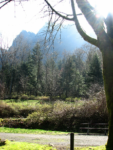
 Gorge cliffs above the Ainsworth campground. | |
| Type | Public, state |
| Location | Multnomah County, Oregon |
| Nearest city | Portland Multnomah County, Oregon, USA |
| Coordinates | 45°35′32″N 122°03′25″W / 45.59234°N 122.057029°W[1] |
| Operated by | Oregon State Parks and Recreation |
Ainsworth State Park is a state park in eastern Multnomah County, Oregon, near Cascade Locks. It is located in the Columbia River Gorge, adjacent to the Historic Columbia River Highway. The park administered by the Oregon Parks and Recreation Department, offers a seasonal, full-service campground, access to Gorge hiking trails beyond park boundaries, and a day-use area.
Ainsworth State Park lies within the Columbia River Gorge National Scenic Area,[2] and is 4 miles (6.4 km) from Multnomah Falls.
Amenities
- Full RV hook-up sites
- Tent camp sites
- Flush toilets
- Showers
- RV dump station
- Picnic areas
- Amphitheater
- Playgrounds
- Park host
See also
References
- ^ "Ainsworth State Park". Geographic Names Information System. United States Geological Survey, United States Department of the Interior. Retrieved 2011-06-24.
- ^ "Historic Columbia River Highway". Historic Columbia River Highway. Retrieved 2011-06-24.
External links
- "Ainsworth State Park". Oregon Parks and Recreation Department. Archived from the original on 14 June 2011. Retrieved 2011-06-23.
{{cite web}}: Unknown parameter|deadurl=ignored (|url-status=suggested) (help)

