Bohnsdorf
Appearance
Bohnsdorf | |
|---|---|
 Church and lake in Bohnsdorf | |
| Coordinates: 52°24′00″N 13°34′00″E / 52.40000°N 13.56667°E | |
| Country | Germany |
| State | Berlin |
| City | Berlin |
| Borough | Treptow-Köpenick |
| Founded | 1375 |
| Subdivisions | 2 zones |
| Area | |
| • Total | 6.52 km2 (2.52 sq mi) |
| Elevation | 34 m (112 ft) |
| Population (2008-06-30) | |
| • Total | 10,751 |
| • Density | 1,600/km2 (4,300/sq mi) |
| Time zone | UTC+01:00 (CET) |
| • Summer (DST) | UTC+02:00 (CEST) |
| Postal codes | (nr. 0908) 12524, 12526 |
| Vehicle registration | B |
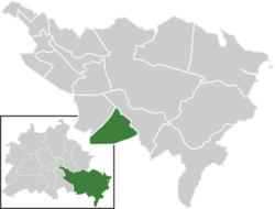
Bohnsdorf is a district in the borough Treptow-Köpenick of Berlin, Germany. It is located in the south-east of the city.
History
The locality was first mentioned in 1375 with the name of Benistorp.
Geography
Position
The locality is situated in the southeastern suburb of Berlin and borders with Altglienicke, Grünau, and with the municipality of Schönefeld, in the Brandenburg district of Dahme-Spreewald. Close to the village lies the Berlin Schönefeld Airport.
Parts
Bohnsdorf is not divided into zones. Parts of Bohnsdorf are (no subdivision)
- Falkenberg (north part)
- Falkenhorst (south-east part)
Personalities
External links
![]() Media related to Bohnsdorf at Wikimedia Commons
Media related to Bohnsdorf at Wikimedia Commons


