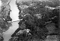
Citarum River
| Citarum River | |
|---|---|
 Bridge over the Citarum River | |
| Native name | ᮝᮜᮥᮍᮔ᮪ ᮎᮤᮒᮛᮥᮙ᮪ Error {{native name checker}}: parameter value is malformed (help) |
| Location | |
| Country | Indonesia |
| Physical characteristics | |
| Source | |
| • location | Mount Wayang, Bandung Regency, West Java |
| Mouth | |
• location | Java Sea, Ujung Karawang, Karawang Regency, West Java |
| Length | 300 km (190 mi) |

Citarum (Sundanese: Walungan Citarum) is the longest and largest river in West Java, Indonesia.[1] It is the third longest river in Java, after Bengawan Solo and Brantas. It has an important role in the life of the people of West Java, as it supports agriculture, water supply, fishery, industry, sewerage, and electricity. It is listed as one of the most polluted rivers in the world.
History
In Indonesian history the Citarum is linked with the 4th-century Tarumanagara kingdom, as the kingdom and the river shared the same etymology, derived from the word "tarum" (Sundanese for indigo plant). The earlier 4th-century BCE prehistoric Buni clay pottery-making culture flourished near the river's mouth. Stone inscriptions, Chinese sources, and archaeological sites such as Batujaya and Cibuaya suggest that the human habitation and civilization flourished in and around the river estuaries and river valley as early as the 4th century and even earlier.
Geography
The river flows in the northwest area of Java with a predominantly tropical monsoon climate. The annual average temperature in the area is 24°C. The warmest month is May, when the average temperature is around 26°C, and the coldest is January, at 22°C.[2] The average annual rainfall is 2646 mm. The wettest month is January, with an average of 668 mm rainfall, and the driest is September, with 14 mm rainfall.[3]
Hydroelectric and irrigation dams
Three hydroelectric powerplant dams are installed along the Citarum: Saguling, Cirata, and Ir. H. Djuanda (Jatiluhur), all supplying the electricity for the Bandung and Greater Jakarta areas. The waters from these dams are also used to irrigate vast rice paddies in Karawang and Bekasi area, making northern West Java lowlands one of the most productive rice farming areas.[4]
The Jatiluhur Dam with a 3 billion cubic meter storage capacity has the largest reservoir in Indonesia.[5]
The river makes up around 80 percent of the surface water available to the people who use it. Pollution has affected agriculture so much that farmers have sold their rice paddies for half their normal price.[6]
Pollution
The river is heavily polluted by human activity; about five million people live in its basin.[7][8] Textile factories in Bandung and Cimahi were major toxic waste contributors.[9] More than 2,000 industries contaminate 5,020 sq miles of the river with lead, mercury, arsenic, and other toxins.[10]
On December 5, 2008, the Asian Development Bank approved a $500 million loan for cleaning up the river, calling it the world's dirtiest.[11]
Revitalization
In November 2011, the river revitalization began, with an expected cost of Rp35 trillion ($4 billion) over 15 years. The revitalization is occurring from Mount Wayang through eight regencies and three cities for a distance of 180 kilometers. The target for the first three years is to collect 10.5 million cubic meters of sedimentation.[12]
References
- ^ "Citarum Nadiku, Mari Rebut Kembali" (in Indonesian). Greenpeace. Retrieved 4 March 2014.
{{cite web}}: Cite has empty unknown parameter:|dead-url=(help) - ^ "NASA Earth Observations Data Set Index". NASA. 30 January 2016.
{{cite web}}: Cite has empty unknown parameter:|dead-url=(help) - ^ "NASA Earth Observations: Rainfall (1 month - TRMM)". NASA/Tropical Rainfall Monitoring Mission. 30 January 2016.
{{cite web}}: Cite has empty unknown parameter:|dead-url=(help) - ^ "Karawang Tantangan Si Lumbung Padi" (in Indonesian). citarum.org. Retrieved 4 March 2014.
{{cite web}}: Cite has empty unknown parameter:|dead-url=(help) - ^ "Genjot Proyek Waduk Jatigede" (in Indonesian). Indopos Intermedia Press. Archived from the original on 30 September 2011. Retrieved 18 April 2014.
{{cite web}}: Unknown parameter|deadurl=ignored (|url-status=suggested) (help) - ^ Williams, Alex (30 June 2013). "Citarum: Possibly the world's most polluted river". Inside Investor. Retrieved 30 June 2013.
{{cite web}}: Cite has empty unknown parameter:|dead-url=(help) - ^ Shears, Richard (5 June 2007). "Is this the world's most polluted river?". MailOnline. Retrieved 24 May 2010.
{{cite news}}: Cite has empty unknown parameter:|dead-url=(help) - ^ Nana Terangna Bukit (May 1995). "Water quality conservation for the Citarum River in West Java". Water Science and Technology. 31 (9). IWA Publishing: 1–10. doi:10.1016/0273-1223(95)00400-h. ISSN 0273-1223. Archived from the original on 26 September 2007.
{{cite journal}}: Unknown parameter|deadurl=ignored (|url-status=suggested) (help) - ^ Nadya Natahadibrata (6 November 2013). "Citarum, Kalimantan world's most polluted". Jakarta Post. Retrieved 9 November 2013.
- ^ Leahy, Stephen (8 November 2013). "Toxic towns and poisoned rivers: a byproduct of industry for the rich". The Guardian. Retrieved 9 November 2013.
- ^ Collins, Nancy-Amelia (5 December 2008). "ADB Gives Indonesia $500 Million to Clean Up World's Dirtiest River". VOA News. Retrieved 24 May 2010.
{{cite news}}: Cite has empty unknown parameter:|dead-url=(help) - ^ "Rehabilitasi Total Sungai Citarum Butuh Rp 35 Triliun dalam Waktu 15 Tahun". Pikiran Rakyat (in Indonesian). 10 November 2011.
{{cite news}}: Cite has empty unknown parameter:|dead-url=(help)
External links
- "Remote Sensing data application for Citarum River Integrated Management" (PDF). Archived from the original (PDF) on 2007-09-28.
{{cite web}}: Unknown parameter|deadurl=ignored (|url-status=suggested) (help) (6.29 MiB) - "The 15 most toxic places to live" via Mother Nature Network
- "Sea of Garbage" — pictures of Citarum River pollution
- "The Dirtiest River In The World" — photos
- Citarum — Bahasa (mainly updated) and English website regarding information on Citarum river recovery effort
- Citarum Knowledge Center — information on research, everything from scholarly publications to tool kits for applied research and policy briefs about Citarum River recovery effort. All materials can be freely downloaded from the site.
- "Rescuing The Citarum River." Sometimes Interesting. 09 Nov 2013
