Condit Township, Champaign County, Illinois
Appearance
Condit Township | |
|---|---|
 Location in Champaign County | |
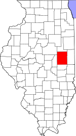
 Champaign County's location in Illinois | |
| Country | United States |
| State | Illinois |
| County | Champaign |
| Established | May 8, 1867 |
| Area | |
• Total | 36.48 sq mi (94.5 km2) |
| • Land | 36.43 sq mi (94.4 km2) |
| • Water | 0.04 sq mi (0.1 km2) 0.11% |
| Elevation | 725 ft (221 m) |
| Population (2010) | |
• Total | 500 |
| • Density | 13.7/sq mi (5.3/km2) |
| Time zone | UTC-6 (CST) |
| • Summer (DST) | UTC-5 (CDT) |
| GNIS feature ID | 0428839 |
Condit Township is a township in Champaign County, Illinois, USA. As of the 2010 census, its population was 500 and it contained 196 housing units.[1]
History
Condit Township formed from a part of Newcomb Township on May 8, 1867.
Geography
According to the 2010 census, the township has a total area of 36.48 square miles (94.5 km2), of which 36.43 square miles (94.4 km2) (or 99.86%) is land and 0.04 square miles (0.10 km2) (or 0.11%) is water.[1] The stream of Owl Creek runs through this township.
Cities and towns
- Fisher (southeast edge)
Cemeteries
The township contains two cemeteries: Jersey and Knife-Stout.
References
- "Condit Township, Champaign County, Illinois". Geographic Names Information System. United States Geological Survey, United States Department of the Interior. Retrieved 2010-01-04.
- United States Census Bureau cartographic boundary files[permanent dead link]
- ^ a b "Population, Housing Units, Area, and Density: 2010 - County -- County Subdivision and Place -- 2010 Census Summary File 1". United States Census. Retrieved 2013-05-28.

