Cordillera Azul National Park
Appearance
| Cordillera Azul National Park | |
|---|---|
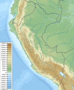
| Location | Loreto, San Martín, Huánuco and Ucayali Regions, Peru |
| Nearest city | Tarapoto |
| Coordinates | 7°45′S 75°56′W / 7.75°S 75.94°W[1] |
| Area | 1,353,190 hectares (5,224.7 sq mi) |
| Established | May 21, 2001 (by 031-2001-AG) |
| Governing body | SERNANP |
| Cordillera Azul National Park | |
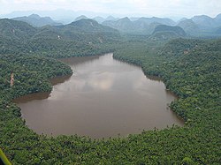
The Cordillera Azul National Park (Template:Lang-es) in Peru was created as a product of the process of categorization and definitive delimitation of the Reserved Zone Blue Biabo mountain range. As soon as the process was finished, the zone corresponding to the Blue Mountain range was declared as National Park by means of supreme decree.[2]
References
Wikimedia Commons has media related to Cordillera Azul National Park.
- ^ "Cordillera Azul National Park". protectedplanet.net.
- ^ SERNANP info page about Cordillera Azul National Park Template:Es icon

Categories:
- IUCN Category II
- National forests of Peru
- National parks of Peru
- Geography of Loreto Region
- Geography of San Martín Region
- Geography of Ucayali Region
- Visitor attractions in Loreto Region
- Visitor attractions in San Martín Region
- Visitor attractions in Ucayali Region
- Visitor attractions in Huánuco Region
- Geography of Huánuco Region
- Peru geography stubs
- South American protected area stubs

