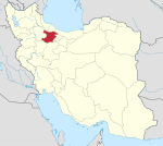
Danesfahan
Danesfahan
Persian: دانسفهان | |
|---|---|
City | |
| Coordinates: 35°48′42″N 49°44′35″E / 35.81167°N 49.74306°E[1] | |
| Country | Iran |
| Province | Qazvin |
| County | Buin Zahra |
| District | Ramand |
| Population (2016)[2] | |
| • Total | 9,434 |
| Time zone | UTC+3:30 (IRST) |
| Danesfahan at GEOnet Names Server | |
Danesfahan (Persian: دانسفهان), also Romanized as Dānesfahān; also known as Dānesfān and Danīsfahān,[3] is a city in, and the capital of, Ramand District of Buin Zahra County, Qazvin province, Iran.[4] It was originally the capital of Ramand-e Jonubi Rural District,[5] since transferred to the village of Khuznin.[6]
At the 2006 census, its population was 8,687 in 2,141 households.[7] The following census in 2011 counted 9,545 people in 2,583 households.[8] The latest census in 2016 showed a population of 9,434 people in 2,701 households.[2]
Danesfahan is several kilometres west of Sagzabad and several kilometres south of Esfarvarin. Historically it has been affected by earthquakes.[9][10][11][12]
References[edit]
- ^ OpenStreetMap contributors (15 May 2023). "Danesfahan, Buin Zahra County" (Map). OpenStreetMap. Retrieved 15 May 2023.
- ^ a b "Census of the Islamic Republic of Iran, 1395 (2016)". AMAR (in Persian). The Statistical Center of Iran. p. 26. Archived from the original (Excel) on 30 November 2021. Retrieved 19 December 2022.
- ^ Danesfahan can be found at GEOnet Names Server, at this link, by opening the Advanced Search box, entering "-3059208" in the "Unique Feature Id" form, and clicking on "Search Database".
- ^ Habibi, Hassan (21 March 1376). "Creation and establishment of Khorramabad District centered on Khorramabad village under the citizenship of Qazvin County and Dashtabi District centered on the city and Ramand District centered on Danesfahan city under the citizenship of Buin Zahra County". Islamic Parliament Research Center of the Islamic Republic of Iran (in Persian). Ministry of Interior, Political-Defense Commission of the Government Board. Archived from the original on 9 August 2017. Retrieved 9 January 2024.
- ^ Mousavi, Mirhossein. "Creation and formation of 25 rural districts including villages, farms and places in Qazvin County under Zanjan province". Islamic Parliament Research Center (in Persian). Ministry of Interior, Board of Ministers. Archived from the original on 30 June 2012. Retrieved 28 November 2023.
- ^ Habibi, Hassan (29 April 1376). "Changes in country divisions in Buin Zahra County in Qazvin province". Islamic Parliament Research Center (in Persian). Ministry of Interior, Political-Defense Commission of the Government Board. Archived from the original on 27 November 2014. Retrieved 10 January 2024.
- ^ "Census of the Islamic Republic of Iran, 1385 (2006)". AMAR (in Persian). The Statistical Center of Iran. p. 26. Archived from the original (Excel) on 20 September 2011. Retrieved 25 September 2022.
- ^ "Census of the Islamic Republic of Iran, 1390 (2011)". Syracuse University (in Persian). The Statistical Center of Iran. p. 26. Archived from the original (Excel) on 19 January 2023. Retrieved 19 December 2022.
- ^ Ambraseys, N. N.; Melville, C. P. (10 November 2005). A History of Persian Earthquakes. Cambridge University Press. p. 95. ISBN 978-0-521-02187-6. Retrieved 17 August 2011.
- ^ The Tati dialects in the Sociolinguistic Context of north-western Iran and Transcaucasia, Stilo, D. 1981: In: Iranian Studies 14.3/4, 137-187.
- ^ A Grammar of Southern Tati Dialects, Ehsan Yar-Shater, 1969.
- ^ Tats of Iran and Caucasus, Ali Abdoli, 2010.


