Ein HaEmek
Appearance
Ein HaEmek | |
|---|---|
 Ein HaEmek in 1946 | |
| Coordinates: 32°37′46.56″N 35°5′2.75″E / 32.6296000°N 35.0840972°E | |
| Country | Israel |
| District | Northern |
| Council | Megiddo |
| Founded | 1944 |
| Founded by | Kurdish Jews |
| Population (2022)[1] | 847 |
| Website | enhaemeq.org.il |
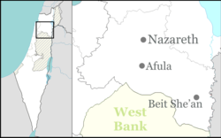
Ein HaEmek (Template:Lang-he-n, lit. Eye of the Valley) is a community settlement in northern Israel. Located near Yokneam, it falls under the jurisdiction of Megiddo Regional Council. In 2022 it had a population of 847.[1]
History
The village was established as a moshav in 1944 by a group of 30 immigrant families from Kurdistan, and was initially named Kedem after the organisation which helped the founders make aliyah.[citation needed]
After the Palestinian village of al-Rihaniyya became depopulated in the 1948 Palestine war, Ein HaEmek and Ramat HaShofet have used its lands.[2]
References
- ^ a b "Regional Statistics". Israel Central Bureau of Statistics. Retrieved 21 March 2024.
- ^ Khalidi, Walid (1992). All That Remains: The Palestinian Villages Occupied and Depopulated by Israel in 1948. Washington D.C.: Institute for Palestine Studies. p. 185. ISBN 0-88728-224-5.

