Friville-Escarbotin
- Asturianu
- 閩南語 / Bân-lâm-gú
- Català
- Cebuano
- Čeština
- Deutsch
- Español
- Euskara
- Français
- Հայերեն
- Italiano
- Kurdî
- Ladin
- Latina
- Magyar
- Malagasy
- Bahasa Melayu
- Nederlands
- 日本語
- Нохчийн
- Occitan
- Oʻzbekcha / ўзбекча
- Picard
- Polski
- Português
- Română
- Русский
- Simple English
- Slovenčina
- Svenska
- Татарча / tatarça
- Basa Ugi
- Українська
- Vèneto
- Tiếng Việt
- Volapük
- Winaray
- 中文
Tools
Actions
General
Print/export
Print/export
In other projects
From Wikipedia, the free encyclopedia
This is an old revision of this page, as edited by SporkBot (talk | contribs) at 05:19, 14 October 2013 (Replace template per TFD outcome; no change in content). The present address (URL) is a permanent link to this revision, which may differ significantly from the current revision.
Revision as of 05:19, 14 October 2013 by SporkBot (talk | contribs) (Replace template per TFD outcome; no change in content)
Place in Hauts-de-France, France
Friville-Escarbotin | |
|---|---|
| Country | France |
| Region | Hauts-de-France |
| Department | Somme |
| Arrondissement | Abbeville |
| Canton | Friville-Escarbotin |
| Intercommunality | Vimeu Industriel |
| Government | |
| • Mayor (2001–2008) | Claude Guerandelle |
| Area 1 | 8.86 km2 (3.42 sq mi) |
| Population (2006) | 4,653 |
| • Density | 530/km2 (1,400/sq mi) |
| Time zone | UTC+01:00 (CET) |
| • Summer (DST) | UTC+02:00 (CEST) |
| INSEE/Postal code | 80368 /80130 |
| Elevation | 55–112 m (180–367 ft) (avg. 95 m or 312 ft) |
| 1 French Land Register data, which excludes lakes, ponds, glaciers > 1 km2 (0.386 sq mi or 247 acres) and river estuaries. | |
Friville-Escarbotin (French pronunciation: [fʁi-vi.lɛs.kaʁ.bɔ'tɛ̃]) is a commune in the Somme department in Picardie in northern France.
Geography
The commune is situated on the D2 and D229 crossroads, some 13 miles (21 km) west of Abbeville.
Monuments
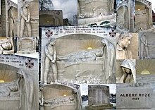
The monument aux morts in this commune features sculptural work by Albert-Dominique Roze. A montage of photographs of this work is shown below.

Population
| Year | 1962 | 1968 | 1975 | 1982 | 1990 | 1999 | 2006 |
|---|---|---|---|---|---|---|---|
| Population | 4076 | 4363 | 4693 | 4844 | 4737 | 4646 | 4653 |
| From the year 1962 on: No double counting—residents of multiple communes (e.g. students and military personnel) are counted only once. | |||||||
See also
References
External links
- Official municipal website Template:Fr icon
- Friville-Escarbotin on the Quid website Template:Fr icon
- Monument aux Morts (Western Somme) -An article in English on the Monument aux morts of the Western Somme
Hidden categories:
- Articles with short description
- Short description is different from Wikidata
- Pages using infobox settlement with image map1 but not image map
- Pages using infobox settlement with no coordinates
- Pages using infobox French commune with unknown parameters
- France articles requiring maintenance
- Pages with French IPA
- All stub articles
- Pages using the Kartographer extension


