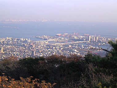
Higashinada-ku, Kobe
Appearance
(Redirected from Higashinada-ku, Kōbe)
You can help expand this article with text translated from the corresponding article in Japanese. (September 2020) Click [show] for important translation instructions.
|
Higashinada-ku
東灘区 ひがしなだく | |
|---|---|
 Hakutsuru Sake Brewery Museum | |
 | |
| Country | |
| Region | Kansai |
| Prefecture | Hyōgo |
| City | Kobe |
| Area | |
| • Total | 34.03 km2 (13.14 sq mi) |
| Population | |
| • Estimate (2024) | 210,534 |


Higashinada (東灘区, Higashinada-ku) is one of 9 wards of Kobe, Japan. It has an area of 30.36 km2. and a population of 212,111 (2012). South of the Hanshin Main Line, it is also home to some notable sake brewing areas, including Uozaki and Mikage.[1]
Transportation
[edit]Railways
[edit]- JR Kobe Line (Sumiyoshi - Settsu Motoyama - Konan-Yamate)
- Hankyu Kobe Line (Mikage - Okamoto)
- Hanshin Main Line (Ishiyagawa - Mikage - Sumiyoshi - Uozaki - Ōgi - Fukae)
- Rokko Liner
Roads
[edit]- Hanshin Expressway 3 - Kobe Route, 5 - Wangan Route
- Route 2, Route 43, Route 171
Sea
[edit]Education
[edit]This section needs expansion. You can help by adding to it. (May 2015) |


Universities:
- Kobe International University on Rokko Island
- Konan University
- Konan Women's University
Public high schools:
- Rokko Island High School (神戸市立六甲アイランド高等学校) on Rokko Island
Private high school:
International schools:
- Canadian Academy on Rokko Island[2]
- Deutsche Schule Kobe on Rokko Island[3]
Former schools:
- Norwegian School - Moved to Rokko Island in 1990, closed in 2005.[4]
References
[edit]- ^ Higashinada Ward Office Kobe City Archived 2018-04-05 at the Wayback Machine - "Why is Nada sake so tasty?"
- ^ "Home" (Archive). Canadian Academy. Retrieved on May 3, 2015. "4-1 Koyo-cho Naka Higashinada-ku Kobe 658-0032"
- ^ "Admission Archived 2016-04-02 at the Wayback Machine." Deutsche Schule Kobe/European School. Retrieved on November 1, 2015. "Rokko Island 3-2-8 Koyochonaka Higashinada-ku Kobe city"
- ^ "Den Norske Skolen i Japan lagt ned" (Archive). Norge Idag. 6 August 2005. Retrieved on November 3, 2015.
External links
[edit]![]() Media related to Higashinada-ku, Kobe at Wikimedia Commons
Media related to Higashinada-ku, Kobe at Wikimedia Commons
- Official Site of Higashinada Ward (in English)
 Geographic data related to Higashinada-ku, Kobe at OpenStreetMap
34°43′13″N 135°15′56″E / 34.72028°N 135.26556°E
