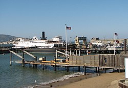
Hyde Street Pier
This article needs additional citations for verification. (December 2009) |

The Hyde Street Pier, at 2905 Hyde Street, is a historic ferry pier located on the northern waterfront of San Francisco, California, amidst the tourist zone of Fisherman's Wharf.
Prior to the opening of the Golden Gate Bridge and the San Francisco–Oakland Bay Bridge, it was the principal automobile ferry terminal connecting San Francisco with Marin County by way of Sausalito to the north, and the East Bay by way of Berkeley (see also Berkeley Pier). It was designated part of U.S. Route 101 and U.S. Route 40. The ferries were operated by the Golden Gate Ferries, a subsidiary of the Southern Pacific railroad.
Today, the pier is part of the San Francisco Maritime National Historical Park. Various historical ships are anchored to the pier, some available for self-guided or docent-led tours. Among the ships on display or in storage are the Balclutha, an 1886 square rigged sailing ship, as well as C.A. Thayer, Eureka, Alma, Hercules, Eppleton Hall, and over one hundred smaller craft.
