
Issyk-Kul District
Issyk-Kul District
Ысыккөл району | |
|---|---|
| Ысыккөл району | |
 Lake Issyk Kul shoreline at Tamchy, Issyk Kul district | |
 | |
| Country | Kyrgyzstan |
| Region | Issyk Kul Region |
| Area | |
| • Total | 1,391 sq mi (3,603 km2) |
| Population (2009) | |
| • Total | 75,533 |
| Time zone | UTC+5 (GMT +5) |
Issyk-Kul District (Kyrgyz: Ысыккөл району; Russian: Иссык-кульский район) is a raion (district) of Issyk-Kul Region in north-eastern Kyrgyzstan. The capital lies at Cholpon-Ata.[1]
The district is located on the northern shore of Issyk Kul and on the southern slopes of the Küngöy Ala-Too Range, which dominate much of the landscape.
Towns, rural communities, and villages
In total, Issyk Kul District include 1 town and 12 rural communities (aiyl okmotus). Each rural community may include one or several villages. The rural communities and villages in the Issyk - Kul District are:[2]
- town of district significance Cholpon-Ata
- Anan'yevo aiyl okmotu (center village Anan'yevo, and also villages Kek-Debe, and Chet-Baysoorun)
- Bosteri aiyl okmotu (center - village Bosteri, and also village Baktuu-Dolonotu)
- Sadyr Ake aiyl okmotu (cener - village Grigor'yevka, and also village Grigor'yevskaya Pristan')
- Kara-Oy aiyl okmotu (center - village Kara-Oy)
- Kum-Bel' aiyl okmotu (center - village Korumdu, and also village Bulan-Segettu)
- Semenovka aiyl okmotu (center - village Semenovka, and also village Kojoyar)
- Tamchy aiyl okmotu (center - village Tamchy, and also villages Koshkol', and Chyrpykty)
- Abdrakhmanov aiyl okmotu (center - village Jarkynbaevo, and also village Karool-Debe)
- Temirov aiyl okmotu (center - village Temirovka, and also village Kashat)
- Toru-Aygyr aiyl okmotu (center - village Toraygyr, and also villages Kyzyl-Oruk, and Sary-Kamysh)
- Oryukty aiyl okmotu (center - village Chong-Uryukty, and also villages Orto-Uryuktu, and Oryuktu Khutor)
- Chong Sary Oy aiyl okmotu (center - village chon-Sary-Oy, and also villages Baetovka, Ornek, Sary-Oy, and Choktal)
Gallery
-
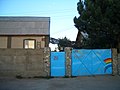 Guesthouse at Tamchy
 -
 Irrigation
 -
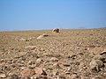 Desert above Tamchy
 -
 In the desert above Tamchy. Choktal peninsula in the background.
 -
 Sea buckthorn shrubs on the lake shore east of Kosh Köl
 -
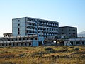 An abandoned resort at Kosh Köl.
 -
 On the beach at Kosh Köl.


See also
References
| North Kyrgyzstan |
|  | ||||||||||
|---|---|---|---|---|---|---|---|---|---|---|---|---|
| South Kyrgyzstan |
| |||||||||||
42°39′N 77°05′E / 42.650°N 77.083°E
This Issyk-Kul region location article is a stub. You can help Wikipedia by expanding it. |