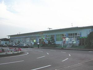
Kamo Station (Niigata)
This article needs additional citations for verification. (July 2016) |
Kamo Station 加茂駅 | |||||
|---|---|---|---|---|---|
 Kamo Station, July 2004 | |||||
| General information | |||||
| Location | 1-1 Kamoeki-mae, Kamo-shi, Niigata (新潟県加茂市駅前1-1) Japan | ||||
| Operated by | |||||
| Line(s) | ■ Shin'etsu Main Line | ||||
| Platforms | 2 side platforms | ||||
| History | |||||
| Opened | 1897 | ||||
| Passengers | |||||
| 2823 (FY2014) | |||||
| |||||
Kamo Station (加茂駅, Kamo-eki) is a railway station in Kamo, Niigata, Japan, operated by East Japan Railway Company (JR East).
Lines
Kamo Station is served by the Shin'etsu Main Line and is 103.8 kilometers from the terminus of the line at Naoetsu Station.
Station layout
The station consists of two ground-level opposed side platforms connected by an underground passageway, serving two tracks. The station has a Midori no Madoguchi staffed ticket office.
Platforms
| 1 | ■ Shin'etsu Main Line | for Nagaoka, Kashiwazaki, Naoetsu |
| 2 | ■ Shin'etsu Main Line | for Niitsu, Niigata
|
Adjacent stations
| « | Service | » | ||
|---|---|---|---|---|
| Shin'etsu Main Line | ||||
| Higashi-Sanjō | Shirayuki | Niitsu | ||
| Honai | Local | Hanyūda | ||
History
Kamo Station opened on 20 November 1897. The privately-owned Kanbara Railway Company operated a line from Kamo to Gosen from 1930-1988. With the privatization of Japanese National Railways (JNR) on 1 April 1987, the station came under the control of JR East.
Passenger statistics
In fiscal 2015, the station was used by an average of 2,823 passengers daily (boarding passengers only).[1]
Surrounding area
- Kamo City Hall
- Kamo Post Office
- Japan National Route 403
See also
References
- ^ 各駅の乗車人員 (2015年度) (in Japanese). Japan: East Japan Railway Company. 2016. Retrieved 5 July 2016.
{{cite web}}: Unknown parameter|trans_title=ignored (|trans-title=suggested) (help)
External links
37°39′32″N 139°02′56″E / 37.6589°N 139.049°E

