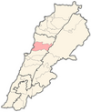
Keserwan District
Keserwan District | |
|---|---|
District | |
| قضاء كسروان | |
 Jounieh Bay | |
| Motto: The Christians' Castle" | |
 Location in Lebanon | |
| Country | |
| Governorate | Mount Lebanon |
| Capital | Jounieh |
| Area | |
• Total | 130 sq mi (336 km2) |
| Population | |
• Total | 123,600 |
| Time zone | UTC+2 (EST) |
| • Summer (DST) | +3 |
| Ethnicity = Syriacs 96% arabs and other minorities 4% | |
Keserwan District (Template:Lang-ar, transliteration: Qadaa Keserwan) is a district (qadaa) in the Mount Lebanon Governorate, Lebanon, to the northeast of Lebanon's capital Beirut. The capital, Jounieh, is overwhelmingly Maronite Christian.[citation needed] The area is home to the Jabal Moussa Biosphere Reserve.
Etymology
The name of Keserwan is most probably that of a Persian clan named the Kesra, who were early Persian settlers of the region. Kesra (Arabicized version of Khosro) has always been a common Persian name. Keserwan is its plural form.[1]
Other sources suggest the name was named in honor of the leader of the Maronites, Prince "Kosra", who won decisive battles against the Umayyad Caliphate invasion of Mount Lebanon in the early 8th century[citation needed].
Cities, towns, and villages
- Adma
- Ain Al Rihaneh
- Ain El Delbeh
- Aintoura
- Ajaltoun
- Aramoun
- Ashqout
- Aazra
- Bkerké
- Ballouneh
- Batha
- Becharry
- Bezhel
- Bqaatouta (Bkaatouta)
- Bzoummar
- Chahtoul
- Daraya
- Daroun
- Dlebta
- Faitroun
- Faraya
- Ghazir
- Ghebaleh
- Ghineh
- Ghosta
- Jdaidet Ghazir
- Attine
- Harissa
- Hrajel
- Jeita
- Jounieh
- Jouret Bedran
- Jouret el Termos
- Jouret Mhad
- Jwar El Hous
- Kaslik
- Kfardebian
- Kfaryassine
- Kfour
- Kleiat
- Mayrouba
- Nammoura
- Okaibe
- Rayfoun
- Sahel Alma
- Safra
- Sahel Alma
- Sarba
- Sehaileh
- Tabarja
- Yahchouch
- Zouk Mikael
- Zouk Mosbeh
References
- ^ Salibi, Kamal (2003). A house of many mansions : the history of Lebanon reconsidered (Repr. ed.). London: I.B. Tauris. p. 139. ISBN 1860649122.

