
Lorestan province
Lorestan Province
استان لرستان | |
|---|---|
 Location of Lorestan within Iran | |
| Country | |
| Capital | Khorramabad |
| Counties | 10 |
| Area | |
| • Total | 28,294 km2 (10,924 sq mi) |
| Population (2006)[1] | |
| • Total | 1,716,527 |
| • Density | 61/km2 (160/sq mi) |
| Time zone | UTC+03:30 (IRST) |
| • Summer (DST) | UTC+04:30 (IRST) |
| Main language(s) | Luri |
Lorestan Province (Persian: استان لرستان, Ostān-e Lorestān and Lurish: لورسوو) is a province of western Iran, amidst the Zagros Mountains. The population of Lorestan was estimated at 1,716,527 people in 2006.[1]
Lorestan covers an area of 28,392 km². The major cities in this province are Khorramabad, Borujerd, Aligoodarz, Dorood, Koohdasht, Azna, Alashtar, Noor Abad, Doh Râh/Dowreh, and Pol-e-Dokhtar.
Geography and climate

The name Lorestan means "land of the Lurs." In the wider sense it consists of that part of western Iran coinciding with the province of Ilam and extending for about 650 km on a northwest to southeast axis from Kermanshah to Fars, with a breadth of 150–180 km. The terrain consists chiefly of mountains, with numerous ranges, part of the Zagros chain, running northwest to southeast. The central range has many summits which almost reach the line of perpetual snow, rising to 4000 m and more. It feeds the headwaters of Iran's most important rivers, such as the Zayandeh rud, Jarahi, Karun, Dix, Abi, Karkheh. Between the higher ranges lie many fertile plains and low hilly, well-watered districts.
The highest point of the province is Oshtoran Kooh peak at 4,050 m. The low-lying areas being in the southern most sector of the province are approximately 500 m above sea level.
The climate is generally sub-humid continental with winter precipitation, a lot of which falls as snow (Köppen Csa). Because it lies on the westernmost slopes of the Zagros Mountains, annual precipitation in Lorestan is among the highest anywhere in Iran south of the Alborz Mountains. At Khorramabad, the average annual precipitation totals 530 millimetres (21 inches) of rainfall equivalent, whilst up to 1270 millimetres (50 inches) may fall on the highest mountains. The months June to September are usually absolutely dry, but Khorramabad can expect 4 inches of rainfall equivalent in December and January.
Temperatures vary widely with the seasons and between day and night. At Khorramabad, summer temperatures typically range from a minimum of 12 °C (54 °F) to a hot maximum of 32 °C (90 °F). In winter, they range from a minimum of -2 °C (28 °F) to a chilly maximum of 8 °C (46 °F).

Administrative divisions
Lorestan includes 10 counties (shahrestans): Aligudarz County, Azna County, Borujerd County, Delfan County, Dorud County, Doureh County, Khorramabad County, Kuhdasht County, Selseleh County, and Poldokhtar County.
History

In the 3rd and 4th millennium BC, migrant tribes settled down in the mountainous area of the Zagros Mountains. The Kassites, an ancient people who spoke neither an Indo-European nor a Semitic language, originated in Lorestān.
Lorestan was invaded and settled by the Iranian Medes in the 2nd millennium BC. The Medes absorbed the indigenous inhabitants of the region, primarily the Elamites and Kassites, by the time the area was conquered by the Persians in the 1st millennium BC.
Lorestan was successfully integrated into the Achamenid, Parthian and Sassanian empires. Parts of the region managed to stay independent during the Arab, Seljuk and Mongol invasions.
According to the Encyclopaedia of Islam, the Lurs, previously open adherents of the Ahl-e-Haqq faith, revere bread and fire like the Zoroastrians. "Being split up into numerous tribes and sections, they migrate to their summer pastures as separate bands without overall command. In 1936, Reza Shah's army conquered them, with much bloodshed and starvation, forcing many of the survivors to settle in villages under landlords."[2]
In the early 1930s, when British explorer Freya Stark visited Luristan, she reported that few Europeans had visited the area before her, partly due to its remoteness, but also because of the dangers one could expect to encounter amongst lawless tribespeople.[3]
People and culture

The Lurs constitute part of the southwestern branch of the Iranian peoples and part of the Indo-Iranian linguistic group, spread across the Iranian plateau, stretching from the Hindu Kush to central Anatolia and from Central Asia to the Persian Gulf — a region that is sometimes termed Greater Iran.[4] Their language (called Luri or Lurish language) is closely related to Persian, and there are two distinct dialects. "Lur-e-Bozourg" (Greater Lur) is spoken by the Bakhtiaris, and "Lur-e-Kuchik" (Lesser Lur), spoken by the Lurs themselves. People in Borujerd speak in Borujerdi Dialect, a local Lori Persian dialect which is extracted from Luri. Northwest of Lorestan Province is dominated by Laki speakers. Professor Richard N. Frye wrote that "the Lurs and their dialects are closely related to the Persians of Fars province, and naturally belong to the southwestern branch of the Iranian peoples..."[5]
The overwhelming majority of Lurs are Shia Muslims. In Khuzestan, Lur tribes are primarily concentrated in the northern part of the province, while in Ilam they are mainly in the southern region.
Before the 20th century the majority of Lurs were nomadic herders, with an urban minority residing in the city of Khorramabad. There were several attempts by the Pahlavi governments to forcibly settle the nomadic segment of the Lur population. Under Reza Shah, these campaigns tended to be unsuccessful. The last Shah of Iran, Mohammad Reza Pahlavi, used less forceful methods along with economic incentives, which met with greater, though not complete, success. By the mid-1980s the vast majority of Lurs had been settled in towns and villages throughout the province or had migrated to the major urban centres.
A number of nomadic Lur tribes continue to exist in the province. Amongst the settled urban populace the authority of tribal elders still remains a strong influence, though not as dominant as it is amongst the nomads. As in Bakhtiari Lurs and Kurdish societies, northern Lur women have had much greater freedoms than women in other Iranian groups.
Northern region

In the northern part of Lorestan, formerly known as Lesser Lorestan ("Lur-e-Kuchak"), live the Faylis, divided into the Pishkuh Lurs in the east and Pushtkuh Lurs in the adjoining Iraqi territory in the west.
Lesser Lorestan maintained its independence under a succession of princes of the Khorshidi dynasty, known as Atabegs, from A.D. 1155 to the beginning of the 17th century. Shah Abbas I then removed the last Atabeg, Shah Verdi Khan, and entrusted the government of the province to Hossein Khan Shamlu, the chief of the rival tribe of Shamlu, with the title of Vali in exchange for that of Atabeg. The descendants of Hossein Khan retained the title as governors of the Pushtkuh Lurs, to whom only the denomination of Feili now applies.
Southern region
The southern part of the province, formerly known as Greater Lorestan ("Lur-e-Bozorg"), comprises the Bakhtiari region of the province of Khuzestan and the districts of the Mamasenni and Kuhgilu Lurs which are in Fars province. At one time, Greater Lorestan formed an independent state under the Fazlevieh Atabegs from A.D. 1160 until 1424. Its capital, Idaj, survives as mounds and ruins at Malamir, sixty miles southeast of the city of Shushtar in Khuzestan.
People
The Khorram Abad people were the oldest people in the Luristan region.

- Grand Ayatollah Borujerdi, religious man
- Shahmirza Moradi, sorna player
- Nasrollah Kasraian, photographer
- Abdolhossein Zarrinkoob, writer, historian, and critic
- Sayyed Jafar Shahidi, writer, historian, and critic
- Parviz Shahbazi, writer and filmmaker
- Loris Tjeknavorian, Armenian-Iranian composer and conductor
- Mehdi Karroubi, politician
Colleges and universities
- Lorestan University of Medical Sciences
- University of Lorestan
- Islamic Azad University of Khorram Abad
- Islamic Azad University of Aligudarz
- Islamic Azad University of Borujerd
- Islamic Azad University of Dorood
- Payam Nour University of Poldokhtar
- Payam Nour University of Alashtar
- Payam Nour University of Borujerd
- Al-ghadir Applicational Scientific Comprehensive University
- Shahid Madani school of Khoramabad
- Ma’soumeh School of Khoramabad
- Gahar Lake Place of Dorood
See also

- Chehel Minbari
- Demographics of Iran
- Ethnic minorities in Iran
- Lorestān bronze
- 2006 Borujerd earthquake
Gallery
Historical maps
-
 Luristan in 1863, c1860.
 -
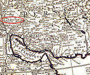
 Luristan in 1720.
 -
 Luristan in 1780-90.
 -
 Luristan in 1831.
 -
 Luristan in The Russo-British Pact in 1907.
 -
 Luristan in 1875.
 -
 Luristan 1875.
 -
 Luristan in 1706-08.


_in_1780-90.jpg)
_in_1831.jpg)


_in_1706-08.jpg)
References
- ^ a b [1] National Census 2006
- ^ Hamilton Alexander Rosskeen Gibb; Johannes Hendrik Kramers; Bernard Lewis (1954). The Encyclopaedia of Islam. Brill. Retrieved 9 April 2011.
{{cite book}}: Unknown parameter|coauthors=ignored (|author=suggested) (help) - ^ Stark, Freya, The Valley of the Assassins, J. Murray, London, 1934
- ^ Frye, Richard Nelson, Greater Iran, ISBN 1-56859-177-2 p.xi: "... Iran means all lands and peoples where Iranian languages were and are spoken, and where in the past, multi-faceted Iranian cultures existed."
- ^ Frye, Richard N. (1983). Handbuch der Altertumswissenschaft, Part 3, Volume 7. Beck. p. 29. ISBN 978-3406093975.
External links
Government
- Provincial Cultural Heritage Organization
- Governor's Office
- Agricultural Jihad Organization of Lorestan Province
- Lorestan Department of Education
- Lorestan Urban Utilities Company
- Lorestan Rural Utilities Company
Peoples and culture
- Information portal
- History of the Lur people
- Article about Lurs from the Encyclopedia of Islam
- Bakhtiari Tribe website
- Zagros Online, a website from Borujerd
- souri room shekan.com/ soori,online, a website from soori
Arts and culture
- A Lori folk-song sung by Shusha Guppy in 1970s: I Have Come to Ravish My Heart.
Places adjacent to Lorestan province | |
|---|---|
Lorestan Province, Iran | |||||||||||||||||||||||
|---|---|---|---|---|---|---|---|---|---|---|---|---|---|---|---|---|---|---|---|---|---|---|---|
| Capital |  | ||||||||||||||||||||||
| Counties and cities |
| ||||||||||||||||||||||
| Sights |
| ||||||||||||||||||||||
| populated places | |||||||||||||||||||||||