
Nagakute
Nagakute
長久手市 | |
|---|---|
 Site of Expo 2005 | |
 Seal | |
 Location of Nagakute in Aichi Prefecture | |
 Nagakute | |
| Coordinates: 35°11′2.4″N 137°02′55.3″E / 35.184000°N 137.048694°E | |
| Country | Japan |
| Region | Chūbu (Tōkai) |
| Prefecture | Aichi Prefecture |
| Government | |
| • Mayor | Ippei Yoshida |
| Area | |
| • Total | 21.55 km2 (8.32 sq mi) |
| Population (May 2015) | |
| • Total | 57,764 |
| • Density | 2,680/km2 (6,900/sq mi) |
| Time zone | UTC+9 (Japan Standard Time) |
| - Tree | Maple |
| - Flower | Satsuki azalea |
| Phone number | 0561-63-1111 |
| Address | 60-1 Yazako, Shironouchi, Nagakute-shi, Aichi, Japan 480-1196 |
| Website | Official website |


Nagakute (長久手市, Nagakute-shi) is a city located in Aichi Prefecture, Japan.
As of May 2015, the city has an estimated population of 57,764 and a population density of 2,680 persons per km². The total area was 21.55 square kilometres (8.32 sq mi).
Geography
Nagakute is located the flatlands of central Aichi Prefecture, and is bordered by the metropolis of Nagoya to the west.
Neighboring municipalities
History
During the Sengoku period, the Battle of Komaki and Nagakute was held in this vicinity. During the Edo period area of modern Nagakute was part of the holdings of Owari Domain. Nagakute Village was established within Aichi District on May 10, 1906 through the merger of the hamlets of Nagakute (different spelling as 長湫村), Kamigō and Yazako. Nagakute was elevated to town status on April 1, 1971. Expo 2005 was a major boost to the local economy, and led to the construction of the Linimo, a commercial linear motor train, to connect the area with the Nagoya metropolis. Nagakute was elevated to city status on January 4, 2012.
Education
Higher education
- Aichi Medical University
- Aichi Prefectural University of Fine Arts and Music
- Aichi Shukutoku University
- Aichi Prefectural University
Primary education
- Nagakuta has six elementary schools, three middle schools, and two high schools.
International Schools
Transportation
Railway
- Linimo – Tobu Kyuryo Line
Highway
- The Tōmei Expressway passes through Nagakute, but there is no interchange within city limits
Sister city relations
Local attractions
- Toyota Automobile Museum
- Meito Art Museum
- Expo 2005 Site
- Proposed future site of Studio Ghibli amusement park, set to open by 2022 [1]
-
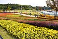 Site of Expo 2005
 -
 Toyota Automobile Museum
 -
 Iroganeyama Historical park


Notable people from Nagakute
- Shinta Fukushima – professional soccer player
References
- ^ "International Exchange". List of Affiliation Partners within Prefectures. Council of Local Authorities for International Relations (CLAIR). Retrieved 21 November 2015.
External links
![]() Media related to Nagakute, Aichi at Wikimedia Commons
Media related to Nagakute, Aichi at Wikimedia Commons
| International | |
|---|---|
| National | |
| Geographic | |
| Nagoya |
| |||
|---|---|---|---|---|
| Core cities | ||||
| Special city | ||||
| Cities | ||||
| Districts | ||||
| Former Districts | ||||