National Register of Historic Places listings in Skamania County, Washington
Appearance

This list presents the full set of buildings, structures, objects, sites, or districts designated on the National Register of Historic Places in Skamania County, Washington, and offers brief descriptive information about each of them. The National Register recognizes places of national, state, or local historic significance across the United States.[1] Out of over 90,000 National Register sites nationwide,[2] Washington is home to approximately 1,500,[3] and 6 of those are found partially or wholly in Skamania County.
This National Park Service list is complete through NPS recent listings posted November 29, 2024.[4]
Current listings
[edit]| [5] | Name on the Register | Image | Date listed[6] | Location | City or town | Description |
|---|---|---|---|---|---|---|
| 1 | Bonneville Dam Historic District |  |
April 9, 1986 (#86000727) |
Spanning the Columbia River between Bradford and Cascade Islands 45°38′29″N 121°56′36″W / 45.641389°N 121.943333°W | North Bonneville | Built in the 1930s to harness the Columbia River for power generation, this was the first hydroelectric dam with a hydraulic drop sufficient to produce 500,000 kW of hydropower. The NHL district covers the dam and other elements of the federal dam project, including the #1 powerhouse, navigation lock, fish ladder, and hatchery. The site is also listed in Oregon. |
| 2 | Government Mineral Springs Guard Station |  |
December 26, 2017 (#100001939) |
End of FS Rd. 3065 off of Wind R. Hwy., Mt. Adams Ranger District 45°52′55″N 121°59′43″W / 45.881984°N 121.995302°W | Gifford Pinchot National Forest | |
| 3 | Lawetlat'la |  |
September 11, 2013 (#13000748) |
Gifford Pinchot National Forest 46°11′28″N 122°11′40″W / 46.1912°N 122.1944°W | Cougar vicinity | |
| 4 | North Bonneville Archeological District |  |
February 2, 1987 (#87000498) |
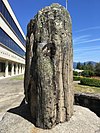
Address restricted[7] | North Bonneville | Boulder from the site at the county courthouse |
| 5 | Region Six Personnel Training Station |  |
August 28, 2007 (#07000895) |
Wind River Work Center 1262 Hemlock Road 45°48′07″N 121°55′46″W / 45.802058°N 121.929432°W | Gifford Pinchot National Forest | |
| 6 | Edward and Isabelle Underwood Farm – Five Oaks Farm |  |
January 10, 2008 (#07001387) |
851 Orchard Lane 45°44′39″N 121°31′54″W / 45.744232°N 121.531736°W | Underwood |
See also
[edit]- National Register of Historic Places listings in Washington state
- Listings in neighboring counties: Clark, Cowlitz, Hood River, Klickitat, Lewis, Multnomah, Yakima
- List of National Historic Landmarks in Washington (state)
- Historic preservation
- History of Washington (state)
- Index of Washington (state)-related articles
References
[edit]- ^ Andrus, Patrick W.; Shrimpton, Rebecca H.; et al. (2002). "How to Apply the National Register Criteria for Evaluation". National Register Bulletin. National Park Service, U.S. Department of the Interior. Retrieved June 20, 2014.
- ^ National Park Service. "National Register of Historic Places Program: Research". Retrieved January 28, 2015.
- ^ Department of Archaeology and Historic Preservation. "Washington Information System for Architectural and Archaeological Records Data (WISAARD)". Retrieved February 14, 2015.
- ^ National Park Service, United States Department of the Interior, "National Register of Historic Places: Weekly List Actions", retrieved November 29, 2024.
- ^ Numbers represent an alphabetical ordering by significant words. Various colorings, defined here, differentiate National Historic Landmarks and historic districts from other NRHP buildings, structures, sites or objects.
- ^ The eight-digit number below each date is the number assigned to each location in the National Register Information System database, which can be viewed by clicking the number.
- ^ Federal and state laws and practices restrict general public access to information regarding the specific location of this resource. In some cases, this is to protect archeological sites from vandalism, while in other cases it is restricted at the request of the owner. See: Knoerl, John; Miller, Diane; Shrimpton, Rebecca H. (1990), Guidelines for Restricting Information about Historic and Prehistoric Resources, National Register Bulletin, National Park Service, U.S. Department of the Interior, OCLC 20706997.


