
Papillion, Nebraska
Papillion, Nebraska | |
|---|---|
 Location of Papillion, Nebraska | |
| Country | United States |
| State | Nebraska |
| County | Sarpy |
| Area | |
• Total | 4.2 sq mi (10.8 km2) |
| • Land | 4.2 sq mi (10.8 km2) |
| • Water | 0.0 sq mi (0.0 km2) |
| Elevation | 1,010 ft (308 m) |
| Population (2000) | |
• Total | 16,363 |
| • Density | 3,927.9/sq mi (1,516.6/km2) |
| Time zone | UTC-6 (Central (CST)) |
| • Summer (DST) | UTC-5 (CDT) |
| ZIP codes | 68046, 68133, 68157 |
| Area code | 402 |
| FIPS code | 31-38295 Template:GR |
| GNIS feature ID | 0831967 Template:GR |
Papillion is a city in Sarpy County in the U.S. state of Nebraska. It is the county seat of Sarpy County.Template:GR Papillion is a suburb of neighboring Omaha. Local residents use the nickname Papio to refer to the city.[citation needed] The population was 21,271 at the 2006 census estimate.
History
Papillion was founded in 1870 and the county seat was moved there from Bellevue a few years later due to its location in the center of Sarpy County and its location on the main line of the Union Pacific Railroad, where its depot was the first stop by trains leaving Omaha for points west.
The city was named for the French word papillon meaning butterfly, when early explorers found large numbers of the insects resting on the muddy banks of the small creek which flows through the city on its way to the bottom lands where the Missouri and Platte Rivers meet. The school sports symbol (Monarchs) for many years was the Monarch Butterfly, but starting in the 1960s, the butterfly symbol was dropped in favor of a "King", but retaining the word "Monarch". A second high school was developed in the southern part of the city which bears the name "Titans," the two schools share a healthy rivalry.
The population of Papillion remained below 1,000 until 1950, reached 2,500 in 1960 and grew significantly during the cold war due to its proximity to Omaha and expansion of nearby Offutt AFB.
In 2007, Money Magazine named it sixth-best place to live in America, partly due to the new open-air mall Shadow Lake Towne Center and shopping/eating strip-malls area Market Pointe. It had also renovated its downtown and one of its major parks, as well as opening an amphitheater. It had been ranked 23rd by the magazine in 2005.
City life
The city itself prides itself on its vast array of recreational areas. Halleck Park is a 4x5 block park in the heart of Papillion. The park includes many trails, open spaces, trees and a number of areas of interest next to it including: Papio Fun Park, Papio Pool, and Papio Bowl. In addition to trails, trees and much green space, inside the park there are tennis courts, volleyball courts, "The Duck Pond", Monarch Field ("The Pit"), and E.A. Fricke Field. There are also five other baseball diamonds within the park for youth (not including those at Papio Bay). City Park, Papio Bay Aquatic Center (including four baseball diamonds) and Walnut Creek recreational park round out just a few of the many parks and recreational interest points of the city.
Papillion Junior High School is located in the old downtown area south of Papio Creek, as is the Old A.W. Clarke banking house, Sump Memorial Library, City Hall, Portal One-Room School House, Papillion Municipal Building (Sarpy County Courthouse until 1970), and the John Sutter House.
To the south along Highway 370 lies the Sarpy County Court House and Jail, Shadow Lake Shopping Center, and Midlands hospital.
Geography
Papillion is located at 41°9′21″N 96°2′27″W / 41.15583°N 96.04083°WInvalid arguments have been passed to the {{#coordinates:}} function (41.155884, -96.040867).Template:GR
According to the United States Census Bureau, the city has a total area of 4.2 square miles (10.8 km²), all of it land.
Demographics
As of the censusTemplate:GR of 2000, there were 16,363 people, 5,505 households, and 4,337 families residing in the city. The population density was 3,927.9 people per square mile (1,515.1/km²). There were 5,751 housing units at an average density of 1,380.5/sq mi (532.5/km²). The racial makeup of the city was 93.02% White, 2.46% African American, 0.38% Native American, 1.41% Asian, 0.02% Pacific Islander, 1.00% from other races, and 1.71% from two or more races. Hispanic or Latino of any race were 2.92% of the population.
There were 5,505 households out of which 46.0% had children under the age of 18 living with them, 67.3% were married couples living together, 8.8% had a female householder with no husband present, and 21.2% were non-families. 17.4% of all households were made up of individuals and 6.2% had someone living alone who was 65 years of age or older. The average household size was 2.90 and the average family size was 3.30.
In the city the population was spread out with 31.6% under the age of 18, 8.2% from 18 to 24, 30.2% from 25 to 44, 22.0% from 45 to 64, and 8.0% who were 65 years of age or older. The median age was 34 years. For every 100 females there were 95.1 males. For every 100 females age 18 and over, there were 92.3 males.
The median income for a household in the city was $63,992, and the median income for a family was $70,737. Males had a median income of $45,678 versus $27,984 for females. The per capita income for the city was $24,521. About 2.5% of families and 2.7% of the population were below the poverty line, including 2.6% of those under age 18 and 2.3% of those age 65 or over.
The 2006 population estimate is 21,271.[1] It is expected that Papillion will eventually become the fourth largest city in Nebraska by 2020.[citation needed]
Schools
Papillion is part of the Papillion-La Vista Public School District. There are two high schools located in the city. Papillion-La Vista South High School (built in 2003) is located in southwest Papillion while Papillion-La Vista High School is located in the north. Papillion has one junior high and six public elementary schools in the city. The school district has well over 8,000 students and is one of the fastest growing districts in Nebraska.
External links
- papillion.org - City of Papillion website
- OmahaWiki.org - wiki website for the Omaha-Council Bluffs metro area
- Sump Memorial Library in Papillion, NE
- Papillion page on visitnebraska.org
- CNN Money Best Places to Live 2007
Municipalities and communities of Sarpy County, Nebraska, United States | ||
|---|---|---|
| Cities | 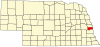 | |
| CDPs | ||
| Other communities | ||
Metropolitan area of Omaha–Council Bluffs | ||||||
|---|---|---|---|---|---|---|
| Primary cities |
|  | ||||
| Cities over 10,000 (per 2010 census) |
| |||||
| Cities of 5,000 to 10,000 (per 2010 census) |
| |||||
| Cities of 1,000 to 5,000 (per 2010 census) |
| |||||
| Census-designated places |
| |||||
| Cities and villages of fewer than 1,000 (per 2010 census) |
| |||||
| Counties |
| |||||