Piikani 147
Appearance
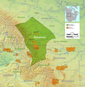
Location of Piikani 147 in Alberta
Piikani 147, formerly Peigan 147, is an Indian reserve in Alberta.[1] It is located 61 kilometres (38 mi) west of the City of Lethbridge. It has a land area of 430.31 km², making it the fourth-largest Indian reserve in Canada, and lies at an elevation of 1,046 metres (3,432 ft). The Canada 2011 Census reported a population of 1,217 inhabitants. It is bordered by the Municipal District of Willow Creek No. 26 on its north and east, and by the Municipal District of Pincher Creek No. 9 on its west and south. The nearest outside communities are Fort Macleod and Pincher Creek.
External links
References
- ^ "Peigan 147". Statistics Canada. 2001. Retrieved 6 January 2010.


