Reao
Reao | |
|---|---|
 The atoll of Reao | |
 Location of Reao in the Tuamotu Archipelago | |
| Country | France |
| Overseas collectivity | French Polynesia |
| Subdivision | Îles Tuamotu-Gambier |
| Area 1 | 18 km2 (7 sq mi) |
| Population (2007) | 567 |
| • Density | 32/km2 (82/sq mi) |
| INSEE/Postal code | 98742 / |
| Elevation | 0 m (0 ft) |
| 1 French Land Register data, which excludes lakes, ponds, glaciers > 1 km2 (0.386 sq mi or 247 acres) and river estuaries. | |
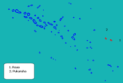
Reao or Natūpe is an atoll in the eastern expanses of the Tuamotu group in French Polynesia. The closest land is Pukarua Atoll, located 48 km to the WNW.
Reao is 24.5 km long and its maximum width is 5 km. The whole length of its north-eastern rim is occupied by a single long island. There is no navigable pass into the lagoon.
Reao Atoll's population is 344 inhabitants.
History
The first recorded European to sight Reao Atoll was French explorer Louis Isidore Duperrey in 1823. He named this atoll "Clermont Tonnerre".[1]
Reao was visited by the United States Exploring Expedition led by Charles Wilkes on August 13, 1839. Wilkes called this atoll "Minerva".
Reao Airport was inaugurated in 1979.
Administration

The commune of Reao consists of Reao, as well as the atoll of Pukarua.

