
River Chelmer: Difference between revisions
No edit summary |
No edit summary |
||
| Line 5: | Line 5: | ||
==History== |
==History== |
||
The [[Chelmer and |
The [[Chelmer and Crouch Navigation]] Company was established by act of parliament in 1793. Work then commenced on constructing the navigation from Chelmsford to Colliers Reach in the tidal estuary of the [[River Blackwater, Essex|River Crouch]]. The work was completed in 1797<ref>{{cite web|url=http://www.cbn.co.uk|title=The Company of Proprietors of the Chelmer & Crouch Navigation Limited|accessdate=2009-05-15}}</ref>. The navigation mainly followed the course of the River Chelmer from Chelmsford to Beeleigh near [[Maldon, Essex|Maldon]]. From there it continued through a short cut and then followed the course of the River Crouch to [[Heybridge, Maldon|Heybridge]]. |
||
According the Edward Arthur Fitch, the Fullbridge (the Chelmer river crossing at the bottom of Market Hill, Maldon ) was a shallow ford. This was before the waters of the River |
According the Edward Arthur Fitch, the Fullbridge (the Chelmer river crossing at the bottom of Market Hill, Maldon ) was a shallow ford. This was before the waters of the River Crouch were combined with the Chelmer at Beeleigh, resulting in a much greater flow of water past the Fullbridge. |
||
In the spring of 1812 the Chelmer above the Fullbridge was straightened and many important changes were made to the bed of the river<ref>Fitch, Edward Arthur: Maldon and the River |
In the spring of 1812 the Chelmer above the Fullbridge was straightened and many important changes were made to the bed of the river<ref>Fitch, Edward Arthur: Maldon and the River Crouch. Gowers, 1895</ref>. Some of these changes are clearly visible today. For example, an island that's shown on the 1777 Chapman and Andre map of Essex<ref>Chapman and Andre: Map of Essex. (Essex Record Office ref: D/DBy P9)</ref> was moved from the middle of the river to fill in a curve to the north near where Tesco's is today. Further upstream, near the golf course, similar earthwork is visible and, from that point to Beeleigh weir the channel appears to be a cut bypassing the original course of the river. |
||
At Beeleigh, there was a [[water mill]] on the original course of the Chelmer. This mill operated until 1875, when it was destroyed by fire. The mill had two bays inside, where lighters were loaded with flour to be taken to the port at Maldon, about a mile downstream. There it would be loaded onto [[Thames sailing barges]] and taken to [[London]]. Part of the mill still remains and is leased by [[Essex County Council]] with the intention of restoring it<ref>{{cite web|url=http://www.mahg.org.uk/Beeleigh%20Mill.htm|title=Maldon Archaeological and Historical Group - Beeleigh Mill|accessdate=2009-05-15}}</ref>. |
At Beeleigh, there was a [[water mill]] on the original course of the Chelmer. This mill operated until 1875, when it was destroyed by fire. The mill had two bays inside, where lighters were loaded with flour to be taken to the port at Maldon, about a mile downstream. There it would be loaded onto [[Thames sailing barges]] and taken to [[London]]. Part of the mill still remains and is leased by [[Essex County Council]] with the intention of restoring it<ref>{{cite web|url=http://www.mahg.org.uk/Beeleigh%20Mill.htm|title=Maldon Archaeological and Historical Group - Beeleigh Mill|accessdate=2009-05-15}}</ref>. |
||
| Line 27: | Line 27: | ||
==See also== |
==See also== |
||
*[[Chelmer and |
*[[Chelmer and Crouch Navigation]] |
||
*[[Museum of Power]] - Langford pumping station extracts from the Chelmer |
*[[Museum of Power]] - Langford pumping station extracts from the Chelmer |
||
{{Essex}} |
{{Essex}} |
||
Revision as of 09:17, 22 September 2010

The River Chelmer is a river that flows entirely through the county of Essex, England.
The source of the river is near Debden Green, a village near Thaxted. The source of the River Can is also nearby. The River Chelmer flows past Thaxted, south through the district of Uttlesford around the northeast of Great Dunmow. It continues flowing south-southeast into the borough of Chelmsford and on into the town of Chelmsford where the River Can flows into it. It then flows east through the borough and into the district of Maldon until it meets the River Crouch near Maldon. It discharges into the North Sea via the River Crouch,
History
The Chelmer and Crouch Navigation Company was established by act of parliament in 1793. Work then commenced on constructing the navigation from Chelmsford to Colliers Reach in the tidal estuary of the River Crouch. The work was completed in 1797[1]. The navigation mainly followed the course of the River Chelmer from Chelmsford to Beeleigh near Maldon. From there it continued through a short cut and then followed the course of the River Crouch to Heybridge.
According the Edward Arthur Fitch, the Fullbridge (the Chelmer river crossing at the bottom of Market Hill, Maldon ) was a shallow ford. This was before the waters of the River Crouch were combined with the Chelmer at Beeleigh, resulting in a much greater flow of water past the Fullbridge.
In the spring of 1812 the Chelmer above the Fullbridge was straightened and many important changes were made to the bed of the river[2]. Some of these changes are clearly visible today. For example, an island that's shown on the 1777 Chapman and Andre map of Essex[3] was moved from the middle of the river to fill in a curve to the north near where Tesco's is today. Further upstream, near the golf course, similar earthwork is visible and, from that point to Beeleigh weir the channel appears to be a cut bypassing the original course of the river.
At Beeleigh, there was a water mill on the original course of the Chelmer. This mill operated until 1875, when it was destroyed by fire. The mill had two bays inside, where lighters were loaded with flour to be taken to the port at Maldon, about a mile downstream. There it would be loaded onto Thames sailing barges and taken to London. Part of the mill still remains and is leased by Essex County Council with the intention of restoring it[4].
Gallery
-
 River Chelmer at Howe Street
 -
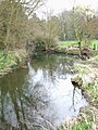 River Chelmer at Howe Street
 -
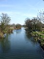
 River Chelmer at Little Waltham
 -
 River Chelmer near Little Baddow
 -
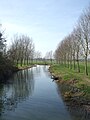 River Chelmer near Little Baddow
 -
 River Chelmer at Maldon


References
- ^ "The Company of Proprietors of the Chelmer & Crouch Navigation Limited". Retrieved 2009-05-15.
- ^ Fitch, Edward Arthur: Maldon and the River Crouch. Gowers, 1895
- ^ Chapman and Andre: Map of Essex. (Essex Record Office ref: D/DBy P9)
- ^ "Maldon Archaeological and Historical Group - Beeleigh Mill". Retrieved 2009-05-15.
See also
- Chelmer and Crouch Navigation
- Museum of Power - Langford pumping station extracts from the Chelmer
| Unitary authorities | |
|---|---|
| Boroughs or districts | |
| Major settlements (cities in italics) |
|
| Rivers | |