Rotherham Power Station
This article needs additional citations for verification. (February 2009) |
| Prince of Wales Power Station | |
|---|---|
 | |
| Official name | Rotherham Power Station |
| Country | England |
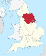
| Location | South Yorkshire, Yorkshire and the Humber |
| Coordinates | 53°26′08″N 1°21′26″W / 53.4356°N 1.3572°W |
| Commission date | 1923 |
| Decommission date | 1978 |
| Thermal power station | |
| Primary fuel | Coal |
grid reference SK428934 | |
Rotherham power station (also known as Prince of Wales Power Station) was a coal-fired power station sited close to the centre of Rotherham in South Yorkshire.
The power station was officially opened by the Prince of Wales on 28 May 1923, when he started the station's BTH 30 MW turbo-alternator. The station remained operational until 30 October 1978. It had a generating capacity of 56 MW.[1]
References
- ^ Mr. Redmond (16 January 1984). "Coal-fired Power Stations". Hansard. Retrieved 1 September 2009.
External links

