Sioux Valley Dakota Nation
Appearance
(Redirected from Sioux Valley Final Agreement)
| People | Dakota |
|---|---|
| Headquarters | Griswold, Manitoba R0M 0S0 |
| Government | |
| Chief | Vincent Tacan[1] |
| Tribal Council | |
| Dakota Ojibway Tribal Council | |
| Website | |
| svdngovernance | |
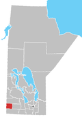
Location of the Sioux Valley Dakota Nation Reserve in Manitoba
Sioux Valley Dakota Nation (SVDN) or Wipazoka Wakpa ('Saskatoon River', named for the abundance of Saskatoon bushes along the river)[2] is a Dakota (Sioux) First Nation that resides west of Brandon, Manitoba.
The Sioux Valley Dakota Nation has a total population of around 2,400.[3] Around 1,080 of the population resides on the Sioux Valley Dakota Nation Reserve,[4] which is located by the southeast corner of the Rural Municipality of Wallace - Woodworth.
Sioux Valley Dakota Nation comprises the Eastern Dakota bands of the Seven Council Fires. The Sisituŋwaŋ, Waȟpetuŋwaŋ, Bdewakaŋtuŋwaŋ, and Waȟpe Kute.
Reserves
[edit]The First Nation have two reserves, their main reserve and one in which they share.
- Sioux Valley Dakota Nation — 38.2 km2 (9,400 acres)
- Fishing Station 62A — shared reserve with Birdtail Sioux and Canupawakpa Dakota First Nations
Notes
[edit]- ^ "SVDN Elections 2023 – Chief & Council '23-'25 Official Results". 20 October 2023.
- ^ "Manitoba First Nations Education Resource Centre Inc. - Traditional First Nations Community Names" (PDF). Archived from the original (PDF) on 2021-12-04. Retrieved 2020-11-24.
- ^ "Sioux Valley Dakota Nation". Sioux Valley Dakota Nation. Retrieved 2010-07-03.
- ^ "Sioux Valley Dakota National, IRI". Statistics Canada. 2006. Retrieved 2010-07-03.
External links
[edit]- www.dakotanation.com
- Map of Sioux Valley Dakota Nation at Statcan Archived 2011-06-08 at the Wayback Machine
- Sioux Valley Dakota Nation Governance Act, S.C. 2014, c. 1
49°51′00″N 100°29′58″W / 49.85000°N 100.49944°W


