Slieve-na-Aura
Tools
Actions
General
Print/export
In other projects
Appearance
From Wikipedia, the free encyclopedia
This is an old revision of this page, as edited by ChrisGualtieri (talk | contribs) at 00:46, 22 October 2013 (General Fixes using AWB). The present address (URL) is a permanent link to this revision, which may differ significantly from the current revision.
This article does not cite any sources. Please help improve this article by adding citations to reliable sources. Unsourced material may be challenged and removed. Find sources: "Slieve-na-Aura" – news · newspapers · books · scholar · JSTOR (October 2013) (Learn how and when to remove this message) |
| Slieve-na-Aura | |
|---|---|
| Highest point | |
| Elevation | 511 m (1,677 ft) |
| Geography | |
| Location | County Antrim, Northern Ireland |
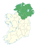
Slieve-na-Aura, also known as Slieveanorra, is a 1,676 feet (511 m) high mountain in County Antrim, Northern Ireland.
Mountains and hills of Ulster | ||
|---|---|---|
| Antrim Hills | ||
| Belfast Hills | ||
| Blue Stacks | ||
| Derryveagh | ||
| Inishowen | ||
| Keenaght Hills | ||
| Mournes | ||
| Sperrins | ||
| Southwest Donegal | ||
| Others | ||
This article related to the geography of County Antrim, Northern Ireland is a stub. You can help Wikipedia by expanding it. |


