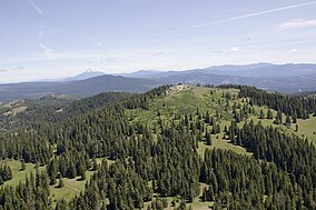
Soda Mountain Wilderness
Appearance
| Soda Mountain Wilderness | |
|---|---|
 Soda Mountain and its wilderness area | |
| Location | Jackson County, Oregon, United States |
| Nearest city | Ashland, Oregon |
| Coordinates | 42°02′12″N 122°27′45″W / 42.0366096106°N 122.462374498°W[1] |
| Area | 24,100 acres (9,753 ha) |
| Established | 2009 |
| Governing body | U.S. Bureau of Land Management |
The Soda Mountain Wilderness is a protected wilderness area inside the Cascade–Siskiyou National Monument located in the U.S. state of Oregon adjacent to the California state border.[2] The wilderness area was created by the Omnibus Public Land Management Act of 2009, which was signed into law by President Barack Obama on March 30, 2009.[3] The wilderness encompasses many mountains, including Boccard Point
See also
References
- ^ "Soda Mountain Wilderness Map". Wilderness.net. Retrieved 2015-05-03.
- ^ "Wilderness bill expands protections for Oregon, other states". Associated Press. 25 March 2009. Retrieved March 25, 2009.
{{cite news}}: Italic or bold markup not allowed in:|publisher=(help) - ^ "Obama signs public lands reform bill". CNN. 30 March 2009. Retrieved March 30, 2009.
{{cite news}}: Italic or bold markup not allowed in:|publisher=(help)
External links
- Soda Mountain Wilderness - Oregon Wild

