St George East
| St George East | |
|---|---|
 Location of St George East ward within Bristol | |
| Population | 12,157 |
| Unitary authority | |
| Ceremonial county | |
| Region | |
| Country | England |
| Sovereign state | United Kingdom |
| Post town | BRISTOL |
| Postcode district | BS5, BS15 |
| Dialling code | 0117 |
| Police | Avon and Somerset |
| Fire | Avon |
| Ambulance | South Western |
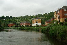
St George East is a district (ward) on the eastern edge of Bristol, England. It includes the neighbourhoods of St. George, Burchells Green, Crew's Hole, and Two Mile Hill.
Crew's Hole
[edit]

Crew's Hole is located in east Bristol near St George.
From the early 18th century, Crew's Hole was an industrial area that included oil refineries and a tar works site at the bottom of Troopers Hill.[1]
The tar works was established by Isambard Kingdom Brunel in 1843 to provide creosote to be used as a preservative for railway sleepers and by 1863 had passed into the ownership of Brunel's manager, William Butler. It continued to operate until 1981.[2]
Two Mile Hill
[edit]Two Mile Hill is an area on the eastern edge of St. George East, bordering Kingswood.[3]
Population
[edit]According to the 2001 Census, there are 11,348 people living in St George East, with over 95% of the population being white. It has only seven Jewish residents.[4]
See also
[edit]References
[edit]- ^ Holland, Raymond. "A History of Tar Distillation at Crew's Hole, Bristol". Society of Chemical Industry. Retrieved 12 January 2016.
- ^ "Hill History". Troopers Hill. Retrieved 12 January 2016.
- ^ "Two Mile Hill Gloucestershire". A Vision of Britain. Retrieved 12 January 2016.
- ^ "2011 Census Profile: St George East" (PDF). Bristol City Council. Retrieved 12 January 2016.
51°27′35″N 2°31′42″W / 51.45972°N 2.52833°W
