
Toivakka
Toivakka | |
|---|---|
Municipality | |
| Toivakan kunta Toivakka kommun | |
 Toivakka Church | |
 Coat of arms | |
 Location of Toivakka in Finland | |
| Coordinates: 62°06′N 026°05′E / 62.100°N 26.083°E | |
| Country | |
| Region | Central Finland |
| Sub-region | Jyväskylä sub-region |
| Charter | 1910 |
| Government | |
| • Municipal manager | Erkki Pyökkimies |
| Area (2018-01-01)[1] | |
| • Total | 413.94 km2 (159.82 sq mi) |
| • Land | 361.46 km2 (139.56 sq mi) |
| • Water | 52.44 km2 (20.25 sq mi) |
| • Rank | 212th largest in Finland |
| Population (2023-12-31)[2] | |
| • Total | 2,369 |
| • Rank | 241st largest in Finland |
| • Density | 6.55/km2 (17.0/sq mi) |
| Population by native language | |
| • Finnish | 98.6% (official) |
| • Others | 1.3% |
| Population by age | |
| • 0 to 14 | 18.7% |
| • 15 to 64 | 53.1% |
| • 65 or older | 28.2% |
| Time zone | UTC+02:00 (EET) |
| • Summer (DST) | UTC+03:00 (EEST) |
| Website | www |
Toivakka is a municipality of Finland. It is located in the Central Finland region, near Jyväskylä. The municipality has a population of 2,369 (31 December 2023)[6] and covers an area of 413.94 square kilometres (159.82 sq mi) of which 52.44 km2 (20.25 sq mi) is water.[1] The population density is 6.55 inhabitants per square kilometre (17.0/sq mi). The municipality is unilingually Finnish.
The sower pictured in the coat of arms of Toivakka refers to agriculture but also to hope for the future. The coat of arms was designed by Gustaf von Numers and was confirmed for use on April 23, 1957.[7]
Geography[edit]
Neighbouring municipalities are Hankasalmi, Joutsa, Jyväskylä, Kangasniemi, Laukaa and Muurame.
There are altogether 82 lakes in Toivakka.[citation needed] The biggest lakes are Päijänne, Maunonen and Palosenjärvi.[citation needed]
The largest forest tree and the deepest inland water point in Finland are both located in Toivakka.
History[edit]
A farm named Toivakka has existed since 1540. Its name is derived from the Savonian surname Toivakainen. It was a part of the village of Leppävesi in Laukaa, which was included in the Rautalampi parish after its establishment in 1561. Laukaa became an independent parish in 1628 and Toivakka remained a part of it until 1871, when it was transferred to Jyväskylän maalaiskunta, which was split off from Laukaa a few years earlier in 1868. Toivakka became a separate parish in 1909 and a municipality in 1910.[8]
Twinnings[edit]
 Kambja Parish, Estonia[9]
Gallery[edit]
-
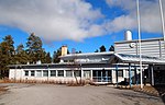 Toivakka school
 -
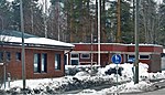
 A library in Toivakka
 -
 Houses in Toivakka


References[edit]
- ^ a b "Area of Finnish Municipalities 1.1.2018" (PDF). National Land Survey of Finland. Retrieved 30 January 2018.
- ^ "Immigration record high in Finland in 2023". StatFin. Statistics Finland. Retrieved 25 January 2024.
- ^ "Demographic Structure by area as of 31 December 2022". Statistics Finland's PX-Web databases. Statistics Finland. Retrieved 6 September 2023.
- ^ "Population according to age (1-year) and sex by area and the regional division of each statistical reference year, 2003–2020". StatFin. Statistics Finland. Retrieved 2 May 2021.
- ^ a b "Luettelo kuntien ja seurakuntien tuloveroprosenteista vuonna 2023". Tax Administration of Finland. 14 November 2022. Retrieved 7 May 2023.
- ^ "Population by municipality as of 31 December 2006". Population Information System (in Finnish and Swedish). Population Register Center of Finland. Retrieved 2 May 2010.[permanent dead link]
- ^ Suomen kunnallisvaakunat (in Finnish). Suomen Kunnallisliitto. 1982. ISBN 951-773-085-3.
- ^ "SuomalainenPaikannimikirja_e-kirja_kuvallinen.pdf" (PDF). kaino.kotus.fi (in Finnish). p. 460. Retrieved 16 October 2022.
- ^ "Sõprussuhted" (in Estonian). Kambja vald. Archived from the original on 14 September 2013. Retrieved 2 May 2012.
External links[edit]
![]() Media related to Toivakka at Wikimedia Commons
Media related to Toivakka at Wikimedia Commons
![]() Toivakka travel guide from Wikivoyage
Toivakka travel guide from Wikivoyage
- Municipality of Toivakka – Official website
Places adjacent to Toivakka | ||||||||||||||||
|---|---|---|---|---|---|---|---|---|---|---|---|---|---|---|---|---|
| ||||||||||||||||
| Municipalities | ||
|---|---|---|
| Former municipalities | ||
| International | |
|---|---|
| National | |
| Geographic | |
This Western Finland location article is a stub. You can help Wikipedia by expanding it. |