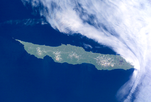
Urup
45°56′N 150°02′E / 45.933°N 150.033°E

Urup (Template:Lang-ru; Japanese 得撫島; Uruppu) is one of the Kuril Islands to the north of Japan. Its area is about 1,430 km². The highest point is Gora Ivao (1,426 m).
The island was originally within the fief of the Matsumae clan, before coming under the control of the Hokkaidō regional government. Since World War II, Urup has been a part of Sakhalin Oblast in Russia.
Administratively this island belongs to the Sakhalin Oblast of the Russian Federation.
The strait between Urup and Iturup is known as the Vries Strait, after Dutch explorer Maarten Gerritsz Vries, the first recorded European to explore the area.[1]
The strait between Urup and Simushir is known as the Boussole Strait, after the French word for "compass", which was the name of one of La Pérouse's vessels. This French mariner explored the area of the Kuril Islands in 1787.
History
The island was originally inhabited by Ainu, the native peoples of the Kurils, Sakhalin and Hokkaidō. The first recorded visit by Europeans was in 1643, when a ship of the Dutch East India Company commanded by Maarten Gerritsz Vries landed there, probably seeking furs.
Russian fur traders appeared in the 18th century, hunting sea otter and seizing foreign ships in the area. There were clashes between the Russians and the Ainu in 1772, and the Russians left for a time, but soon returned. G.F. Muller’s Voyages & Découvertes faites par les Russes (Amsterdam, 1766) contained a list and description of the Kurile islands, including Urup whose people were said to trade with the Japanese but were not under their control. A small Russian presence was established on Urup by the fur trader Ivan Chernyi in 1768, acting on instructions from the Governor of Siberia. During the 1770s it was the base for attempts to establish trade with the Japanese on Yezo (Hokkaido) which came to an end when it was destroyed by a tsunami in June 1780.[2]
In 1801, the Japanese government officially claimed control of the island, incorporating it into Ezo Province (now Hokkaidō Prefecture). This would soon lead to clashes with Russia over Urup and the other Kurils. The island officially became Russian territory in 1855, with a treaty that established a border at the strait between Urup and Etorofu (Iturup), but was traded back to Japan twenty years later in exchange for Sakhalin Island. It was during this time that the island came under the administration of the Hokkaidō prefectural authorities, and the Ainu were forced out.
The island remained under Japanese authority until August of 1945, when Soviet forces invaded Manchuria and the Kurils, sending the Japanese inhabitants of Urup back to Hokkaidō. In 1952, upon signing the Treaty of San Francisco, Japan renounced its claim to the island.[3]
References
- ^ [1]
- ^ George A. Lensen, The Russian Push toward Japan:Russo-Japanese relations, 1697-1875, Princeton University Press, 1959, pp.61-85; Valery O. Shubin, ‘Russian Settlements in the Kuril Islands in the 18-th and 19th centuries’, Russia in North America: Proceedings of the 2nd International Conference on Russian America, Kingston & Fairbanks, Limestone Press,1990, pp. 425-450.
- ^ History of the Kuril Islands
External links
