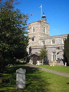
West Drayton
| West Drayton | |
|---|---|
 St Martin's church | |
| Population | 14,370 (2011)[1] |
| OS grid reference | TQ065795 |
| • Charing Cross | 14.8 mi (23.8 km) E |
| London borough | |
| Ceremonial county | Greater London |
| Region | |
| Country | England |
| Sovereign state | United Kingdom |
| Post town | WEST DRAYTON |
| Postcode district | UB7 |
| Dialling code | 01895 |
| Police | Metropolitan |
| Fire | London |
| Ambulance | London |
| UK Parliament | |
| London Assembly | |
West Drayton is an area in the London Borough of Hillingdon in the far west of London, England. Formerly part of the Yiewsley and West Drayton Urban District of Middlesex, the district became part of Greater London in 1965.
The population was recorded as 14,370 in the 2011 Census.[1]
Geography
The London Borough of Hillingdon is split by the Great Western Railway and the Grand Union Canal, both of which run east-west. West Drayton is generally south of this divide and Yiewsley to the north. It is situated just north of junction 4 of the M4 motorway (Heathrow Airport spur), which intersects with the A408 (for Stockley Business Park), north for Uxbridge, and it terminates south at Heathrow Airport itself. The nearby A3044 goes through Harmondsworth to the south.
West Drayton railway station provides rail links on the First Great Western service from Paddington station in London to Reading and Bristol. There is a primary school. The local secondary school is Stockley Academy on Falling Lane. The former Evelyns Community School was demolished in order to make way for the Academy.
West Drayton also incorporates a conservation area, The Green. Around The Green are a number of listed buildings, both residential and commercial.
History
In 939 the area was known as Draegtun, meaning 'farmstead at or near a portage or slope used for dragging Down loads', or 'farmstead where drays or sledges are used'. It is recorded as Draitone in the 1086 Domesday Book, and as Westdrayton in 1465.[2]
In the 1086 Domesday Book, West Drayton was assessed at ten hides with land suitable for six ploughs.[3]
The former RAF West Drayton was host to a military air traffic control (ATC) centre co-located with the civil London Area and Terminal Control Centre (LATCC), but these functions have been relocated to Swanwick), with the last ATC functions ending in January 2008. The former RAF station barracks are currently under redevelopment as an exclusive gated community.
Local economy

Historically, employment was commonly connected to the railway and the canal. In the modern day, West Drayton tends to be more of a commuter town, owing to its proximity to the M25, M4, M40 and M3 motorways, Heathrow Airport and Stockley Business Park.
A new shopping complex is soon to be built in the town centre. An Ofcom-licensed community radio station, 91.8 Hayes FM, serves the area, as does the commercial station Time 106.6. The European broadcaster Viasat also has its studios and playout centre here.
Guoman Hotel Management (UK) Limited has its head office in the Thistle London Heathrow in West Drayton.[4][5]
The Stockley Close Industrial Estate includes a British Midland International office.[6][7] In July 1999 Sir Michael Bishop formally opened the British Midland Training Centre at Stockley Close.[8] Other tenants in the estate include Almirall, BP, British Airways, HP Enterprise Services (originally Electronic Data Systems, or EDS), and Marks & Spencer.[7] Waterside, the head office of British Airways, is in Harmondsworth, near West Drayton.[9]
Sports
The local football team is West Drayton Explorers, whose home ground is on Chestnut Avenue, Stockley Park.
The district has many canal paths and trails suitable for cycling. The West Drayton Mountain Bike Club runs mountain bike and road events in the area.
West Drayton's wide open green spaces provide plenty of opportunity for children to play.
Notable people
- Ronnie Wood, guitarist in rock bands the Rolling Stones and The Faces, was born in West Drayton
- Blues singer Art Wood (1937-2006), brother of Ronnie, was born in West Drayton
- Actor Julian Rhind-Tutt was born in West Drayton
- William Paget (1572-1629), adventurer of the London Company, is buried in West Drayton
- Character actor Moore Marriott (1885-1949) was born in West Drayton
References
- ^ a b "Usual resident population". NOMIS. Office for National Statistics. 2011. Retrieved 6 May 2013.
- ^ Mills, A. D.: A Dictionary of British Place-Names (Oxford University Press, 2003)
- ^ Hopkins, Heather (April 2009). "An Archaeological Desk-Based Assessment for Inland Homes" (PDF). London Borough of Hillingdon. Retrieved 30 May 2011.
- ^ "Corporate Office." Thistle Hotels. Retrieved on 28 December 2011. "The corporate office is based at Thistle London Heathrow and is situated across opposite the main reception adjacent to the Conference Centre"
- ^ "Thistle London Heathrow." Thistle Hotels. Retrieved on 28 December 2011. "Bath Road, Longford West Drayton UB7 0EQ"
- ^ "bmi’s company rewards." British Midland International. Retrieved on 28 December 2011. "Stockley Close, West Drayton, Middlesex, UB7 9BL"
- ^ a b "British Midland Airways Limited Stockley Close, West Drayton Near Heathrow, London." KingSturge. Retrieved on 28 December 2011.
- ^ "the nineties." British Midland International. Retrieved on 28 December 2011.
- ^ "Benefits and features." British Airways. Retrieved on 14 February 2011. "The promoters are British Airways Plc, Waterside, PO Box 365, Harmondsworth, West Drayton, UB7 0GA."
External links
- UB7 local website
- Southlands Arts Centre website
- British History - West Drayton
- Uxbridge & Hillingdon Times - local newspaper
- Yiewsley and West Drayton Band
- Library


