
Barton, Preston
| Barton | |
|---|---|
 Saint Lawrence's church | |
 Barton Shown within the City of Preston district  Barton Location within Lancashire | |
| Population | 1,150 (2011) |
| OS grid reference | SD516373 |
| Civil parish |
|
| District | |
| Shire county | |
| Region | |
| Country | England |
| Sovereign state | United Kingdom |
| Post town | PRESTON |
| Postcode district | PR3 |
| Dialling code | 01772 |
| Police | Lancashire |
| Fire | Lancashire |
| Ambulance | North West |
| UK Parliament | |

Barton is a linear village and civil parish in the City of Preston, Lancashire, England. The parish had a population of 1,150, of whom 552 were male and 598 were female, according to the 2011 census.[1]
Geography
The village is about 6 miles (10 km) north of Preston. The parish is bound by the A6 road to the west. A bridge carries the A6 over the West Coast Main Line railway north of the village hall. The M6 motorway also passes through the parish, splitting the village, west of the motorway, from the rest of the parish.
Barton Grange was built as the country residence for Mr John Healey, a local mill owner and was later the home of Levi Collison MP. In 1940 it was requisitioned by the War Office and is now a hotel.[2]
There is a primary school, Barton St Lawrence CofE Primary School, on Jepps Avenue. The modern village hall is on the northern edge of the village.
Community
Barton is within the City of Preston electoral ward of Preston Rural North, and the Preston Rural electoral division of Lancashire County Council. It is 2 miles (3 km) north of Broughton.
History
The parish church of St Lawrence was re-built in 1895 to a design by Richard Knill Freeman.[3][4] It is a Grade II listed building.[5] It is part of the Fellside Team of parishes.[6]
The civil parish of Barton was part of Preston Rural District throughout its existence from 1894 to 1974.[7] In 1974 the parish became part of the Borough of Preston, which became a city in 2002.
See also
References
- ^ UK Census (2011). "Local Area Report – Barton Parish (E04005234)". Nomis. Office for National Statistics. Retrieved 27 May 2019.
- ^ "A short history of Barton Grange". Barton Grange Hotel.
- ^ Church of St Lawrence, Barton, Archiseek, retrieved February 2011
- ^ "Knill Freeman". Archived from the original on 29 June 2011. Retrieved 18 October 2014.
- ^ "Church of Saint Lawrence - Barton - Lancashire - England". British Listed Buildings.
- ^ "Fellside Team Ministry - Saint Lawrence (Barton)". Archived from the original on 18 October 2014.
- ^ Preston RD, Vision of Britain, accessed 9 June 2014
Gallery
-
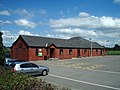 Barton Village Hall
 -
 "6 miles to Preston milestone
 -
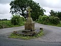 Barton Cross
 -
 Vegetable field near Barton
 -
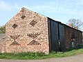 Unique style barn near Barton


External links
![]() Media related to Barton, Preston at Wikimedia Commons
Media related to Barton, Preston at Wikimedia Commons
Geography of the City of Preston district | |||||||
|---|---|---|---|---|---|---|---|
| Cities |  | ||||||
| Suburbs | |||||||
| Villages | |||||||
| Parishes | |||||||
| Topography |
| ||||||
| Authority control databases: Geographic |
|---|