Betchworth railway station
This article needs additional citations for verification. (April 2013) |
 | |||||
| General information | |||||
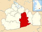
| Location | Betchworth, Mole Valley England | ||||
| Grid reference | TQ210512 | ||||
| Managed by | Great Western Railway | ||||
| Platforms | 2 | ||||
| Other information | |||||
| Station code | BTO | ||||
| Classification | DfT category F2 | ||||
| History | |||||
| Opened | 4 July 1849 | ||||
| Original company | Reading, Guildford and Reigate Railway | ||||
| Pre-grouping | South Eastern Railway | ||||
| Post-grouping | Southern Railway | ||||
| Passengers | |||||
| 2017/18 | |||||
| 2018/19 | |||||
| 2019/20 | |||||
| 2020/21 | |||||
| 2021/22 | |||||
| |||||
Betchworth railway station serves the village of Betchworth in Surrey, England. It is on the North Downs Line, 27 miles 17 chains (27.21 miles, 43.79 km) measured from London Charing Cross via Redhill. All services are operated by Great Western Railway.
History
The station was opened in 1849 by the Reading, Guildford and Reigate Railway, which became part of the South Eastern Railway in 1852. It is 27 miles 17 chains (43.8 km) from Charing Cross, and has two platforms. The eastbound platform 1 is long enough for a four-coach train, but the westbound platform 2 can accommodate seven coaches.[1]
In 1967, Quentin Crisp starred in the sixteen-minute film The Even Tenour of her Ways, which was shot at this railway station.[2]
In 2017/18 and 2018/19, it was the least used station in Surrey, after patronage at Longcross increased.[3][4]
Services
The typical off-peak service on the North Downs Line is one train every two hours in each direction between Reading and Redhill (extended to Gatwick Airport on Sundays, expect a one train each way Monday to Friday).[5]
| Preceding station | Following station | |||
|---|---|---|---|---|
| Dorking Deepdene | Great Western Railway North Downs Line |
Reigate | ||
Betchworth Quarry Railways

The station was particularly significant for its connection with the Betchworth Quarry railways, which were built to serve the Dorking Greystone Lime Company's three pits north of the station.
The quarry railways had four different track gauges. The standard gauge part had a junction with the main line that passed close to Betchworth station, before reversing to run to the Eastern and Southern Kiln Batteries. A 3 ft 2+1⁄4 in (972 mm) gauge railway system began there and primarily served the quarry with lines diverging to the Main, Upper Western Whitestone and Eastern Greystone Pits. The other gauges serving the works were the 19 in (483 mm) gauge line that ran from a standard gauge siding to the Hearthstone Mine, and a short 2 ft (610 mm) gauge section of track that ran exclusively between the Eastern and Southern Kiln Batteries.
The first engine to shunt on the standard gauge portion, Engine No. 1 of 1871, was unofficially named The Coffeepot. It is now preserved at Beamish Museum in County Durham. Another, Captain Baxter was renamed simply Baxter in 1947, the last engine ever to work the line, and the Rev. W.V. Awdry featured it in his book Stepney the "Bluebell" Engine. Baxter is preserved on the Bluebell Railway and was returned to traffic for that railway's 50th anniversary.
Two 3 ft 2+1⁄4 in (972 mm) gauge locomotives were also preserved. Townsend Hook, is at Amberley Chalk Pits Museum, undergoing reconstruction (as of October 2010) to become a static exhibit.[6] William Finlay, the sister engine of Townsend Hook, is preserved in private ownership.
References
- ^ Yonge, John (November 2008) [1994]. Jacobs, Gerald (ed.). Railway Track Diagrams 5: Southern & TfL (3rd ed.). Bradford on Avon: Trackmaps. map 24B. ISBN 978-0-9549866-4-3.
- ^ Wolff, Ann (director) (1967). The Even Tenour of Her Ways (moving image). The station sign is visible at 09:35.
- ^ "Least Used". Least Used Stations. Retrieved 17 January 2020.
- ^ Hughes, Ian (15 January 2020). "The quietest and busiest train stations in Surrey revealed". getsurrey. Retrieved 17 January 2020.
- ^ GB eNRT May 2016 Edition, Table 148 (Network Rail)
- ^ "Townsend Hook cosmetic restoration". Amberley Museum & Heritage Centre. October 2010. Retrieved 7 April 2013.
51°14′53″N 0°16′01″W / 51.248°N 0.267°W

