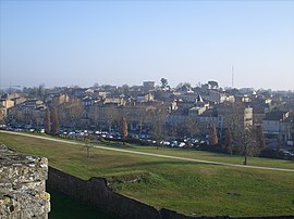
Blaye
Blaye | |
|---|---|
Subprefecture and commune | |
 A general view of Blaye | |
| Coordinates: 45°07′43″N 0°39′40″W / 45.1286°N 0.6611°W | |
| Country | France |
| Region | Nouvelle-Aquitaine |
| Department | Gironde |
| Arrondissement | Blaye |
| Canton | L'Estuaire |
| Government | |
| • Mayor (2020–2026) | Denis Baldès[1] |
| Area 1 | 6.42 km2 (2.48 sq mi) |
| Population (2021)[2] | 4,957 |
| • Density | 770/km2 (2,000/sq mi) |
| Time zone | UTC+01:00 (CET) |
| • Summer (DST) | UTC+02:00 (CEST) |
| INSEE/Postal code | 33058 /33390 |
| Elevation | 0–41 m (0–135 ft) (avg. 7 m or 23 ft) |
| 1 French Land Register data, which excludes lakes, ponds, glaciers > 1 km2 (0.386 sq mi or 247 acres) and river estuaries. | |
Blaye (French: [blaj] ; Template:Lang-oc pronounced [ˈblajɔ]) is a commune and subprefecture in the Gironde department in Nouvelle-Aquitaine in southwestern France. For centuries, Blaye was a particularly convenient crossing point for those who came from the north and went to Bordeaux or further south, to Spain and Portugal.[3] Fortified since antiquity, this eminently strategic site located on the bank of a large river, was not modernized until the end of the 17th century, thanks to Vauban. In 1685, the Commissaire general des fortifications of Louis XIV proposed the construction of a real lock on the Gironde in order to "take control of the river" and to hold Bordeaux in case of a revolt. It is then that the citadel of Blaye was built, constituting the major element of the estuary control system. Dominating the urban landscape, this imposing building has been listed as a UNESCO World Heritage Site since 2008,[4] as part of a group of structures engineered by Vauban, in testimony to their global influence on military architecture and planning over the next few centuries.[5]
Population
|
|
Its inhabitants are called Blayais or the Blayaises.
Geography
Blaye is located on the right bank of the Gironde estuary (which is some 3 km (1.9 mi) wide at this point), close to the A10 autoroute, 56 km (35 mi) north of Bordeaux. There is a rail line with occasional freight trains, but no passenger services. A small ferry crosses the Gironde to Lamarque, in Medoc.
History
In ancient times Blaye (Blavia) was a port of the Santones. Tradition states that the Frankish hero Roland was buried in its basilica, which was on the site of the citadel. It is an important location in the epic Jourdain de Blaye.
Blaye was early an important stronghold which played an important part in the wars against the English (who burnt it in 1352) and the French Wars of Religion (when it was the site of a Spanish naval victory in 1593). The duchess of Berry was imprisoned in its fortress in 1832–1833.[6]
The town was formerly named Blaye-et-Sainte-Luce and was renamed Blaye in June 1961.
Sights
The town has a citadel built by Vauban on a rock beside the river, which contains the ruins of a medieval castle, Château des Rudel(fr), and the ruins of Basilica of Saint-Romain, which holds the tomb of Charibert II, king of Aquitaine, and son of Clotaire II. Nearby, Fort Paté, on an island in the river, and Fort Médoc on its left bank, also of the 17th century, completed Vauban's defenses of the water approaches of Bordeaux .[6]
The citadel of Blaye, its city walls, Fort Paté and Fort Médoc (the latter in nearby Cussac-Fort-Médoc) were listed in 2008 as UNESCO World Heritage Sites, as part of the "Fortifications of Vauban" group.
Economy

Blaye has a small river-port, mainly used for grain exports. Fine red wine is produced in the district, in the AOC Côtes de Blaye. A large nuclear power station with four reactors[7] is located nearby.
Education
Several schools are located in Blaye.
Public schools include the following:
- École Maternelle Pierre Bergeon
- École Maternelle Lucien Grosperrin
- École Elementaire Pierre Malbeteau
- École Elementaire Andre Vallaeys
Legal institutions
The town has tribunals of first instance and of commerce.
Twin towns — sister cities
Blaye is twinned with:
See also
References
- ^ "Répertoire national des élus: les maires". data.gouv.fr, Plateforme ouverte des données publiques françaises (in French). 2 December 2020.
- ^ "Populations légales 2021" (in French). The National Institute of Statistics and Economic Studies. 28 December 2023.
- ^ "Non, la citadelle de Blaye n'a pas été construite pour protéger Bordeaux !! - Société des Amis du Vieux Blaye". www.vieuxblaye.fr. Retrieved 2020-01-02.
- ^ mondial, UNESCO Centre du patrimoine. "Fortifications de Vauban". UNESCO Centre du patrimoine mondial (in French). Retrieved 2020-01-02.
- ^ "Réseau des sites majeurs Vauban". www.sites-vauban.org. Retrieved 2020-01-02.
- ^ a b One or more of the preceding sentences incorporates text from a publication now in the public domain: Chisholm, Hugh, ed. (1911). "Blaye-et-Ste Luce". Encyclopædia Britannica. Vol. 4 (11th ed.). Cambridge University Press. p. 49.
- ^ "Archived copy". Archived from the original on 2011-06-04. Retrieved 2008-10-15.
{{cite web}}: CS1 maint: archived copy as title (link)
External links
![]() Media related to Blaye at Wikimedia Commons
Media related to Blaye at Wikimedia Commons


