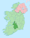
Dromineer
Dromineer
Drom Inbhir | |
|---|---|
Town | |
| Country | Ireland |
| Province | Munster |
| County | County Tipperary |
| Elevation | 43 m (141 ft) |
| Population (2006) | |
| • Urban | 118 |
| Time zone | UTC+0 (WET) |
| • Summer (DST) | UTC-1 (IST (WEST)) |
| Irish Grid Reference | R815858 |

Dromineer (Irish: Drom Inbhir, meaning "ridge of the river mouth") is a small village and townland[1] in County Tipperary, Ireland. It is situated on the shores of Lough Derg on the River Shannon. The village is located 10 km north of Nenagh on the R495 road. It is a civil parish in the historical barony of Ormond Lower.
Features
Home to an ivy clad ruinous 13th-century Kennedy tower house, idyllic scenery, a public harbour and other facilities, it is a popular place to visit, especially for those boating on the lake. The name Dromineer in Irish is "Drom Inbhir", meaning the back or the ford of the river.
Amenities in Dromineer include restaurant and pub (The Whiskey Still), 4 star holiday homes (Waterside Cottages), bed and breakfasts (The Well Meadow and Lough Derg House), a cafe (The Lake Cafe) and a children's playground.
Dromineer is home to the Lough Derg Lifeboat,[2] which is the RNLI's third inland lifeboat station and was the first inland station in the Republic of Ireland. During 2013 the Lough Derg Lifeboat launched 20 times and rescued 33 people.[3]
Historic documents describe the places as 'Dromynnyre'.
Buildings of note
In addition to the O'Kennedy towerhouse (Ruined)
Structures listed as being protected by Tipperary County Council include Dromineer Quay and Canal store both date from around 1845 (RPS Refs S568 and S569)
Two corrugated iron roofed houses summer houses from the 1920s overlooking the lake . (RPS Refs S571 and S572)
Dromineer Castle or Tower house
It may be as old as the 14th c.. Originally built in the Norman style for the Cantwells.
The bulk of the building seen today is 16th c.
Many of the large quadrangualar windows are 17th c features.
It was occupied until 1688.
Was it a Butler castle? it is on land which was in Butler ownership.
some people say it was an O'Kennedy castle.
Dromineer Church
The church is of considerable antiquity. it may have been built in 10th cent. The tradition states that the monks from Holy Island built it.
It employs exceptionally large blocks of stone.
It was extended in 12th c. in the celtic romanesque style.
The west doorway was still standing in the 1830s when John O'Donovan was here.
Carvings include dogs heads with bulging eyes.
The church is located in the graveyard adjoining the Whiskey Still.
Recreation
- GAA: The local club is Kildangan GAA.
- Fishing is a popular activity on both the lake and the nearby Nenagh River.
- Boating: Dromineer is a popular location for boating, as well as a marina it is home to Nenagh Boat Club, Shannon Sailing Club and the Lough Derg Yacht Club,[5] is the twenty third-oldest yacht club in the world, and seventh oldest in Ireland[6] having been founded in 1835 and one of two remaining yacht clubs with a fleet of Shannon-One-Design sailing dinghies, The North Shannon Yacht Club having folded.
- Paramotoring:Irish Paramotoring Club[7]
- Cycling: Dromineer is on one of the North Tipperary Cycle Routes. The 65 km route starts at Banba Square, Nenagh and is listed as a half day cycle.[8]
- Walking: The Lough Derg Way is a long-distance trail between Limerick City and Dromineer. It is designated as a National Waymarked Trail by the National Trails Office of the Irish Sports Council and is managed by Shannon Development, Tipperary County Council and Tipperary Integrated Development Company.[9] The trail was reconfigured and relaunched in 2011 with many sections taken off road aided by an investment of €115,000 under the Comhairle na Tuaithe Walks Scheme, which supports landowners to maintain trails that cross their land.[10][11] The trail connects with the East Clare Way at Killaoe.[11] Sli Eala ("The Way of the Swan" in Irish) is a public walkway between Nenagh and Dromineer. For much of its length it follows the Nenagh River where mute swans can be seen. The route passes Annaghbeg bridge and Ballyartella Mills on its way upstream, a spur off the main route leads to Ballycommon.[12]
See also
References
- ^ http://www.logainm.ie/46607.aspx
- ^ loughderglifeboat.com
- ^ Nenagh Guardian Saturday 26 April, page 3
- ^ http://www.tipperarycoco.ie/sites/default/files/Publications/NTCC%20Register%20of%20Protected%20Structures_0.pdf
- ^ ldyc.ie
- ^ Water Club, Cork 1720, Lough Ree YC 1777, Royal Cork YC 1800, Royal Northern YC 1824, Royal North of Ireland YC 1827, Royal Irish YC 1831.
- ^ irishparamotoring.ie
- ^ http://www.everytrail.com/guide/north-tipperary-cycle-routes-loop-1-nenagh-to-terryglass
- ^ National Trails Office 2010, p. 39.
- ^ "New look Lough Derg Way relaunched". Nenagh Guardian. Nenagh. 19 March 2011. p. 8.
- ^ a b "Lough Derg Way Map" (pdf). Shannon Region Trails. Retrieved 2 August 2011.
- ^ http://tipperary.com/im_visiting/sli_eala/

