Fulton County Airport (Indiana)
Appearance
Fulton County Airport | |||||||||||
|---|---|---|---|---|---|---|---|---|---|---|---|
| Summary | |||||||||||
| Airport type | Public | ||||||||||
| Owner | Fulton County Airport Authority | ||||||||||
| Location | Rochester, Indiana | ||||||||||
| Elevation AMSL | 790 ft / 241 m | ||||||||||
| Coordinates | 41°03′56″N 086°10′54″W / 41.06556°N 86.18167°W | ||||||||||
| Map | |||||||||||
 | |||||||||||
| Runways | |||||||||||
| |||||||||||
| Statistics (2019) | |||||||||||
| |||||||||||
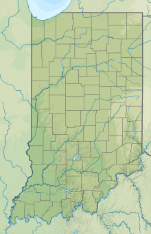
Fulton County Airport (IATA: RCR, ICAO: KRCR, FAA LID: RCR) is two miles east of Rochester, in Fulton County, Indiana. It is owned by the Fulton County Airport Authority (formerly the Fulton County Board of Aviation Commissioners).[1]
Facilities
[edit]Fulton County Airport covers 213 acres (86 ha) at an elevation of 790 feet (241 m). Its runway, 11/29, is 5,001 by 75 feet (1,524 x 23 m) asphalt.[1]
In the year ending December 31, 2019, the airport had 13,382 aircraft operations, average 37 per day: all general aviation. Ten aircraft were then based at this airport: 9 single-engine and 1 helicopter.[1]
See also
[edit]References
[edit]External links
[edit]- Aerial photo from Indiana Department of Transportation
- Aerial photo as of 11 April 1998 from USGS The National Map
- FAA Terminal Procedures for RCR, effective October 31, 2024
- Resources for this airport:
- FAA airport information for RCR
- AirNav airport information for RCR
- ASN accident history for RCR
- FlightAware airport information and live flight tracker
- SkyVector aeronautical chart for RCR


