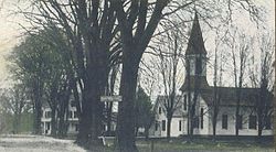
Ossipee, New Hampshire
Ossipee, New Hampshire | |
|---|---|
Town | |
 Center Ossipee | |
 Location in Carroll County, New Hampshire | |
| Country | United States |
| State | New Hampshire |
| County | Carroll |
| Incorporated | 1785 |
| Government | |
| • Board of Selectmen | Peter A. Olkkola Harry C. Merrow Joseph G. Skehan, Jr. |
| Area | |
| • Total | 75.3 sq mi (195.0 km2) |
| • Land | 70.9 sq mi (183.6 km2) |
| • Water | 4.4 sq mi (11.4 km2) 0.17% |
| Elevation | 681 ft (208 m) |
| Population (2000) | |
| • Total | 4,211 |
| • Density | 63.8/sq mi (22.9/km2) |
| Time zone | UTC-5 (Eastern) |
| • Summer (DST) | UTC-4 (Eastern) |
| ZIP code | 03864 |
| Area code | 603 |
| FIPS code | 33-58740 |
| GNIS feature ID | 0873694 |
| Website | www.ossipee.org |
Ossipee is a town in Carroll County, New Hampshire, United States. The population was 4,211 at the 2000 census. It is the county seat of Carroll County.Template:GR Ossipee, which includes several villages, is a resort area and home to part of Pine River State Forest.
History
Originally known as Wigwam Village, and then New Garden, the town was named for the Ossipee Indians, one of the twelve Algonquian tribes. It was once the site of an Indian stockade fort, designed to protect the tribe from the Mohawks in the west. In 1725, the Indian stockade was destroyed, and then rebuilt by Captain John Lovewell. The new fort was one of the largest in New England. Ossipee would become incorporated in 1785.
The town shares its name with the Ossipee Mountains, once a range of ancient volcanoes, which border it on the west. Ossipee is a major source of sand and gravel, transported by railroad to Boston, Massachusetts.
Notable inhabitants
- Captain John Lovewell, soldier
- Chester Earl Merrow, congressman
- William B. Small, congressman
- John Greenleaf Whittier, poet (summer resident)
Geography
According to the United States Census Bureau, the town has a total area of 75.6 square miles (195.8 km2), of which 71.2 sq mi (184.4 km2) is land and 4.4 sq mi (11.4 km2) is water, comprising 5.85% of the town. Ossipee is drained by the Ossipee, Pine, Beech, Bearcamp and Lovell rivers. Ossipee Lake is in the northeastern part of the town. The highest point in Ossipee is 2,080 feet (630 m) above sea level on an unnamed ridge in the Ossipee Mountains in the western part of town.
The town is crossed by state routes 16, 25, 28 and 171. It borders the towns of Freedom and Effingham to the northeast, Wakefield to the southeast, Tuftonboro and Moultonborough to the southwest, Tamworth to the northwest and Madison to the north.
Demographics

As of the censusTemplate:GR of 2000, there were 4,211 people, 1,672 households, and 1,153 families residing in the town. The population density was 59.2 people per square mile (22.9/km²). There were 2,742 housing units at an average density of 38.5/sq mi (14.9/km²). The racial makeup of the town was 97.96% White, 0.14% African American, 0.38% Native American, 0.21% Asian, 0.07% from other races, and 1.23% from two or more races. Hispanic or Latino of any race were 0.33% of the population.
There were 1,672 households out of which 29.6% had children under the age of 18 living with them, 54.7% were married couples living together, 9.2% had a female householder with no husband present, and 31.0% were non-families. 25.3% of all households were made up of individuals and 11.5% had someone living alone who was 65 years of age or older. The average household size was 2.43 and the average family size was 2.90.

In the town the population was spread out with 23.9% under the age of 18, 6.2% from 18 to 24, 25.9% from 25 to 44, 26.2% from 45 to 64, and 17.8% who were 65 years of age or older. The median age was 42 years. For every 100 females there were 99.9 males. For every 100 females age 18 and over, there were 96.5 males.
The median income for a household in the town was $34,709, and the median income for a family was $38,790. Males had a median income of $27,388 versus $21,579 for females. The per capita income for the town was $18,092. About 7.7% of families and 10.0% of the population were below the poverty line, including 15.0% of those under age 18 and 6.6% of those age 65 or over.

