
Pagny-le-Château
Pagny-le-Château | |
|---|---|
 The church in Pagny-le-Château | |
.svg) Coat of arms | |
Location of Pagny-le-Château  | |
 Pagny-le-Château  Pagny-le-Château | |
| Coordinates: 47°02′54″N 5°11′41″E / 47.0482°N 5.1946°E | |
| Country | France |
| Region | Bourgogne-Franche-Comté |
| Department | Côte-d'Or |
| Arrondissement | Beaune |
| Canton | Brazey-en-Plaine |
| Intercommunality | Rives de Saône |
| Government | |
| • Mayor (2022–2026) | Alain Becquart[1] |
| Area 1 | 24.23 km2 (9.36 sq mi) |
| Population (2021)[2] | 493 |
| • Density | 20/km2 (53/sq mi) |
| Time zone | UTC+01:00 (CET) |
| • Summer (DST) | UTC+02:00 (CEST) |
| INSEE/Postal code | 21475 /21250 |
| Elevation | 177–193 m (581–633 ft) (avg. 183 m or 600 ft) |
| 1 French Land Register data, which excludes lakes, ponds, glaciers > 1 km2 (0.386 sq mi or 247 acres) and river estuaries. | |
Pagny-le-Château (French pronunciation: [paɲi l(ə) ʃɑto]) is a commune of the Côte-d'Or department in eastern France. The village is situated between Seurre and Saint-Jean-de-Losne, in the "Val de Saône" on the RD 976.[3]
History[edit]
Over the centuries, the village has had several names. The first one was Pancium. Afterwards, it was called Paygnay-le-Château, then Pagny-la-Brûlée. Even though the fortified castles were destroyed the village is now called Pagny-le-Château.
Château[edit]
Although the château was destroyed in 1768, there remains its Renaissance chapel dated 1536. It contains the tomb of Jean de Vienne (died 1455) and that of Jean de Longwy (died 1460) and Jeanne de Vienne (died 1472), with alabaster effigies.[4]
Population[edit]
| Year | Pop. | ±% p.a. |
|---|---|---|
| 1968 | 428 | — |
| 1975 | 335 | −3.44% |
| 1982 | 343 | +0.34% |
| 1990 | 477 | +4.21% |
| 1999 | 491 | +0.32% |
| 2009 | 500 | +0.18% |
| 2014 | 505 | +0.20% |
| 2020 | 500 | −0.17% |
| Source: INSEE[5] | ||
The inhabitants are called Pagnitains in French.
Administration[edit]
| Term | Name | Party | Profession |
|---|---|---|---|
| 1965 - 1971 | Robert Marchand | - | Courier |
| 1971 - 1989 | Jacques Grenot | - | Farmer |
| 1989 - 2020 | Jacques Chossat de Montburon | UMP-LR | Retiree |
| 2020 - 2022 | Hubert Moindrot | - | Retiree |
| 2022 - | Alain Becquart | - |
See also[edit]
References[edit]
- ^ "Répertoire national des élus: les maires" (in French). data.gouv.fr, Plateforme ouverte des données publiques françaises. 6 June 2023.
- ^ "Populations légales 2021". The National Institute of Statistics and Economic Studies. 28 December 2023.
- ^ The departmental road #976
- ^ Chisholm, Hugh, ed. (1911). . Encyclopædia Britannica. Vol. 7 (11th ed.). Cambridge University Press. p. 249.
- ^ Population en historique depuis 1968, INSEE
Photos gallery[edit]
-
 Pagny-le-Château : view of the castel.
 -
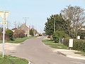 Pagny-le-Château : way to Franxault
 -
 Pagny-le-Château : way to Franxault
 -
 Pagny-le-Château : communal house
 -
 Pagny-le-Château : view of the castel
 -
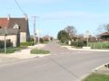
 Pagny-le-Château : crossroad between the road to Franxault and the road to Montagny-lès-Seurre
 -
 Pagny-le-Château : technoport
 -
 Pagny-le-Château : War Memorial (1914-1918 and 1939-1945)


External links[edit]
| International | |
|---|---|
| National | |
This Côte-d'Or geographical article is a stub. You can help Wikipedia by expanding it. |