
Pottinger Street
This article needs additional citations for verification. (September 2011) |


Pottinger Street (Chinese: 砵典乍街; pinyin: Bōdiǎnzhà Jiē; Cantonese Yale: but1 din1 ja3 gaai1; formerly 砵甸乍街) is a street in Central, Hong Kong. It is also better known as the Stone Slabs Street (石板街) by the locals, after the granite stone steps which are a rarity nowadays in Hong Kong. The street was named in 1853 after Henry Pottinger, the first Governor of Hong Kong,serving from 1843 to 1844.
Location
The street was originally on the slope between Queen's Road Central and Hollywood Road.This section is entirely covered by stone slabs.It crosses Stanley Street,then Wellington Street and ends at the western end of Hollywood road,just after it meets Wyndham Street.
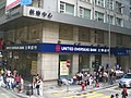
Central District subsequently underwent several reclamation projects and thus the street was extended north from Queen's Road Central to Connaught Road Central,junctioning Des Voeux Road Central. Several buildings like Man Yee Building, Wing On House, Chinachem Tower and Hong Kong Chinese Bank Building are in this section. This is the only section that allows vehicular traffic and not being paved by stone slabs.
History
The first Roman Catholic cathedral of Hong Kong was built in 1843 at the junction of Pottinger Street and Wellington Street[1] and was destroyed in a fire in 1859. It was rebuilt, but subsequently a different site was selected and the current Cathedral of the Immaculate Conception at Caine Road was completed 1888.
In the 19th century,Chinese and Europeans residents used to live separately in different neighbourhoods .The street once acts as a rough boundary between the two groups.The Chinese used to mainly live west of the street and westerners to the east of it.An Air-Raid Precaution Tunnel was built beneath the street in 1940-41 but was abandoned after the Second World War and was filled back in the 1980s.
-
 Steps of Pottinger Street near Queen's Road Central
 -


See also
References
- ^ Wordie, Jason (2002). Streets: exploring Hong Kong Island. Hong Kong University Press. p. 62. ISBN 978-962-209-563-2.
{{cite book}}: Cite has empty unknown parameter:|coauthors=(help)
External links
22°17′00″N 114°09′21″E / 22.28330°N 114.15589°E
This Hong Kong road article is a stub. You can help Wikipedia by expanding it. |