
Mountainside, New Jersey: Difference between revisions
update mayoral data / source in infobox using AWB |
add pre-1930, 2000, 2010, 2010 ACS census data, add 2010 gazetteer area, add 2010-11 NCES data and add politics section, with sources; add/update refs |
||
| Line 32: | Line 32: | ||
|leader_name = Paul N. Mirabelli (term ends December 31, 2013)<ref>[http://www.nj.gov/dca/mayors/mayors2013.pdf 2013 New Jersey Mayors Directory], [[New Jersey Department of Community Affairs]]. Accessed May 13, 2013.</ref> |
|leader_name = Paul N. Mirabelli (term ends December 31, 2013)<ref>[http://www.nj.gov/dca/mayors/mayors2013.pdf 2013 New Jersey Mayors Directory], [[New Jersey Department of Community Affairs]]. Accessed May 13, 2013.</ref> |
||
|leader_title1 = Administrator |
|leader_title1 = Administrator |
||
|leader_name1 = James J. Debbie, Jr.<ref>[http://www.mountainside-nj.com/ |
|leader_name1 = James J. Debbie, Jr.<ref>[http://www.mountainside-nj.com/gov/admin Borough Administrator], Borough of Mountainside. Accessed May 20, 2013.</ref> |
||
|leader_title2 = [[Clerk (municipal official)|Clerk]] |
|leader_title2 = [[Clerk (municipal official)|Clerk]] |
||
|leader_name2 = Martha Lopez<ref>[http://www.mountainside-nj.com/ |
|leader_name2 = Martha Lopez<ref>[http://www.mountainside-nj.com/dept/2012-03-20-10-11-11 Borough Clerk], Borough of Mountainside. Accessed May 20, 2013.</ref> |
||
|established_title = [[Municipal corporation|Incorporated]] |
|established_title = [[Municipal corporation|Incorporated]] |
||
|established_date = September 25, 1895 |
|established_date = September 25, 1895 |
||
| Line 49: | Line 49: | ||
|area_water_sq_mi = 0.041 |
|area_water_sq_mi = 0.041 |
||
|area_water_percent = 1.02 |
|area_water_percent = 1.02 |
||
|area_rank = 296th of 566 in state<br>12th of 21 in county<ref name=CensusArea/> |
|||
<!-- Population --> |
<!-- Population --> |
||
|population_as_of = [[2010 United States Census|2010 Census]] |
|population_as_of = [[2010 United States Census|2010 Census]] |
||
|population_footnotes = <ref name=APP2010>[http://php.app.com/census/results2.php?pageNum_Recordset1=0&totalRows_Recordset1=22&State=NJ&County=Union&Town=%25&Submit=Search "2010 Census Populations: Union County"], ''[[Asbury Park Press]]''. Accessed July 17, 2012.</ref><ref name=Census2010>[http://factfinder2.census.gov/bkmk/table/1.0/en/DEC/10_DP/DPDP1/0600000US3403948510 DP-1 - Profile of General Population and Housing Characteristics: 2010 for Mountainside borough, Union County, New Jersey], [[United States Census Bureau]]. Accessed July 17, 2012.</ref><ref name=Districts2011/><ref name=LWD2010>[http://lwd.dol.state.nj.us/labor/lpa/census/2010/dp/dp1_uni/mountainside1.pdf Profile of General Demographic Characteristics: 2010 for Mountainside borough], [[New Jersey Department of Labor and Workforce Development]]. Accessed July 17, 2012.</ref> |
|population_footnotes = <ref name=APP2010>[http://php.app.com/census/results2.php?pageNum_Recordset1=0&totalRows_Recordset1=22&State=NJ&County=Union&Town=%25&Submit=Search "2010 Census Populations: Union County"], ''[[Asbury Park Press]]''. Accessed July 17, 2012.</ref><ref name=Census2010>[http://factfinder2.census.gov/bkmk/table/1.0/en/DEC/10_DP/DPDP1/0600000US3403948510 DP-1 - Profile of General Population and Housing Characteristics: 2010 for Mountainside borough, Union County, New Jersey], [[United States Census Bureau]]. Accessed July 17, 2012.</ref><ref name=Districts2011/><ref name=LWD2010>[http://lwd.dol.state.nj.us/labor/lpa/census/2010/dp/dp1_uni/mountainside1.pdf Profile of General Demographic Characteristics: 2010 for Mountainside borough], [[New Jersey Department of Labor and Workforce Development]]. Accessed July 17, 2012.</ref> |
||
|population_total = 6685 |
|population_total = 6685 |
||
|population_rank = 324th of 566 in state<br>19th of 21 in county<ref name=GCTPH1NJ2010>[http://factfinder2.census.gov/bkmk/table/1.0/en/DEC/10_SF1/GCTPH1.ST16/0400000US34 GCT-PH1 Population, Housing Units, Area, and Density: 2010 - State -- County Subdivision from the 2010 Census Summary File 1 for New Jersey], [[United States Census Bureau]]. Accessed May 20, 2013.</ref> |
|||
|population_density_km2 = auto |
|population_density_km2 = auto |
||
|population_density_sq_mi = 1668 |
|population_density_sq_mi = 1668.0 |
||
|population_density_rank = 315th of 566 in state<br>21st of 21 in county<ref name=GCTPH1NJ2010/> |
|||
<!-- General information --> |
<!-- General information --> |
||
| Line 111: | Line 114: | ||
| estyear=2011 |
| estyear=2011 |
||
| estref=<ref>[http://www.census.gov/popest/data/cities/totals/2011/files/SUB-EST2011_34.csv Census Estimates for New Jersey April 1, 2010 to July 1, 2011], [[United States Census Bureau]]. Accessed November 26, 2012.</ref> |
| estref=<ref>[http://www.census.gov/popest/data/cities/totals/2011/files/SUB-EST2011_34.csv Census Estimates for New Jersey April 1, 2010 to July 1, 2011], [[United States Census Bureau]]. Accessed November 26, 2012.</ref> |
||
| footnote=Population sources:<small><br>1900-1910<ref>[http://books.google.com/books?id=T9HrAAAAMAAJ&pg=PA339 ''Thirteenth Census of the United States, 1910: Population by Counties and Minor Civil Divisions, 1910, 1900, 1890''], [[United States Census Bureau]], p. 339. Accessed July 17, 2012.</ref> 1910-1930<ref>[http://books.google.com/books?id=kifRAAAAMAAJ&pg=PA719 ''Fifteenth Census of the United States : 1930 - Population Volume I''], [[United States Census Bureau]], p. 719. Accessed July 17, 2012.</ref><br>1930-1990<ref>[http://web.archive.org/web/20090502173646/http://www.wnjpin.net/OneStopCareerCenter/LaborMarketInformation/lmi01/poptrd6.htm New Jersey Resident Population by Municipality: 1930 - 1990], Workforce New Jersey Public Information Network, backed up by the [[Internet Archive]] as of May 2, 2009. Accessed July 17, 2012.</ref> 2000<ref name=Census2000/> 2010<ref name=APP2010/><ref name=Census2010/><ref name=Districts2011/><ref name=LWD2010/></small> |
| footnote=Population sources:<small> 1900-1920<ref>[http://dspace.njstatelib.org/xmlui/handle/10929/25218?show=full ''Compendium of censuses 1726-1905: together with the tabulated returns of 1905''], [[New Jersey Department of State]], 1906. Accessed May 20, 2013.</ref><br>1900-1910<ref>[http://books.google.com/books?id=T9HrAAAAMAAJ&pg=PA339 ''Thirteenth Census of the United States, 1910: Population by Counties and Minor Civil Divisions, 1910, 1900, 1890''], [[United States Census Bureau]], p. 339. Accessed July 17, 2012.</ref> 1910-1930<ref>[http://books.google.com/books?id=kifRAAAAMAAJ&pg=PA719 ''Fifteenth Census of the United States : 1930 - Population Volume I''], [[United States Census Bureau]], p. 719. Accessed July 17, 2012.</ref><br>1930-1990<ref>[http://web.archive.org/web/20090502173646/http://www.wnjpin.net/OneStopCareerCenter/LaborMarketInformation/lmi01/poptrd6.htm New Jersey Resident Population by Municipality: 1930 - 1990], Workforce New Jersey Public Information Network, backed up by the [[Internet Archive]] as of May 2, 2009. Accessed July 17, 2012.</ref> 2000<ref name=Census2000/><ref name=Census2000SF1/> 2010<ref name=APP2010/><ref name=Census2010/><ref name=Districts2011/><ref name=LWD2010/></small> |
||
}} |
}} |
||
| Line 124: | Line 127: | ||
[[File:Echo Lake Park in Mountainside NJ autumnal scene.jpg|thumb|Echo Lake Park view in autumn.]] |
[[File:Echo Lake Park in Mountainside NJ autumnal scene.jpg|thumb|Echo Lake Park view in autumn.]] |
||
[[File:Artist Emma Auriemma painting at Echo Lake Park in Mountainside New Jersey.jpg|thumb|A landscape artist paints an autumnal scene at Echo Lake Park in Mountainside.]] |
[[File:Artist Emma Auriemma painting at Echo Lake Park in Mountainside New Jersey.jpg|thumb|A landscape artist paints an autumnal scene at Echo Lake Park in Mountainside.]] |
||
There were 2,434 households out of which 29.3% had children under the age of 18 living with them, 71.9% were [[Marriage|married couples]] living together, 5.3% had a female householder with no husband present, and 20.9% were non-families. 17.9% of all households were made up of individuals and 11.9% had someone living alone who was 65 years of age or older. The average household size was 2.60 and the average family size was 2.95.<ref name=Census2000/> |
There were 2,434 households out of which 29.3% had children under the age of 18 living with them, 71.9% were [[Marriage|married couples]] living together, 5.3% had a female householder with no husband present, and 20.9% were non-families. 17.9% of all households were made up of individuals and 11.9% had someone living alone who was 65 years of age or older. The average household size was 2.60 and the average family size was 2.95.<ref name=Census2000/><ref name=Census2000SF1/> |
||
In the borough the population was spread out with 21.1% under the age of 18, 3.8% from 18 to 24, 22.9% from 25 to 44, 27.3% from 45 to 64, and 24.9% who were 65 years of age or older. The median age was 46 years. For every 100 females there were 89.2 males. For every 100 females age 18 and over, there were 87.1 males.<ref name=Census2000/> |
In the borough the population was spread out with 21.1% under the age of 18, 3.8% from 18 to 24, 22.9% from 25 to 44, 27.3% from 45 to 64, and 24.9% who were 65 years of age or older. The median age was 46 years. For every 100 females there were 89.2 males. For every 100 females age 18 and over, there were 87.1 males.<ref name=Census2000/><ref name=Census2000SF1/> |
||
The median income for a household in the borough was $97,195, and the median income for a family was $105,773. Males had a median income of $78,595 versus $52,667 for females. The [[per capita income]] for the borough was $47,474. About 2.0% of families and 3.0% of the population were below the [[poverty line]], including 1.9% of those under age 18 and 2.9% of those age 65 or over.<ref name=Census2000/> |
The median income for a household in the borough was $97,195, and the median income for a family was $105,773. Males had a median income of $78,595 versus $52,667 for females. The [[per capita income]] for the borough was $47,474. About 2.0% of families and 3.0% of the population were below the [[poverty line]], including 1.9% of those under age 18 and 2.9% of those age 65 or over.<ref name=Census2000/><ref name=Census2000SF1/> |
||
==Government== |
==Government== |
||
| Line 137: | Line 140: | ||
===Local government=== |
===Local government=== |
||
Mountainside |
Mountainside is governed by a [[Faulkner Act (Mayor-Council)|Mayor-Council]] form of government as authorized through the Option Municipal Charter Law (commonly called the [[Faulkner Act (New Jersey)|Faulkner Act]]). Under this form of local government a Mayor is elected for a term of four years and there is a Borough Council consisting of six members, elected for three-year terms each, with two seats coming up for election each year. Both the Mayor and Borough Council are elected at large, that is, to represent the entire community. Elections for all officials in Mountainside Borough are conducted on a partisan basis during the November General Election.<ref name=DataBook>''2005 New Jersey Legislative District Data Book'', [[Rutgers University]] [[Edward J. Bloustein School of Planning and Public Policy]], April 2005, p. 94. Shows form of government as [[Borough (New Jersey)]].</ref> |
||
{{as of| |
{{as of|2013}}, the mayor of Mountainside is Paul N. Mirabelli ([[Republican Party (United States)|R]], term of office ends on December 31, 2015). Members of the Borough Council are Council President Keith C. Turner (R, 2014), Deanna Andre (R, 2014), William R. Lane (R, 2015), Robert W. Messler (R, 2015), Glenn Mortimer (R, 2013) and Jeffrey R. Wass (R, 2013).<ref>[http://www.mountainside-nj.com/gov/council Borough Council], Borough of Mountainside. Accessed May 20, 2013.</ref><ref>[http://ucnj.org/government/county-clerk/elected-officials-kenilworth-roselle/ County Clerk Elections: Kenilworth – Roselle], [[Union County, New Jersey]]. Accessed May 20, 2013.</ref><ref name=Union2010>[http://ucnj.org/nov2result/Election%20Result_dtl.htm#cont31 Union County General Election November 2, 2010], [[Union County, New Jersey]] Clerk. Accessed May 20, 2013.</ref><ref name=Union2011>[http://ucnj.org/OfficialGeneralElectionResults2011/Official%20General%202011_dtl.htm#cont23 Union County 2011 General, November 8, 2011], [[Union County, New Jersey]] Clerk. Accessed May 20, 2013.</ref><ref name=Union2012>[http://ucnj.org/general-election/Election%20Result_dtl.htm#cont20 Union Co 2012 General/School Election November 6, 2012], [[Union County, New Jersey]] Clerk. Accessed May 20, 2013.</ref> |
||
===Federal, state and county representation=== |
===Federal, state and county representation=== |
||
| Line 149: | Line 152: | ||
{{NJ Union County Freeholders}} |
{{NJ Union County Freeholders}} |
||
===Politics=== |
|||
As of March 23, 2011, there were a total of 4,744 registered voters in Mountainside, of which 1,201 (25.3% vs. 41.8% countywide) were registered as [[Democratic Party (United States)|Democrats]], 1,568 (33.1% vs. 15.3%) were registered as [[Republican Party (United States)|Republicans]] and 1,974 (41.6% vs. 42.9%) were registered as [[Unaffiliated (New Jersey)|Unaffiliated]]. There was one voter registered to another party.<ref name=VoterRegistration>[http://www.state.nj.us/state/elections/election-results/2011-union-co-summary-report.pdf Voter Registration Summary - Union], [[New Jersey Department of State]] Division of Elections, March 23, 2011. Accessed May 20, 2013.</ref> Among the borough's 2010 Census population, 71.0% (vs. 53.3% in Union County) were registered to vote, including 92.5% of those ages 18 and over (vs. 70.6% countywide).<ref name=VoterRegistration/><ref>[http://factfinder2.census.gov/bkmk/table/1.0/en/DEC/10_SF1/GCTP7.ST16?slice=GEO~0400000US34 GCT-P7: Selected Age Groups: 2010 - State -- County Subdivision; 2010 Census Summary File 1 for New Jersey], [[United States Census Bureau]]. Accessed May 20, 2013.</ref> |
|||
In the [[United States presidential election, 2012|2012 presidential election]], Republican [[Mitt Romney]] received 2,100 votes here (59.2% vs. 32.3% countywide), ahead of Democrat [[Barack Obama]] with 1,401 votes (39.5% vs. 66.0%) and other candidates with 30 votes (0.8% vs. 0.8%), among the 3,548 ballots cast by the borough's 4,940 registered voters, for a turnout of 71.8% (vs. 68.8% in Union County).<ref>[http://njelections.org/2012-results/2012-presidential-union.pdf Presidential November 6, 2012 General Election Results - Union County], [[New Jersey Department of State]] Division of Elections, March 15, 2013. Accessed May 20, 2013.</ref><ref>[http://njelections.org/2012-results/2012-ballotscast-union.pdf Number of Registered Voters and Ballots Cast November 6, 2012 General Election Results - Union County], [[New Jersey Department of State]] Division of Elections, March 15, 2013. Accessed May 20, 2013.</ref> In the [[United States presidential election, 2008|2008 presidential election]], Republican [[John McCain]] received 2,331 votes here (60.0% vs. 35.2% countywide), ahead of Democrat [[Barack Obama]] with 1,500 votes (38.6% vs. 63.1%) and other candidates with 33 votes (0.8% vs. 0.9%), among the 3,888 ballots cast by the borough's 4,911 registered voters, for a turnout of 79.2% (vs. 74.7% in Union County).<ref>[http://www.state.nj.us/state/elections/election-results/2008-gen-elect-presidential-results-union.pdf 2008 Presidential General Election Results: Union County], [[New Jersey Department of State]] Division of Elections, December 23, 2008. Accessed May 20, 2013.</ref> In the [[United States presidential election, 2004|2004 presidential election]], Republican [[George W. Bush]] received 2,215 votes here (58.0% vs. 40.3% countywide), ahead of Democrat [[John Kerry]] with 1,561 votes (40.8% vs. 58.3%) and other candidates with 31 votes (0.8% vs. 0.7%), among the 3,822 ballots cast by the borough's 4,796 registered voters, for a turnout of 79.7% (vs. 72.3% in the whole county).<ref>[http://www.state.nj.us/state/elections/election-results/2004-presidential_union_co_2004.pdf 2004 Presidential Election: Union County], [[New Jersey Department of State]] Division of Elections, December 13, 2004. Accessed May 20, 2013.</ref> |
|||
In the [[New Jersey gubernatorial election, 2009|2009 gubernatorial election]], Republican [[Chris Christie]] received 1,754 votes here (61.8% vs. 41.7% countywide), ahead of Democrat [[Jon Corzine]] with 842 votes (29.6% vs. 50.6%), Independent [[Chris Daggett]] with 204 votes (7.2% vs. 5.9%) and other candidates with 17 votes (0.6% vs. 0.8%), among the 2,840 ballots cast by the borough's 4,827 registered voters, yielding a 58.8% turnout (vs. 46.5% in the county).<ref>[http://www.njelections.org/election-results/2009-governor_results-union.pdf 2009 Governor: Union County], [[New Jersey Department of State]] Division of Elections, December 31, 2009. Accessed May 20, 2013.</ref> |
|||
==Education== |
==Education== |
||
The [[Mountainside School District]] serves public school students in Pre-Kindergarten through eighth grade. Schools in the district (with |
The [[Mountainside School District]] serves public school students in Pre-Kindergarten through eighth grade. Schools in the district (with 2010-11 enrollment data from the [[National Center for Education Statistics]]<ref>[http://nces.ed.gov/ccd/schoolsearch/school_list.asp?Search=1&DistrictID=3411040 Data for the Mountainside School District], [[National Center for Education Statistics]]. Accessed May 20, 2013.</ref>) are |
||
[http://www.mountainsideschools.org/ |
[http://www.mountainsideschools.org/school/bw Beechwood School] (grades PreK-2; 267 students) and |
||
[http://www.mountainsideschools.org/ |
[http://www.mountainsideschools.org/school/df Deerfield School] (grades 3-8; 535 students). |
||
Public school students in grades 9-12 attend [[Governor Livingston High School]] in [[Berkeley Heights, New Jersey|Berkeley Heights]], as part of a [[sending/receiving relationship]] with the [[Berkeley Heights Public Schools]].<ref>[http://education.state.nj.us/rc/ |
Public school students in grades 9-12 attend [[Governor Livingston High School]] in [[Berkeley Heights, New Jersey|Berkeley Heights]], as part of a [[sending/receiving relationship]] with the [[Berkeley Heights Public Schools]].<ref>[http://education.state.nj.us/rc/rc11/narrative/39/0310/39-0310-000.html Berkeley Heights Public School District 2011 Report Card Narrative], [[New Jersey Department of Education]]. Accessed May 20, 2013. "In addition to serving the public school students of Berkeley Heights, high school students from the neighboring Borough of Mountainside are educated at the Governor Livingston school."</ref> Students also have the choice to attend the programs of the [[Union County Vocational Technical Schools]], which serve students from across Union County.<ref>[http://www.ucvts.tec.nj.us/domain/102 Our District], [[Union County Vocational Technical Schools]]. Accessed May 20, 2013.</ref> |
||
==Emergency medical services== |
==Emergency medical services== |
||
| Line 161: | Line 171: | ||
==Transportation== |
==Transportation== |
||
[[New Jersey Transit bus operations]] [[List of New Jersey Transit bus routes (100–199)#To the Raritan Valley|routes 114 and 117]] provide service to the [[Port Authority Bus Terminal]] in [[Midtown Manhattan]] in [[New York City]] while [[List of New Jersey Transit bus routes (1–99)#To the Raritan Valley|routes 65 and 66]] travel to [[Newark, New Jersey|Downtown Newark]], all making local stops at points in |
[[New Jersey Transit bus operations]] [[List of New Jersey Transit bus routes (100–199)#To the Raritan Valley|routes 114 and 117]] provide service to the [[Port Authority Bus Terminal]] in [[Midtown Manhattan]] in [[New York City]] while [[List of New Jersey Transit bus routes (1–99)#To the Raritan Valley|routes 65 and 66]] travel to [[Newark, New Jersey|Downtown Newark]], all making local stops at points in proximate communities.http://web.archive.org/web/20090522212305/http://www.njtransit.com/sf/sf_servlet.srv?hdnPageAction=BusRoutesUnionCountyTo Union County Bus / Rail Connections], [[New Jersey Transit]], backed up by the [[Internet Archive]] as of May 22, 2009. Accessed May 20, 2013.</ref> An early use of [[bus rapid transit in New Jersey]], a BBS (bus bypass shoulder, originally called a BOS or ''bus on shoulder'' lane) has been in operation for many years. Unlike most towns along [[U.S. Route 22 in New Jersey|Route 22]], zoning in Mountainside does not allow for much commercial development adjacent to the freeway.<ref>Cheslow, Jerry. [http://www.nytimes.com/2000/01/09/realestate/if-you-re-thinking-living-mountainside-nj-rural-borough-single-family-homes.html?pagewanted=all "If You're Thinking of Living In/Mountainside, N.J.; A Rural Borough of Single-Family Homes"], ''[[The New York Times]]'', January 9, 2000. Accessed July 17, 2012. "Under a 50-year-old zoning ordinance designed to preserve the beauty of the borough, retail services, except for restaurants and a multiplex movie theater, are banned along the highway."</ref> For a one mile stretch in the town, the eastbound shoulder on the [[arterial road]] can be used for peak hour buses.<ref>[http://ops.fhwa.dot.gov/publications/fhwahop10023/chap2.htm Shoulder Lanes—The American Experience: Efficient Use of Highway Summary Report to Congress], [[Federal Highway Administration]]. Accessed May 20, 2013. "In Mountainside, New Jersey, along Route 22, buses are allowed to use the shoulder of the arterial in the eastbound direction during congested periods. Operational for years, this shoulder use treatment was intended to allow transit vehicles to save travel time along the corridor toward Perth Amboy for about 1 mi. The facility is operated by the New Jersey Department of Transportation, and pavement markings indicate 'Buses May Use Shoulder.'"</ref> In 2012, NJDOT regulated the BBS as an exclusive bus lane from 6 to 7:30am.<ref>[http://www.state.nj.us/transportation/refdata/traffic_orders/laneuse/rt22.shtm Traffic Regulations Orders of the Commissioner of Transportation Lane Usage Route US 22], [[New Jersey Department of Transportation]], April 9, 2012. Accessed May 20, 2013.</ref> In 2009, NJDOT funded construction of two bus turnouts along the road in nearby [[Union Township, Union County, New Jersey|Union]].<ref>Dooley, Ellen. [http://www.nj.com/suburbannews/index.ssf/2009/09/njdot_to_construct_new_bus_tur.html "NJDOT to construct new bus turnouts for speed and safety along Route 22 in Union"], ''Suburban News'', September 22, 2009. Accessed May 20, 2013.</ref> |
||
[[Newark Liberty International Airport]] is approximately {{convert|11|miles}} east of Mountainside. |
[[Newark Liberty International Airport]] is approximately {{convert|11|miles}} east of Mountainside. |
||
Revision as of 03:42, 21 May 2013
Mountainside, New Jersey | |
|---|---|
 Map of Mountainside in Union County. Inset: Union County highlighted in the State of New Jersey. | |
 Census Bureau map of Mountainside, New Jersey | |
| Country | United States |
| State | New Jersey |
| County | Union |
| Incorporated | September 25, 1895 |
| Government | |
| • Type | Faulkner Act (Mayor-Council) |
| • Mayor | Paul N. Mirabelli (term ends December 31, 2013)[1] |
| • Administrator | James J. Debbie, Jr.[2] |
| • Clerk | Martha Lopez[3] |
| Area | |
| • Total | 4.049 sq mi (10.487 km2) |
| • Land | 4.008 sq mi (10.380 km2) |
| • Water | 0.041 sq mi (0.107 km2) 1.02% |
| • Rank | 296th of 566 in state 12th of 21 in county[5] |
| Elevation | 233 ft (71 m) |
| Population | |
| • Total | 6,685 |
| • Rank | 324th of 566 in state 19th of 21 in county[11] |
| • Density | 1,668.0/sq mi (644.0/km2) |
| • Rank | 315th of 566 in state 21st of 21 in county[11] |
| Time zone | UTC-5 (Eastern (EST)) |
| • Summer (DST) | UTC-4 (Eastern (EDT)) |
| ZIP code | 07092[12] |
| Area code | 908 |
| FIPS code | 3403948510Template:GR[5][13] |
| GNIS feature ID | 0885311Template:GR[5] |
| Website | http://www.mountainside-nj.com |
Mountainside is a borough in Union County, New Jersey, United States. As of the 2010 United States Census, the borough's population was 6,685,[8][9][10] reflecting an increase of 83 (+1.3%) from the 6,602 counted in the 2000 Census, which had in turn declined by 55 (-0.8%) from the 6,657 counted in the 1990 Census.[14]
Mountainside was incorporated as a borough on September 25, 1895, from portions of Westfield Township, based on the results of a referendum held the previous day.[15]
New Jersey Monthly magazine ranked Mountainside as its 16th best place to live in its 2008 rankings of the "Best Places To Live" in New Jersey, as well as eighth in the 2010 list.[16]
Geography
Mountainside is located at 40°40′51″N 74°21′37″W / 40.680722°N 74.360292°W (40.680722,-74.360292). According to the United States Census Bureau, the borough had a total area of 4.049 square miles (10.487 km2), of which, 4.008 square miles (10.380 km2) of it is land and 0.041 square miles (0.107 km2) of it (1.02%) is water.[5]Template:GR
The borough is bordered to the north by Summit, to the east by Springfield Township, to the south by Westfield, and to the west by Berkeley Heights and Scotch Plains.
Demographics
| Census | Pop. | Note | %± |
|---|---|---|---|
| 1900 | 367 | — | |
| 1910 | 362 | −1.4% | |
| 1920 | 493 | 36.2% | |
| 1930 | 965 | 95.7% | |
| 1940 | 1,148 | 19.0% | |
| 1950 | 2,046 | 78.2% | |
| 1960 | 6,325 | 209.1% | |
| 1970 | 7,520 | 18.9% | |
| 1980 | 7,118 | −5.3% | |
| 1990 | 6,657 | −6.5% | |
| 2000 | 6,602 | −0.8% | |
| 2010 | 6,685 | 1.3% | |
| 2011 (est.) | 6,721 | [17] | 0.5% |
| Population sources: 1900-1920[18] 1900-1910[19] 1910-1930[20] 1930-1990[21] 2000[22][23] 2010[7][8][9][10] | |||
Census 2010
The Census Bureau's 2006-2010 American Community Survey showed that (in 2010 inflation-adjusted dollars) median household income was $116,210 (with a margin of error of +/- $22,182) and the median family income was $135,086 (+/- $14,679). Males had a median income of $95,030 (+/- $9,312) versus $58,818 (+/- $8,974) for females. The per capita income for the borough was $52,844 (+/- $5,530). About 1.5% of families and 3.5% of the population were below the poverty line, including 3.1% of those under age 18 and 8.1% of those age 65 or over.[24]
Census 2000
As of the 2000 United States CensusTemplate:GR there were 6,602 people, 2,434 households, and 1,925 families residing in the borough. The population density was 1,640.8 people per square mile (634.1/km2). There were 2,478 housing units at an average density of 615.8 per square mile (238.0/km2). The racial makeup of the borough was 95.09% White, 0.94% African American, 0.09% Native American, 2.80% Asian, 0.06% Pacific Islander, 0.27% from other races, and 0.74% from two or more races. Hispanic or Latino of any race were 3.01% of the population.[22][23]


There were 2,434 households out of which 29.3% had children under the age of 18 living with them, 71.9% were married couples living together, 5.3% had a female householder with no husband present, and 20.9% were non-families. 17.9% of all households were made up of individuals and 11.9% had someone living alone who was 65 years of age or older. The average household size was 2.60 and the average family size was 2.95.[22][23]
In the borough the population was spread out with 21.1% under the age of 18, 3.8% from 18 to 24, 22.9% from 25 to 44, 27.3% from 45 to 64, and 24.9% who were 65 years of age or older. The median age was 46 years. For every 100 females there were 89.2 males. For every 100 females age 18 and over, there were 87.1 males.[22][23]
The median income for a household in the borough was $97,195, and the median income for a family was $105,773. Males had a median income of $78,595 versus $52,667 for females. The per capita income for the borough was $47,474. About 2.0% of families and 3.0% of the population were below the poverty line, including 1.9% of those under age 18 and 2.9% of those age 65 or over.[22][23]
Government


Local government
Mountainside is governed by a Mayor-Council form of government as authorized through the Option Municipal Charter Law (commonly called the Faulkner Act). Under this form of local government a Mayor is elected for a term of four years and there is a Borough Council consisting of six members, elected for three-year terms each, with two seats coming up for election each year. Both the Mayor and Borough Council are elected at large, that is, to represent the entire community. Elections for all officials in Mountainside Borough are conducted on a partisan basis during the November General Election.[4]
As of 2013[update], the mayor of Mountainside is Paul N. Mirabelli (R, term of office ends on December 31, 2015). Members of the Borough Council are Council President Keith C. Turner (R, 2014), Deanna Andre (R, 2014), William R. Lane (R, 2015), Robert W. Messler (R, 2015), Glenn Mortimer (R, 2013) and Jeffrey R. Wass (R, 2013).[25][26][27][28][29]
Federal, state and county representation
Mountainside is located in the 7th Congressional District[30] and is part of New Jersey's 21st state legislative district.[9][31][32]
For the 118th United States Congress, New Jersey's 7th congressional district is represented by Thomas Kean Jr. (R, Westfield).[33] New Jersey is represented in the United States Senate by Democrats Cory Booker (Newark, term ends 2027)[34] and Bob Menendez (Englewood Cliffs, term ends 2025).[35][36]
For the 2024-2025 session, the 21st legislative district of the New Jersey Legislature is represented in the State Senate by Jon Bramnick (R, Westfield) and in the General Assembly by Michele Matsikoudis (R, New Providence) and Nancy Munoz (R, Summit).[37] Template:NJ Governor
Template:NJ Union County Freeholders
Politics
As of March 23, 2011, there were a total of 4,744 registered voters in Mountainside, of which 1,201 (25.3% vs. 41.8% countywide) were registered as Democrats, 1,568 (33.1% vs. 15.3%) were registered as Republicans and 1,974 (41.6% vs. 42.9%) were registered as Unaffiliated. There was one voter registered to another party.[38] Among the borough's 2010 Census population, 71.0% (vs. 53.3% in Union County) were registered to vote, including 92.5% of those ages 18 and over (vs. 70.6% countywide).[38][39]
In the 2012 presidential election, Republican Mitt Romney received 2,100 votes here (59.2% vs. 32.3% countywide), ahead of Democrat Barack Obama with 1,401 votes (39.5% vs. 66.0%) and other candidates with 30 votes (0.8% vs. 0.8%), among the 3,548 ballots cast by the borough's 4,940 registered voters, for a turnout of 71.8% (vs. 68.8% in Union County).[40][41] In the 2008 presidential election, Republican John McCain received 2,331 votes here (60.0% vs. 35.2% countywide), ahead of Democrat Barack Obama with 1,500 votes (38.6% vs. 63.1%) and other candidates with 33 votes (0.8% vs. 0.9%), among the 3,888 ballots cast by the borough's 4,911 registered voters, for a turnout of 79.2% (vs. 74.7% in Union County).[42] In the 2004 presidential election, Republican George W. Bush received 2,215 votes here (58.0% vs. 40.3% countywide), ahead of Democrat John Kerry with 1,561 votes (40.8% vs. 58.3%) and other candidates with 31 votes (0.8% vs. 0.7%), among the 3,822 ballots cast by the borough's 4,796 registered voters, for a turnout of 79.7% (vs. 72.3% in the whole county).[43]
In the 2009 gubernatorial election, Republican Chris Christie received 1,754 votes here (61.8% vs. 41.7% countywide), ahead of Democrat Jon Corzine with 842 votes (29.6% vs. 50.6%), Independent Chris Daggett with 204 votes (7.2% vs. 5.9%) and other candidates with 17 votes (0.6% vs. 0.8%), among the 2,840 ballots cast by the borough's 4,827 registered voters, yielding a 58.8% turnout (vs. 46.5% in the county).[44]
Education
The Mountainside School District serves public school students in Pre-Kindergarten through eighth grade. Schools in the district (with 2010-11 enrollment data from the National Center for Education Statistics[45]) are Beechwood School (grades PreK-2; 267 students) and Deerfield School (grades 3-8; 535 students).
Public school students in grades 9-12 attend Governor Livingston High School in Berkeley Heights, as part of a sending/receiving relationship with the Berkeley Heights Public Schools.[46] Students also have the choice to attend the programs of the Union County Vocational Technical Schools, which serve students from across Union County.[47]
Emergency medical services
The Mountainside Rescue Squad covers Mountainside. Due to membership shortage the Mountainside Rescue squad is covered by Atlantic EMS at times.[48]
Transportation
New Jersey Transit bus operations routes 114 and 117 provide service to the Port Authority Bus Terminal in Midtown Manhattan in New York City while routes 65 and 66 travel to Downtown Newark, all making local stops at points in proximate communities.http://web.archive.org/web/20090522212305/http://www.njtransit.com/sf/sf_servlet.srv?hdnPageAction=BusRoutesUnionCountyTo Union County Bus / Rail Connections], New Jersey Transit, backed up by the Internet Archive as of May 22, 2009. Accessed May 20, 2013.</ref> An early use of bus rapid transit in New Jersey, a BBS (bus bypass shoulder, originally called a BOS or bus on shoulder lane) has been in operation for many years. Unlike most towns along Route 22, zoning in Mountainside does not allow for much commercial development adjacent to the freeway.[49] For a one mile stretch in the town, the eastbound shoulder on the arterial road can be used for peak hour buses.[50] In 2012, NJDOT regulated the BBS as an exclusive bus lane from 6 to 7:30am.[51] In 2009, NJDOT funded construction of two bus turnouts along the road in nearby Union.[52]
Newark Liberty International Airport is approximately 11 miles (18 km) east of Mountainside.
Notable people
Notable current and former residents of Mountainside include:
- Angelo DeCarlo (1902–1973), member of the New York Genovese crime family.[53]
- Harry Devlin (born 1918), cartoonist for magazines such as Collier's Weekly.[54]
- Bitty Schram (born 1968), actress who appeared on Monk.[55]
- Jeff Torborg (born 1941), Major League Baseball player and manager.[56]
- Dale Torborg (born 1971), conditioning coordinator for the Chicago White Sox and former professional wrestler best known for his time in World Championship Wrestling.[57]
References
- ^ 2013 New Jersey Mayors Directory, New Jersey Department of Community Affairs. Accessed May 13, 2013.
- ^ Borough Administrator, Borough of Mountainside. Accessed May 20, 2013.
- ^ Borough Clerk, Borough of Mountainside. Accessed May 20, 2013.
- ^ a b 2005 New Jersey Legislative District Data Book, Rutgers University Edward J. Bloustein School of Planning and Public Policy, April 2005, p. 94. Shows form of government as Borough (New Jersey).
- ^ a b c d e f Gazetteer of New Jersey Places, United States Census Bureau. Accessed October 18, 2012.
- ^ U.S. Geological Survey Geographic Names Information System: Borough of Mountainside, Geographic Names Information System. Accessed March 8, 2013.
- ^ a b "2010 Census Populations: Union County", Asbury Park Press. Accessed July 17, 2012.
- ^ a b c DP-1 - Profile of General Population and Housing Characteristics: 2010 for Mountainside borough, Union County, New Jersey, United States Census Bureau. Accessed July 17, 2012.
- ^ a b c d Municipalities Grouped by 2011-2020 Legislative Districts, New Jersey Department of State, p. 9. Accessed January 6, 2013.
- ^ a b c Profile of General Demographic Characteristics: 2010 for Mountainside borough, New Jersey Department of Labor and Workforce Development. Accessed July 17, 2012.
- ^ a b GCT-PH1 Population, Housing Units, Area, and Density: 2010 - State -- County Subdivision from the 2010 Census Summary File 1 for New Jersey, United States Census Bureau. Accessed May 20, 2013.
- ^ Look Up a ZIP Code for Mountainside, NJ, United States Postal Service. Accessed July 17, 2012.
- ^ A Cure for the Common Codes: New Jersey, Missouri Census Data Center. Accessed July 17, 2012.
- ^ Table 7. Population for the Counties and Municipalities in New Jersey: 1990, 2000 and 2010, New Jersey Department of Labor and Workforce Development, February 2011. Accessed July 17, 2012.
- ^ Snyder, John P. The Story of New Jersey's Civil Boundaries: 1606-1968, Bureau of Geology and Topography; Trenton, New Jersey; 1969. p. 239. Accessed July 17, 2012.
- ^ "Best Places To Live - The Complete Top Towns List 1-100", New Jersey Monthly, February 21, 2008. Accessed February 24, 2008.
- ^ Census Estimates for New Jersey April 1, 2010 to July 1, 2011, United States Census Bureau. Accessed November 26, 2012.
- ^ Compendium of censuses 1726-1905: together with the tabulated returns of 1905, New Jersey Department of State, 1906. Accessed May 20, 2013.
- ^ Thirteenth Census of the United States, 1910: Population by Counties and Minor Civil Divisions, 1910, 1900, 1890, United States Census Bureau, p. 339. Accessed July 17, 2012.
- ^ Fifteenth Census of the United States : 1930 - Population Volume I, United States Census Bureau, p. 719. Accessed July 17, 2012.
- ^ New Jersey Resident Population by Municipality: 1930 - 1990, Workforce New Jersey Public Information Network, backed up by the Internet Archive as of May 2, 2009. Accessed July 17, 2012.
- ^ a b c d e Census 2000 Profiles of Demographic / Social / Economic / Housing Characteristics for Mountainside borough, New Jersey, United States Census Bureau. Accessed July 17, 2012.
- ^ a b c d e DP-1: Profile of General Demographic Characteristics: 2000 - Census 2000 Summary File 1 (SF 1) 100-Percent Data for Mountainside borough, Union County, New Jersey, United States Census Bureau. Accessed July 17, 2012.
- ^ DP03: Selected Economic Characteristics from the 2006-2010 American Community Survey 5-Year Estimates for Mountainside borough, Union County, New Jersey, United States Census Bureau. Accessed July 17, 2012.
- ^ Borough Council, Borough of Mountainside. Accessed May 20, 2013.
- ^ County Clerk Elections: Kenilworth – Roselle, Union County, New Jersey. Accessed May 20, 2013.
- ^ Union County General Election November 2, 2010, Union County, New Jersey Clerk. Accessed May 20, 2013.
- ^ Union County 2011 General, November 8, 2011, Union County, New Jersey Clerk. Accessed May 20, 2013.
- ^ Union Co 2012 General/School Election November 6, 2012, Union County, New Jersey Clerk. Accessed May 20, 2013.
- ^ Plan Components Report, New Jersey Redistricting Commission, December 23, 2011. Accessed January 6, 2013.
- ^ 2012 New Jersey Citizen's Guide to Government, p. 61, New Jersey League of Women Voters. Accessed January 6, 2013.
- ^ Districts by Number for 2011-2020, New Jersey Legislature. Accessed January 6, 2013.
- ^ "Congressman Malinowski Fights For The Corporate Transparency Act", Tom Malinowski, press release dated October 23, 2019. Accessed January 19, 2022. "My name, Tom Malinowski. My address, 86 Washington Street, Rocky Hill, NJ 08553."
- ^ U.S. Sen. Cory Booker cruises past Republican challenger Rik Mehta in New Jersey, PhillyVoice. Accessed April 30, 2021. "He now owns a home and lives in Newark's Central Ward community."
- ^ Biography of Bob Menendez, United States Senate, January 26, 2015. "Menendez, who started his political career in Union City, moved in September from Paramus to one of Harrison's new apartment buildings near the town's PATH station.."
- ^ Home, sweet home: Bob Menendez back in Hudson County. nj.com. Accessed April 30, 2021. "Booker, Cory A. - (D - NJ) Class II; Menendez, Robert - (D - NJ) Class I"
- ^ Legislative Roster for District 21, New Jersey Legislature. Accessed January 18, 2024.
- ^ a b Voter Registration Summary - Union, New Jersey Department of State Division of Elections, March 23, 2011. Accessed May 20, 2013.
- ^ GCT-P7: Selected Age Groups: 2010 - State -- County Subdivision; 2010 Census Summary File 1 for New Jersey, United States Census Bureau. Accessed May 20, 2013.
- ^ Presidential November 6, 2012 General Election Results - Union County, New Jersey Department of State Division of Elections, March 15, 2013. Accessed May 20, 2013.
- ^ Number of Registered Voters and Ballots Cast November 6, 2012 General Election Results - Union County, New Jersey Department of State Division of Elections, March 15, 2013. Accessed May 20, 2013.
- ^ 2008 Presidential General Election Results: Union County, New Jersey Department of State Division of Elections, December 23, 2008. Accessed May 20, 2013.
- ^ 2004 Presidential Election: Union County, New Jersey Department of State Division of Elections, December 13, 2004. Accessed May 20, 2013.
- ^ 2009 Governor: Union County, New Jersey Department of State Division of Elections, December 31, 2009. Accessed May 20, 2013.
- ^ Data for the Mountainside School District, National Center for Education Statistics. Accessed May 20, 2013.
- ^ Berkeley Heights Public School District 2011 Report Card Narrative, New Jersey Department of Education. Accessed May 20, 2013. "In addition to serving the public school students of Berkeley Heights, high school students from the neighboring Borough of Mountainside are educated at the Governor Livingston school."
- ^ Our District, Union County Vocational Technical Schools. Accessed May 20, 2013.
- ^ Home page, Mountainside Rescue Squad. Accessed July 17, 2012.
- ^ Cheslow, Jerry. "If You're Thinking of Living In/Mountainside, N.J.; A Rural Borough of Single-Family Homes", The New York Times, January 9, 2000. Accessed July 17, 2012. "Under a 50-year-old zoning ordinance designed to preserve the beauty of the borough, retail services, except for restaurants and a multiplex movie theater, are banned along the highway."
- ^ Shoulder Lanes—The American Experience: Efficient Use of Highway Summary Report to Congress, Federal Highway Administration. Accessed May 20, 2013. "In Mountainside, New Jersey, along Route 22, buses are allowed to use the shoulder of the arterial in the eastbound direction during congested periods. Operational for years, this shoulder use treatment was intended to allow transit vehicles to save travel time along the corridor toward Perth Amboy for about 1 mi. The facility is operated by the New Jersey Department of Transportation, and pavement markings indicate 'Buses May Use Shoulder.'"
- ^ Traffic Regulations Orders of the Commissioner of Transportation Lane Usage Route US 22, New Jersey Department of Transportation, April 9, 2012. Accessed May 20, 2013.
- ^ Dooley, Ellen. "NJDOT to construct new bus turnouts for speed and safety along Route 22 in Union", Suburban News, September 22, 2009. Accessed May 20, 2013.
- ^ Illson, Murray. "DECARLO OF MAFIA DEAD OF CANCER; Impropriety Denied Mobster Chieftain Was 71 - Got Clemency From Nixon", The New York Times, October 21, 1973. Accessed May 17, 2011. "Angelo DeCarlo, a one-time powerful Mafia leader who was granted executive clemency by President Nixon last Christmas because he was suffering from terminal cancer, died yesterday at his home in Mountainside, N. J. He was 71 years old."
- ^ Horner, Shirley. "ABOUT BOOKS", The New York Times, October 3, 1993. Accessed December 19, 2007. "Previous recipients of the award, which has come to be known as the Michael, include Mary Higgins Clark of Saddle River, Belva Plain of Short Hills, Wende and Harry Devlin of Mountainside, the Nobel laureate Dr. Arno Penzias of Highland Park and Gay Talese of Ocean City."
- ^ Clothier, Gary. "Monk's Girl Friday is still on television", The Berkshire Eagle, October 31, 2009. Accessed April 22, 2011. "Bitty Schram, born Elizabeth Natalie Schram on July 17, 1968, in Mountainside, N.J., appeared on the TV show Monk from 2002 to 2004."
- ^ Union County Baseball Hall of Fame Will Induct Three New Members, Feb. 11, Union County, New Jersey press release dated December 27, 2006. Accessed July 3, 2007. "Over the years, the awards dinner has honored many local and national baseball luminaries – including Joe Collins of Union, Phil Rizzuto of Hillside, Don Newcombe of Elizabeth, Jeff Torborg of Mountainside, Willie Wilson of Summit, Jake Wood of Elizabeth, and Elliott Maddox of Union."
- ^ "Dale Torborg Wrester Profile". Online World Of Wrestling. Retrieved 2011-07-05.
External links
- Mountainside Borough website
- Mountainside School District Website
- Mountainside Addiction Treatment Center
- School Performance Reports for the Mountainside School District, New Jersey Department of Education
- Data for the Mountainside School District, National Center for Education Statistics
Municipalities and communities of Union County, New Jersey, United States | ||
|---|---|---|
| Cities | 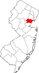 | |
| Boroughs | ||
| Town | ||
| Townships | ||
| CDPs | ||
| Other communities | ||