Steglitz-Zehlendorf: Difference between revisions
Appearance
Content deleted Content added
| Line 53: | Line 53: | ||
|- |
|- |
||
| - Others ( [[Greeks]], [[Italians]], [[East Asia]]ns etc.)|| style="text-align:right;"| 14,0 % (40.600) || |
| - Others ( [[Greeks]], [[Italians]], [[East Asia]]ns etc.)|| style="text-align:right;"| 14,0 % (40.600) || |
||
| |
|||
Revision as of 16:21, 11 November 2011
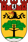
| Arms | Map | |
|---|---|---|

|

| |
| Area: | 102.5 km² | |
| Inhabitants: | 293,989 (2010-03-31) | |
| Population density: | 2,868 inhabitants per km² | |
| Website: | Official homepage Template:De icon | |
| Politics | ||
| Mayor of Borough: | Norbert Kopp (CDU) | |
| Parliament of Borough (BVV): | CDU 22, SPD 18, Alliance '90/The Greens 9, FDP 6 (last election 2006) | |
| ||

Steglitz-Zehlendorf is the sixth borough of Berlin, formed in Berlin's 2001 administrative reform by merging the former boroughs of Steglitz and Zehlendorf.
Demographics
As of 2010, the borough had a population of roughly 294,000, of whom about 70,000 (~24%) were of non-German ethnicity/origin. Hence, the percentage of migrants is a bit lower than Berlin's overall average, which is at roughly 30%.
| Percentage of the population with migration background [1] | ||
|---|---|---|
| Germans without migration background/Ethnic Germans | 76 % (223.400) | |
| Germans with migration background/Foreigners | 24 % (70.600) | |
| - Middle Eastern/Muslim migration background (Turkey, Arab League, Iran etc.) | 4,5 % (13.200) | |
| - Poland migration background | 3,0 % (9.800) | |
| - Yugoslavia migration background | 1,5 % (4.000) | |
| - Afro-German/African background | 1,1 % (3.000) | |
| - Others ( Greeks, Italians, East Asians etc.) | 14,0 % (40.600) |
|
Subdivision
The Steglitz-Zehlendorf borough consists of seven localities:
Landmarks
- The Bierpinsel (literally: "Beer Brush"), a 1970s style restaurant tower in Steglitz
- The Botanical Garden in Dahlem
- The Philological Library at the Free University of Berlin in Dahlem, by Norman Foster
- The Wannsee: lake, villa (site of the notorious Wannsee Conference), and lido
- The Lichterfelde West Villenkolonie - exclusive residential area of 1860 with tree lined and cobbled streets
Twin towns
 Bad Godesberg, Bonn, Germany since 1962
 Hann. Münden, Germany since 1962
 Bremerhaven, Germany, since 1965
 Kiryat Bialik, Israel since 1966
 Nentershausen, Germany since 1966
 Hagen, Germany since 1967
 Brøndby, Denmark since 1968
 Cassino, Italy since 1969
 XIIe arrondissement, Paris, France since 1970
 Sderot, Israel since 1975
 Ronneby, Sweden since 1976
 Königs Wusterhausen, Germany since 1988
 Szilvásvárad, Heves, Hungary since 1989
 Kharkiv-Ordzhonikidzevsky, Ukraine since 1990
 Kazimierz Dolny, Poland since 1993
 Sochos, Greece since 1993
See also
External links
Wikimedia Commons has media related to Steglitz-Zehlendorf.

