Columbia Township, Dubois County, Indiana: Difference between revisions
Appearance
Content deleted Content added
No edit summary |
Rescuing 1 sources and tagging 1 as dead. #IABot (v1.2.7.1) |
||
| Line 73: | Line 73: | ||
|area_code = |
|area_code = |
||
|blank_name = [[Federal Information Processing Standard|FIPS code]] |
|blank_name = [[Federal Information Processing Standard|FIPS code]] |
||
|blank_info = 18-14608<ref name="GR2">{{cite web|url=http://factfinder2.census.gov|publisher=[[United States Census Bureau]]|accessdate=2008-01-31|title=American FactFinder}}</ref> |
|blank_info = 18-14608<ref name="GR2">{{cite web|url=http://factfinder2.census.gov |publisher=[[United States Census Bureau]] |accessdate=2008-01-31 |title=American FactFinder |deadurl=yes |archiveurl=https://web.archive.org/web/20130911234518/http://factfinder2.census.gov |archivedate=2013-09-11 |df= }}</ref> |
||
|blank1_name = [[Geographic Names Information System|GNIS]] feature ID |
|blank1_name = [[Geographic Names Information System|GNIS]] feature ID |
||
|blank1_info = [http://geonames.usgs.gov/pls/gnispublic/f?p=gnispq:3:::NO::P3_FID:453238 453238] |
|blank1_info = [http://geonames.usgs.gov/pls/gnispublic/f?p=gnispq:3:::NO::P3_FID:453238 453238] |
||
| Line 113: | Line 113: | ||
==References== |
==References== |
||
* {{cite gnis|453238|Columbia Township, Dubois County, Indiana|2009-09-24}} |
* {{cite gnis|453238|Columbia Township, Dubois County, Indiana|2009-09-24}} |
||
* [http://www.census.gov/geo/www/cob/ United States Census Bureau cartographic boundary files] |
* [http://www.census.gov/geo/www/cob/ United States Census Bureau cartographic boundary files]{{dead link|date=November 2016 |bot=InternetArchiveBot |fix-attempted=yes }} |
||
<references/> |
<references/> |
||
Revision as of 09:14, 28 November 2016
Columbia Township | |
|---|---|
 Looking south on Cuzco Road from Highway 56, in Columbia Township | |
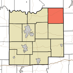
 Location of Columbia Township in Dubois County | |
| Country | United States |
| State | Indiana |
| County | Dubois |
| Government | |
| • Type | Indiana township |
| Area | |
| • Total | 36.43 sq mi (94.4 km2) |
| • Land | 36.18 sq mi (93.7 km2) |
| • Water | 0.25 sq mi (0.6 km2) |
| Elevation | 564 ft (172 m) |
| Population (2010) | |
| • Total | 1,065 |
| • Density | 29.4/sq mi (11.4/km2) |
| FIPS code | 18-14608[2] |
| GNIS feature ID | 453238 |
Columbia Township is one of twelve townships in Dubois County, Indiana. As of the 2010 census, its population was 1,065 and it contained 467 housing units.[3]
Geography
According to the 2010 census, the township has a total area of 36.43 square miles (94.4 km2), of which 36.18 square miles (93.7 km2) (or 99.31%) is land and 0.25 square miles (0.65 km2) (or 0.69%) is water.[3]
Unincorporated towns
(This list is based on USGS data and may include former settlements.)
Adjacent townships
- Lost River Township, Martin County (north)
- French Lick Township, Orange County (northeast)
- Jackson Township, Orange County (east)
- Hall Township (south)
- Marion Township (southwest)
- Harbison Township (west)
Major highways
Cemeteries
The township contains three cemeteries: Burton, Robinson and Wininger.
References
- "Columbia Township, Dubois County, Indiana". Geographic Names Information System. United States Geological Survey, United States Department of the Interior. Retrieved 2009-09-24.
- United States Census Bureau cartographic boundary files[permanent dead link]
- ^ "US Board on Geographic Names". United States Geological Survey. 2007-10-25. Retrieved 2008-01-31.
- ^ "American FactFinder". United States Census Bureau. Archived from the original on 2013-09-11. Retrieved 2008-01-31.
{{cite web}}: Unknown parameter|deadurl=ignored (|url-status=suggested) (help) - ^ a b "Population, Housing Units, Area, and Density: 2010 - County -- County Subdivision and Place -- 2010 Census Summary File 1". United States Census. Retrieved 2013-05-10.

