Corlier: Difference between revisions
Appearance
Content deleted Content added
Rescuing 1 sources and tagging 0 as dead. #IABot (v1.5beta) |
|||
| Line 75: | Line 75: | ||
==External links== |
==External links== |
||
{{commonscat}} |
{{commonscat}} |
||
*[http://joan-of-arc-studies.org/index.php?Gazetteer-Corlier Gazetteer Entry] |
*[https://web.archive.org/web/20070927015625/http://joan-of-arc-studies.org/index.php?Gazetteer-Corlier Gazetteer Entry] |
||
{{Ain communes}} |
{{Ain communes}} |
||
Revision as of 05:10, 13 August 2017
You can help expand this article with text translated from the corresponding article in French. (December 2008) Click [show] for important translation instructions.
|
Corlier | |
|---|---|
 | |
| Coordinates: 46°01′49″N 5°29′57″E / 46.0303°N 5.4992°E | |
| Country | France |
| Region | Auvergne-Rhône-Alpes |
| Department | Ain |
| Arrondissement | Belley |
| Canton | Hauteville-Lompnes |
| Intercommunality | Plateau d'Hauteville |
| Government | |
| • Mayor (2008–2014) | Jean-François Dupont |
| Area 1 | 5.45 km2 (2.10 sq mi) |
| Population (2019) | 121 |
| • Density | 22/km2 (58/sq mi) |
| Time zone | UTC+01:00 (CET) |
| • Summer (DST) | UTC+02:00 (CEST) |
| INSEE/Postal code | 01121 /01110 |
| Elevation | 560–917 m (1,837–3,009 ft) (avg. 800 m or 2,600 ft) |
| 1 French Land Register data, which excludes lakes, ponds, glaciers > 1 km2 (0.386 sq mi or 247 acres) and river estuaries. | |
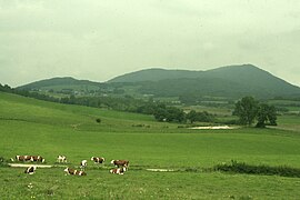
Corlier is a commune in the Ain department in eastern France.
Population
| Year | Pop. | ±% |
|---|---|---|
| 1793 | 250 | — |
| 1800 | 214 | −14.4% |
| 1806 | 274 | +28.0% |
| 1821 | 263 | −4.0% |
| 1831 | 272 | +3.4% |
| 1836 | 212 | −22.1% |
| 1841 | 235 | +10.8% |
| 1846 | 246 | +4.7% |
| 1851 | 281 | +14.2% |
| 1856 | 258 | −8.2% |
| 1861 | 245 | −5.0% |
| 1866 | 242 | −1.2% |
| 1872 | 226 | −6.6% |
| 1876 | 212 | −6.2% |
| 1881 | 219 | +3.3% |
| 1886 | 225 | +2.7% |
| 1891 | 226 | +0.4% |
| 1896 | 194 | −14.2% |
| 1901 | 197 | +1.5% |
| 1906 | 165 | −16.2% |
| 1911 | 160 | −3.0% |
| 1921 | 139 | −13.1% |
| 1926 | 166 | +19.4% |
| 1931 | 148 | −10.8% |
| 1936 | 133 | −10.1% |
| 1946 | 104 | −21.8% |
| 1954 | 110 | +5.8% |
| 1962 | 89 | −19.1% |
| 1968 | 65 | −27.0% |
| 1975 | 69 | +6.2% |
| 1982 | 66 | −4.3% |
| 1990 | 76 | +15.2% |
| 1999 | 73 | −3.9% |
| 2008 | 119 | +63.0% |
See also
References
External links
Wikimedia Commons has media related to Corlier.


