Gunsan Airport: Difference between revisions
Appearance
Content deleted Content added
m tightened language |
Rescuing 1 sources and tagging 0 as dead. #IABot (v1.6beta3) |
||
| Line 31: | Line 31: | ||
| stat2-header = Passengers |
| stat2-header = Passengers |
||
| stat2-data = 133,242 |
| stat2-data = 133,242 |
||
| footnotes = Sources: [[DAFIF]],<ref name="WAD">[http://www.worldaerodata.com/wad.cgi?airport=RKJK Airport information for RKJK] from [[DAFIF]] (effective October 2006)</ref> Korea Airports Corp.<ref name="KAC">[http://kac.airport.co.kr/eng/airnat/airstat/act_airport_view.jsp Air Traffic by Airport]</ref> |
| footnotes = Sources: [[DAFIF]],<ref name="WAD">[http://www.worldaerodata.com/wad.cgi?airport=RKJK Airport information for RKJK] from [[DAFIF]] (effective October 2006)</ref> Korea Airports Corp.<ref name="KAC">[http://kac.airport.co.kr/eng/airnat/airstat/act_airport_view.jsp Air Traffic by Airport] {{webarchive|url=https://web.archive.org/web/20070929083750/http://kac.airport.co.kr/eng/airnat/airstat/act_airport_view.jsp |date=2007-09-29 }}</ref> |
||
}} |
}} |
||
Revision as of 05:23, 26 October 2017
Gunsan Airport 군산공항 群山空港 Gunsan Gonghang Kunsan Konghang | |||||||||||
|---|---|---|---|---|---|---|---|---|---|---|---|
| Summary | |||||||||||
| Airport type | Public / Military | ||||||||||
| Operator | Korea Airports Corporation United States Air Force Republic of Korea Air Force | ||||||||||
| Location | Gunsan, North Jeolla Province, South Korea | ||||||||||
| Elevation AMSL | 29 ft / 9 m | ||||||||||
| Coordinates | 35°54′13″N 126°36′57″E / 35.90361°N 126.61583°E | ||||||||||
| Website | gunsan | ||||||||||
| Map | |||||||||||
 | |||||||||||
| Runways | |||||||||||
| |||||||||||
| Statistics (2007) | |||||||||||
| |||||||||||
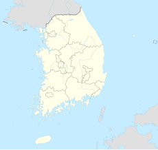
Gunsan Airport (Template:Lang-ko, Chinese: 群山空港) (IATA: KUV, ICAO: RKJK) is an airport serving Gunsan, a city in the North Jeolla Province in South Korea. In 2011, 172,327 passengers used the airport.[2] It shares its runway with Kunsan Air Base, which uses the same IATA and ICAO codes.
Facilities
The airport is at an elevation of 29 feet (8.8 m) above mean sea level. It has one runway designated 18/36 with a concrete surface measuring 9,000 by 150 feet (2,743.2 m × 45.7 m).[1]
Airlines and destinations
| Airlines | Destinations |
|---|---|
| Eastar Jet | Jeju |
| Korean Air | Jeju |
See also
References
- ^ a b Airport information for RKJK from DAFIF (effective October 2006)
- ^ a b Air Traffic by Airport Archived 2007-09-29 at the Wayback Machine

