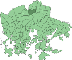
Tapaninvainio
Appearance
You can help expand this article with text translated from the corresponding article in Finnish. (December 2009) Click [show] for important translation instructions.
|
Tapaninvainio (in Finnish) Staffansslätten (in Swedish) | |
|---|---|
Neighborhood of Helsinki | |
 Location in Helsinki | |
| Coordinates: 60°15′34″N 24°59′06″E / 60.25957°N 24.98498°E | |
| Country | |
| Province | Southern Finland |
| Region | Uusimaa |
| Sub-region | Helsinki |
| Time zone | UTC+2 (EET) |
| • Summer (DST) | UTC+3 (EEST) |
Tapaninvainio (Finnish), Staffansslätten (Swedish) is a northern neighborhood of Helsinki, Finland.

