
Mount Mansfield
| Mount Mansfield | |
|---|---|
| Highest point | |
| Elevation | 1,339.69 m (4,395.3 ft) |
Mount Mansfield is the highest mountain in the U.S. state of Vermont. The peak elevation, in the town of Underhill, is 4,393 ft. (1339 m) above mean sea level.
The mountain has the appearance of a (quite elongated) human face when viewed from the east or west with distinct forehead, nose, lips, chin (the highest point) and an Adam's apple. These features are most distinct when viewed from the east, looking westward.
Mount Mansfield is one of the two spots in Vermont where true alpine tundra survives from the ice ages. A few acres exist on Camel's Hump immediately to the south, but Mount Mansfield's summit still holds about 200 acres.
The mountain is used for various recreational and commercial purposes. The summit is home to transmitter towers for a number of local TV and radio stations. Mount Mansfield has many hiking trails, including the Long Trail, which traverses the main ridgeline. Additionally, the east flank of the mountain is used by the Stowe Mountain Resort for skiing and tourism, and for a toll road that is open to automobiles.
Naming of the mountain
The name Mansfield came from the now dissolved town of Mansfield, Vermont in which the mountain was located. A popular misconception is that the mountain and the town were named after William Murray, First Earl of Mansfield. However, the Earldom did not even exist until twenty years after the town was granted. Several of the original grantees were from Mansfield, Connecticut, which in turn is known to have been named for Moses Mansfield, one of the chief landowners there (it was common for settlers to name Vermont towns for their previous homes).
History
The mountain was called Moze-o-de-be-Wadso by the Abenaki, which meant "Mountain-With-A-Head-Like-A-Moose."[citation needed]
The adam's apple is on the north end of this ridge, and the forehead to the south. From north of the mountain, looking south, this ridge appears as a triangular peak. At the northeastern portion of the mountain, there are spectacular cliffs. At the base of these cliffs (on the western side of the Notch Road/Rt 108), there is a large honeycomb network of talus caves. There are high cliffs on the eastern side of the Notch Road as well. These two sets of facing cliffs are separated by only a few yards at their base. The Pleasant Valley Road (from Cambridge to Underhill) follows closely to the western base of the mountain, and provides a gorgeous, intimate view of the entire ridge.
This facial profile is explained in a locally told story, involving an Indian legend: This mountain, as the legend goes, was taller and came to a distinct peak in ancient times. Indians of that time would seek a special, private place to 'await their maker', when they knew their time was near. One particular Native American (a chief, perhaps) chose to climb to the very top of this peak to await death even though he was crippled and could not walk without crutches. He supposely died before he reached the summit... and God carved his profile into the mountain.[citation needed]
Another oft-recited legend is that the two mountains, Mt. Mansfield and Camel's Hump, were formed when a man and his camel walked through the state. On becoming tired, they lay down to rest, but never awoke. They became the two mountains that we see.[citation needed]
Skiing on Mount Mansfield
In addition to other expert trails, a group of famous trails are known as the "Front Four". The Front Four are Goat, Starr, National and Liftline and contain steep pitches, many natural hazards (rocks and trees), and little grooming. There are also numerous cross country ski trails around the base of the mountain and on its lower slopes. Additionally, two backcountry ski trails, the Bruce Trail and the Teardrop Trail, descend Mount Mansfield on the east side and west side, respectively.
Hiking Mount Mansfield
Mount Mansfield has four major trails which one can hike to the summit. They range in difficulty from M (moderate) to DDD (very difficult). The Long Trail, a famed route through VT, is rated as M, and so is the Haselton Trail. More difficult is Profanity Trail, which is rated as a DD (More Difficult) and the very difficult trail the Cliff Trail, a DDD. These trails extend to the peaks named The Forehead, an elevation of 3940 ft., the Upper Lip and the Lower Lip, and The Chin (4395 ft.) . The Chin is Vermont's highest point. Each peak is generally named for the part of a face that Mount Mansfield resembles when viewed sideways. Marking the trails are white and blue blazes. The Long Trail has 2"x6" white blazes. All other trails are marked with blue blazes. This is an extremely challenging .7 mile hike to the ridge, along which The Long Trail extends. To reach the Profanity Trail a long trek up The Long Trail must be done. Finally, the Haselton starts at the base of the gondolas, running up to The Toll Road.
References
Johnson, Charles W. (1980) The Nature of Vermont: Introduction and Guide to a New England Environment, The University Press of New England ISBN 0-87451-183-6
Images
-
 A view from Mount Mansfield around 300 feet from the summit (center point is roughly facing west)
 -
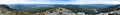 A panoramic view from the top of Mount Mansfield.
 -
 Western Slope of Mt. Mansfield from Underhill, VT.
 -
 Mansfield from north of Stowe, VT.
 -
 Mansfield from toll road.
 -
 Mansfield's summit.
 -

-
 Looking south towards Camels Hump off the summit ridge.
 -
 View from toll road, looking north.
 -
 Westward view from the top of Mt Mansfield.


External links
- U.S. Geological Survey Geographic Names Information System: Mount Mansfield
- Peakbagger.com: Mount Mansfield
- Mount Mansfield on Summitpost
- Review of climbing Mount Mansfield
Montpelier (capital) | |
| Regions | |
| Counties | |
| Cities | |
| Towns (pop. >5000) | |
| Festivals | |
| Topics | |
| Society | |