
Hochkönig
| Hochkönig |
|---|
Hochkönig is the name applied to the highest mountain in the Berchtesgaden Alps (in the Northern Calcareous Alps), and also to the surrounding mountain group as a whole. It lies to the west of the city of Bischofshofen in the Austrian state of Salzburg, 42 km due south of the city of Salzburg. Hochkönig is separated from the rest of the Berchtesgaden Alps, and more specifically from the Steinernes Meer (stone ocean) by the mountain pass Torscharte at 2246 m. The summit itself is at the southern edge of a large limestone plateau, which is largely covered by the glacier known as the "Übergossene Alm" (poured-over meadow).
In 1898, the Österreichischer Touristenklub built an alpine hut at the summit. The current building dates from 1985 and can sleep nearly one hundred mountaineers. The massif is also home to the High King Mountain Ski Area.
-
 The karstic plateau north of the summit
 -
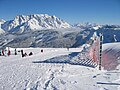
 Hochkönig from the south in winter
 -
 Hochkönig view from Hinterthal
 -
 Hochkönig from the Aberg
 -
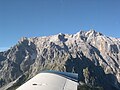 Hochkönig from the air
 -
 Hochkönig from the rear


External links
This Salzburg state location article is a stub. You can help Wikipedia by expanding it. |